My 7:30 AM forecast had good winds forecast for Pt. Isabel and good but WEST winds in the 3rd Ave. Channel and crappy winds for the 3rd. Ave. launch site winds.
And there was a decent chance of brief Anita Rock winds close to Crissy Field.
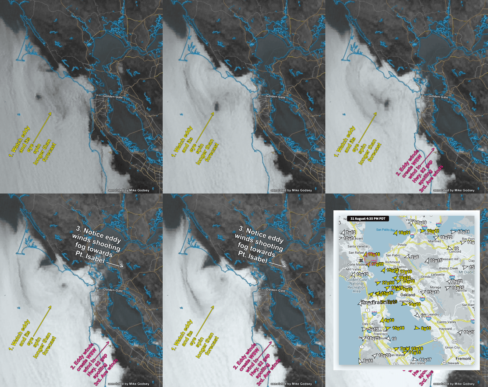
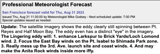
Then, around 11 AM, I issued this update because it looked like the counter-clockwise eddy between Pt. Reyes and Half Moon Bay would linger all day.
I reasoned that the lingering eddy would shoot wind from the mid Golden Gate past Treasure Island and Point Blunt to Pt. Isabel.
The same flow would make both the 3rd Ave. Channel and launch sites and see unfavorable WSW due combo of the eddy southerly winds and a pressure gradient towards Stockton.
Plus the more southerly wind would move the Golden Gate wind more towards the North Tower, increase the fog and make Anita Rock less likely.
These images support that forecast update.


