In today’s forecast, there is mention of the Sea of Cortez wind from the North Pacific High being a bit NNW. This wind direction is side-shore to most of our coastline, which weakens the wind due to friction with the hills and bluffs. To get that wind to curve into a more favorable N to NNE direction where it has a straight shot at our beaches, we need sunshine to create a strong pressure gradient in our Coastal Valleys.
This is why our favorite wind comes from high-pressure in the 4-Corners region in the southern Great Basin. That wind is more N to NNE and fills our beaches perfectly.
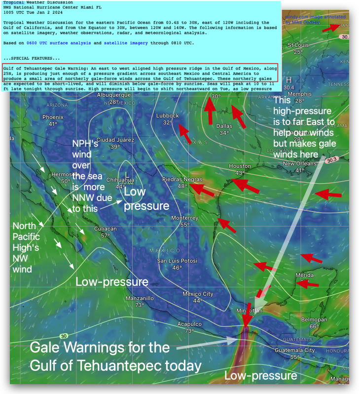
That wind machine has not been very active in recently. In this image, you can see that high pressure is centered over Arkansas and extends over the Gulf of Mexico. Notice how this position makes for Gale Force winds in the Gulf of Tehuantepec, where a low place in the mountains makes one of the world’s most dramatic venturi effect winds. For real winds today, pack your .5 meter wing and catch an airplane.