The Southern California and Central California launch site wind forecast for the current day can be
found on iwindsurf.com or kitesurf.com.
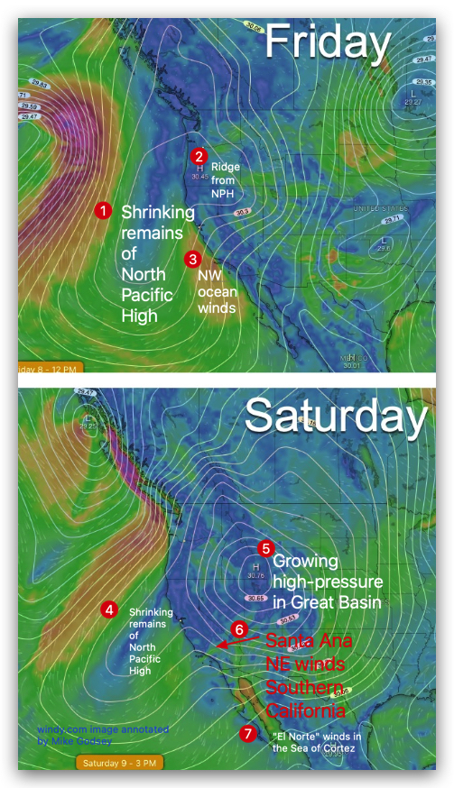
We all know how Santa Ana winds localize and how they feel but what causes these winds?
Generally, these winds are caused by a surface high-pressure area in the Great Basin.
But what causes this high-pressure to develop?
The cause of the surface high-pressure is easy to visualize:
- Sometimes high-pressure moves into the Great Basin from the north. If this small surface high-pressure has a convergence zone in the winds aloft it can quickly balloon onto a large huge high-pressure zone from the Southern California Deserts to past Colorado.
- Other times the Great Basin high-pressure starts as the North Pacific High extends a ridge inland over California towards the Great Basin.
But how does the tinny ridge you see in Friday’s image turn into the massive high-pressure zone in Saturday’s image?
The answer to this is the behavior of the upper-level winds especially at ≈ 18,000 feet aloft (500 MB).
These rivers of wind snake their way around the world. Northward-extending loops in these winds are called Upper Ridges.
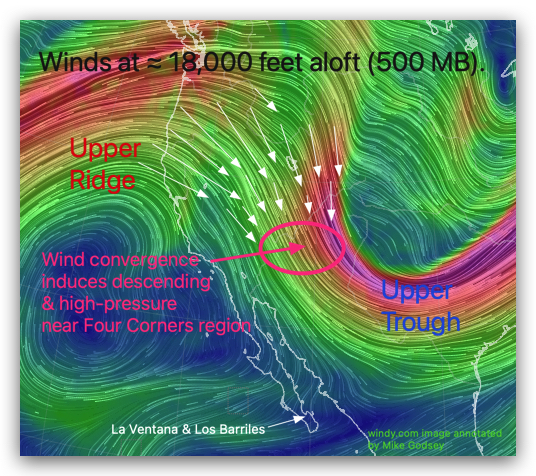
These upper ridges bring warmer more tropical air over more northerly winds latitudes.
Sorthward-extending loops in these winds are called Upper Troughs. These upper troughs bring colder over more southerly winds latitudes. You can see these in this image,
Ever noticed that river of water widens the speed of the water slows while when a rver becomes narrow the water speed increases? The same happens with these upper-level winds. So in this image areas of slow-velocity air are green while areas of fast-moving air are red.
But notice the white arrows in the upper ridge. In areas where the velocity is increasing the wind converges. This makes the air in that area denser.
This heavier fast moving air then begins subsiding towards the surface where it creates the area of high pressure you see in the Saturday image above.
In this case, the high-pressure area is over the Great Basin.
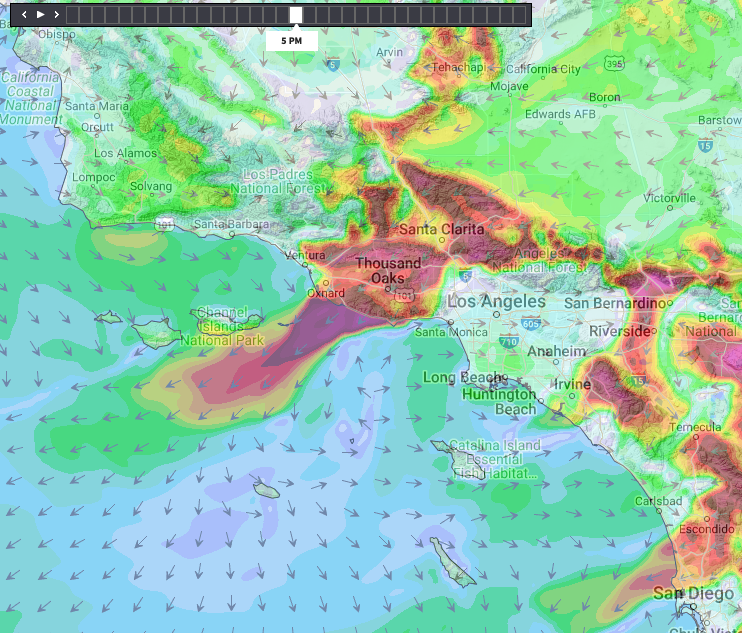
This high-pressure air then begins flowing towards lower pressure over the Southern California Bight. Local canyons in Southern California cause this wind to converge so it accelerates. And this wind becomes our sometimes ferocious Santa Ana surface winds as in the last image.