The La Ventana, El Sargento & Los Barriles launch site forecast for the current day can be found on iwindsurf.com or kitesurf.com.
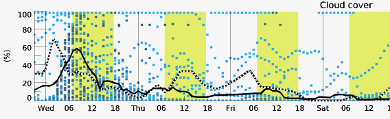
Forecast Jargon Decoder, Dec. 13, 2023
Today’s forecast: In this second image, notice the dreaded 3500-mile-long Sub Tropical Jet Stream cloud mass streaming from the SW over Baja’s East Cape.
At dawn today, we are on the extreme northerly edge of the cloud mass, so we may see some clearing, especially La Ventana.
So, we may get a bit of weak wind on the beaches, especially for La Ventana.
High-pressure is beginning to build north of the 4-Corners region so mild northerly winds will blow in the northern Sea of Cortez from San Felipe to Bahia De Los Angles.
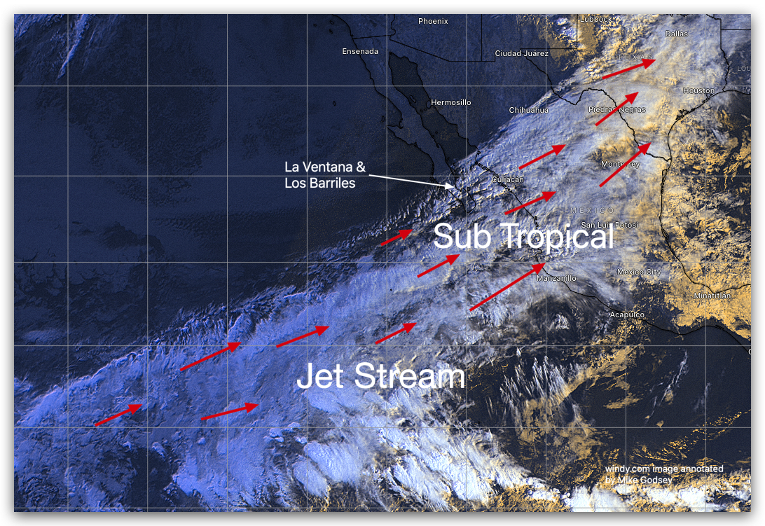
These El Norte winds will reach us Thursday.
But that hinges on our arch-enemy, the Sub Tropical Jet Stream, following my forecast and moving south of the position you see in this satellite image!