Thursday’s Wind Recipe:
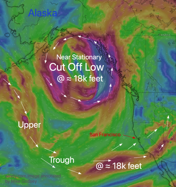
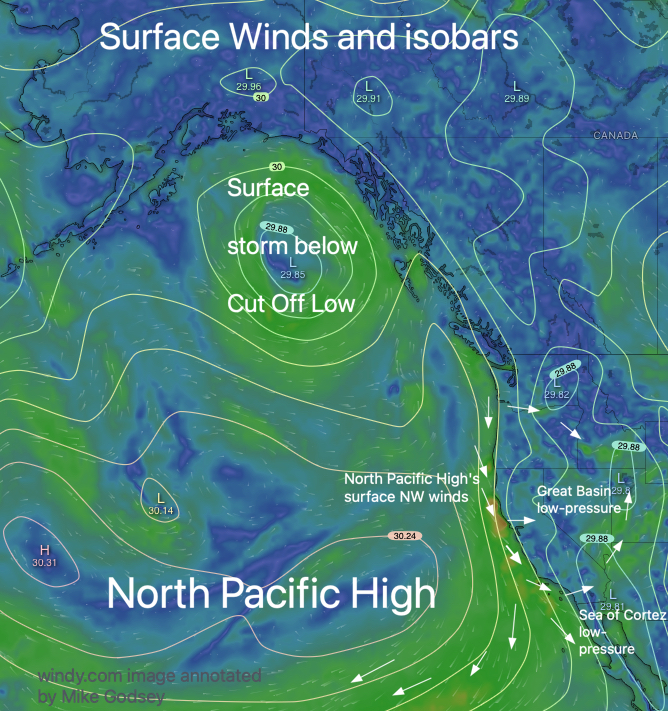
1- A huge Cut Off Low in the Gulf of Alaska anchors mild North Pacific High’s surface NW winds ramp up in the PM but maintains coast fog.
2- Southerly winds prevail in the AM from Half Moon Bay to Stinson but turn westerly as the eddy dies in the PM.
3- There is a moderate pressure gradient towards Napa, which weakens the Sherman AM winds. PM sees combo Napa, Stockton, and Sacramento, which makes the winds more southerly than usual.
4- This brings SW to WSW upper-teens to low 20’s Wind to the mid Golden Gate to TI to Brooks Island, Shimada Park & WNW to Sherman with lesser winds for Larkspur/Clark’s Brickyards, Race Track and Berkeley.
5- The Stockton gradient brings upper-teens to low 20’s the Coyote and 3rd channel and pressure gradient but some W to WSW flow from the Hwy. 92 gap area is likely at the 3rd. launch sites.
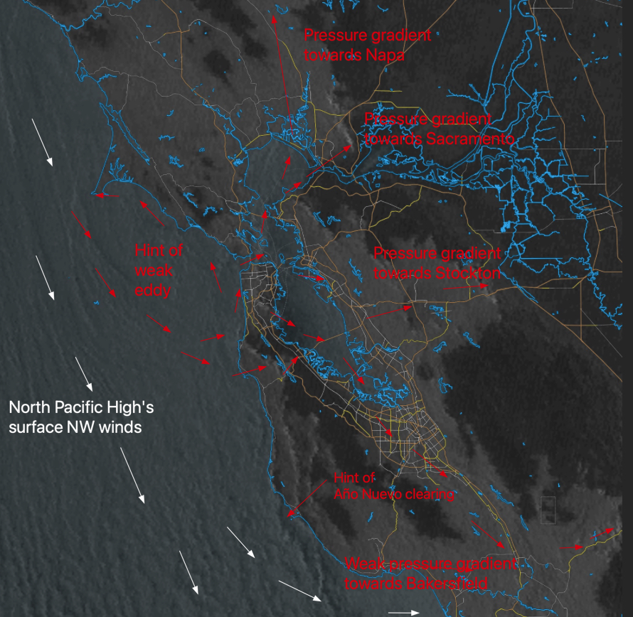
6- The satellite imagery already shows signs of Año Nuevo clearing, so Waddell hits the low/mid-20s. Bodega has potential, but fog will probably keep winds light.