Part 1 : Rare Sept. marine surge could develop overnight.
by Mike Godsey, mike AT iwindsurf.com
Looking at Mark’s extended forecast for tomorrow Thursday Sept. 8 there is a mention of southerly flow along the coast. I have been watching the pressure gradients and the satellite imagery today and there is a chance this southerly flow could turn into a rare late season marine surge.
This is the first year in decades when we have not seen any marine surges. Instead there have been endless eddies. The eddies have little in common with a marine surge except they both create southerly wind mostly at sites North of the Bay Bridge. In fact for most kiters and windsurfers who only care about the wind strength and direction the difference hardly matters.
The first hint of an impeding marine surge was in the satellite imagery early this morning.
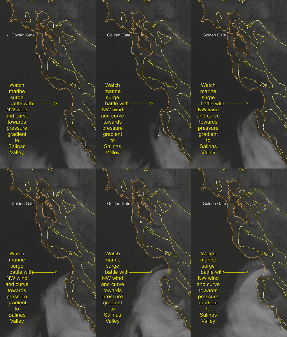
Looking at this animation of the NRL satellite imagery notice how the marine layer clouds round Monterey an begin to head northward.
 However this southerly flow slows as it feels the North Pacific High’s strong surface NW winds. Then as it lunges into Monterey Bay you can see it curve eastward. Why? Because the Salinas Valley is hot and this creates a pressure gradient that sucks the fog inland.
Forecasting this and all marine surges is tricky because both the NW wind and the Salinas Valley pressure gradient try to stall the marine surge before it reaches Santa Cruz much less the Golden Gate.
But overnight the pressure gradient to the Salinas Vally fades and typically the NW winds weaken near the coast. So there is a good chance that the marine surge will reach the Golden Gate by dawn.
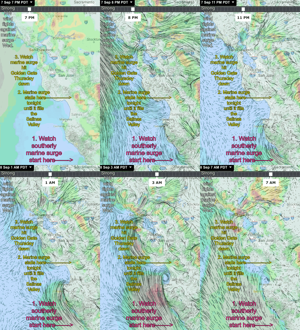
The model output in the next animation goes from today at 7PM until 7AM Thursday Sept 8.
Looking at the bottom text note at 7PM today the weak southerly wind near Monterey. Also note the strong NW wind over the ocean.
The watch as the marine surge works its way up the coast by dawn tomorrow.
Of course this model output is hypothetical and if the NW winds does not weaken we could have another hot day tomorrow. But give that the southerly winds in the satellite imagery in the first animation are about 4 hours early compared to the model output my bet is we see a marine surge tomorrow.
And just as I published this blog I noticed that the Waddell winds have turned southerly!!
Part 2 : Rare Sept. marine surge blasts to  Sherman Island by dawn.
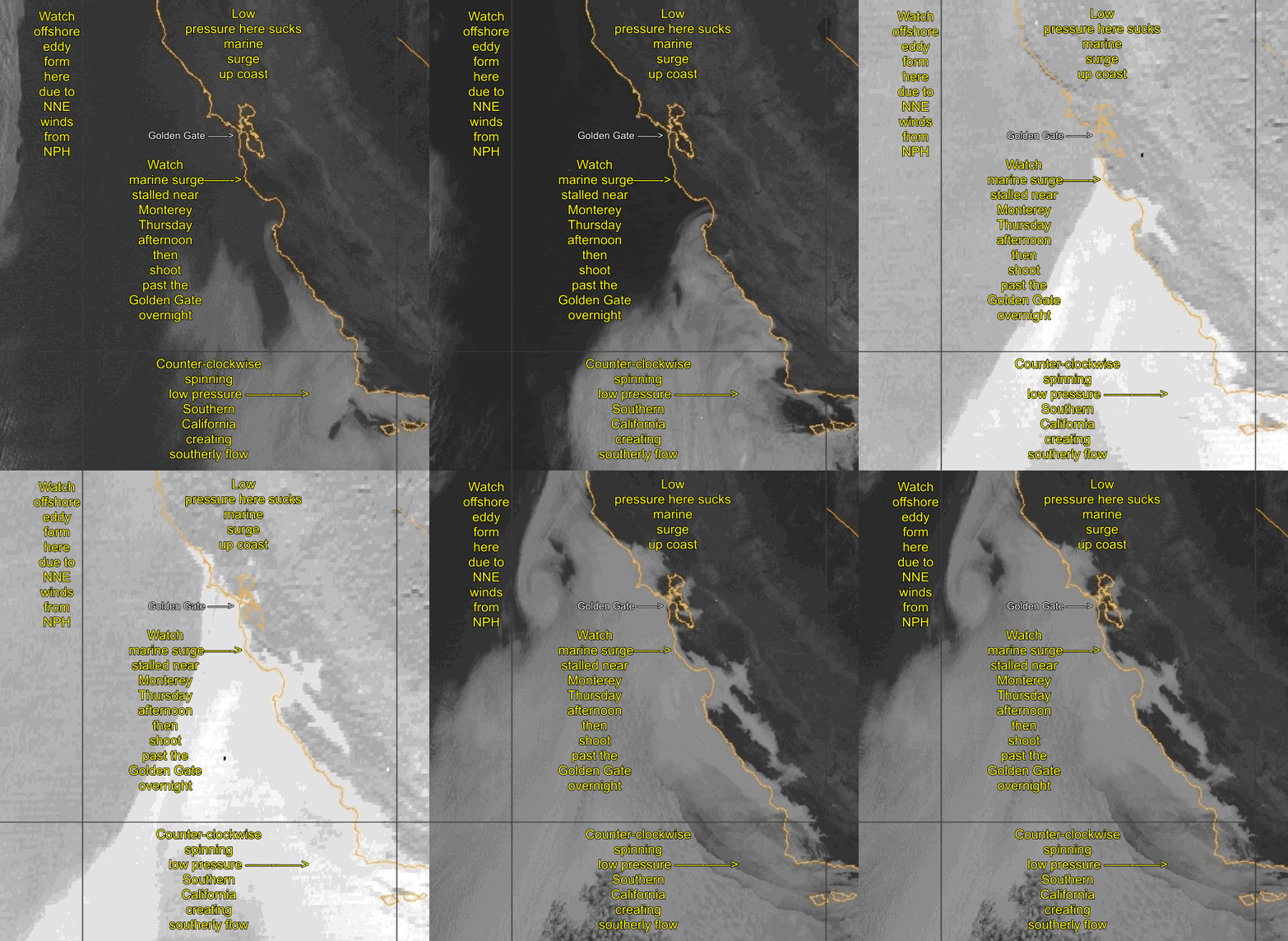
It is always nice when a challenging forecast turns out right. This marine surge is atypical in several ways. First marine surges don’t usually occur in Sept. Second this is marine surge has 2 causes. 1. The heat producing upper ridge at ≈ 18,000 ft. is departing but at the surface the Central Valley thermal low has left a lobe of low pressure over Napa creating a S. to N. pressure gradient. This is the typical cause of a marine surge. 2. But this marine surge was turbocharged by a counter-clockwise spinning low pressure near Southern California that sending southerly wind up the coast. You can see all of this happening from yesterday afternoon through the night to 8AM this morning.

