Some new ingredients for todays wind recipe: 1. 1000 miles due west of La Ventana an upper Cut Off Low is creating a surface low-pressure which helps draw early wind right to our beaches. 2. High-pressure near the 4-Corners region fans the Southern California Santa Ana fire winds while sending El Norte winds down the…
Note: This autopsy imagery covers the impact of low-pressure over the Sea of Cortez on Baja’s East Cape winds. Tragically, that same low-pressure helped created massive Santa Ana winds in Southern California creating nightmare fire conditions. That event will be covered in an upcoming blog. Here is the text part of my wind forecast for…
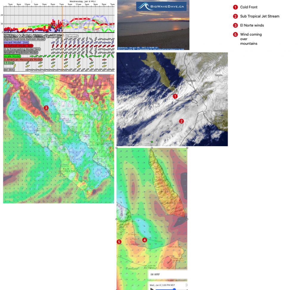
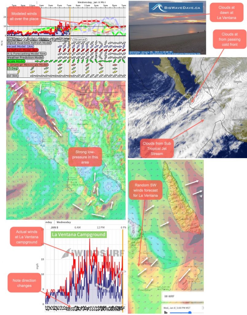
Bottom Line: The models are all over the place regarding wind velocity but all agree on an unfavorable WSW wind direction. This means our wind will be coming over the mountains which causes the wind to ripple and reach the surface randomly. Don’t launch during a brief windy period since you could be stranded in wind…
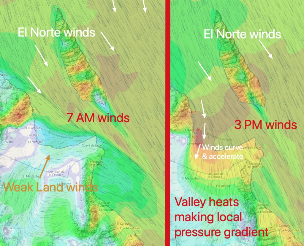
Note: Despite the AM glassy waters use caution fishing and kayaking near arroyos since there is a chance of random strong WEST wind blasts. Bottom Line: Sub to maybe low-teens near arroyos as strong westerly wind hitting the mountain tops sometimes comes down the arroyos where it disrupts the weak E to ENE surface winds. Today’s Wind…
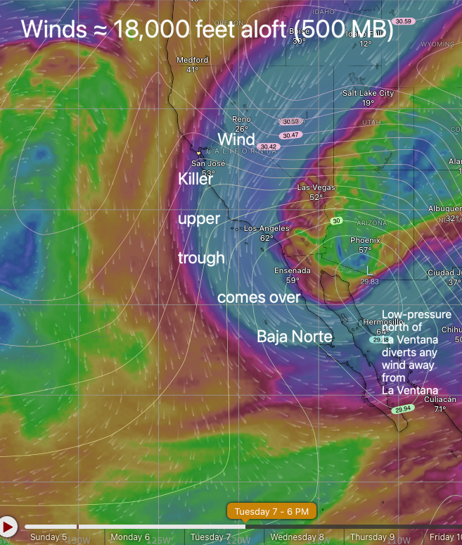
Today’s Wind Recipe: 1. A chilly upper trough at ≈ 18,000 feet aloft drops over the 4-Corners region destroying the El Norte wind producing 4-Corners region high-pressure. 2. Killer creates a surface low-pressure at the north end of the Sea of Cortez spoiling the wind for that north half of the sea. 3. Low-pressure south…
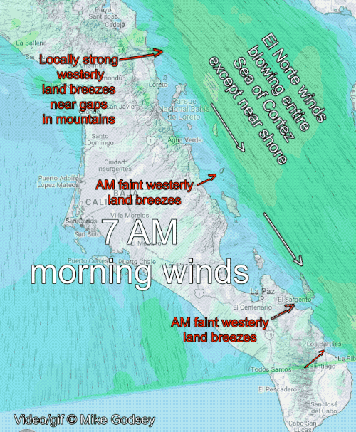
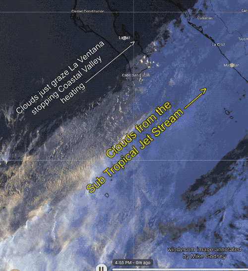
If you have ever camped along the coast of the sea in the winter you are very aware of the cool westerly breeze that blows most early mornings. In this model animation from ikitesurf.com/WeatherFlow-Tempest you can see the strong El Norte winds that often blow all night in the Sea of Cortez. However, at 7…
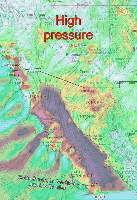
Today’s wind recipe: 1. Moderate swell hitting the beaches confirms the strong winds to the north reported by the most recent ASCAT pass. 2. Checking your retina, notice the dark blue line towards the horizon. You know what that means. 3. All this reflects the strong high-pressure over the USA’s 4-Corners region, pushing El Norte…
Bottom line: GUSTY strong winds most reliably and strongest OUTSIDE once clouds clear. Punta Bufeo far to the north is already seeing 28g37. Watch our Rasta Beach sensor for early warning! Today’s wind recipe: 1. High-pressure in the Great Basin sends NNW winds down the Sea of Cortez. 2. Low-pressure south of Cabo sucks this…
Today, race with the clock. Most models have wind-killing clouds clearing by noon, while some have them lingering. Bottom line: Mid to maybe weak upper-teens focused La Ventana IF clouds clear early. Today’s wind recipe: 1. Bully boy, high pressure is preparing to move into the Great Basin to create Tuesday’s wild Baja wind, but it…
Dreaming of warm air and water, big swell and sandy beaches and most importantly reliable wind? Baja’s East Cape offers it all. Your accommodations can range from a tent at the campground to a private home to a resort or even bunk beds. We are going into a La Niña pattern which usually means strong…