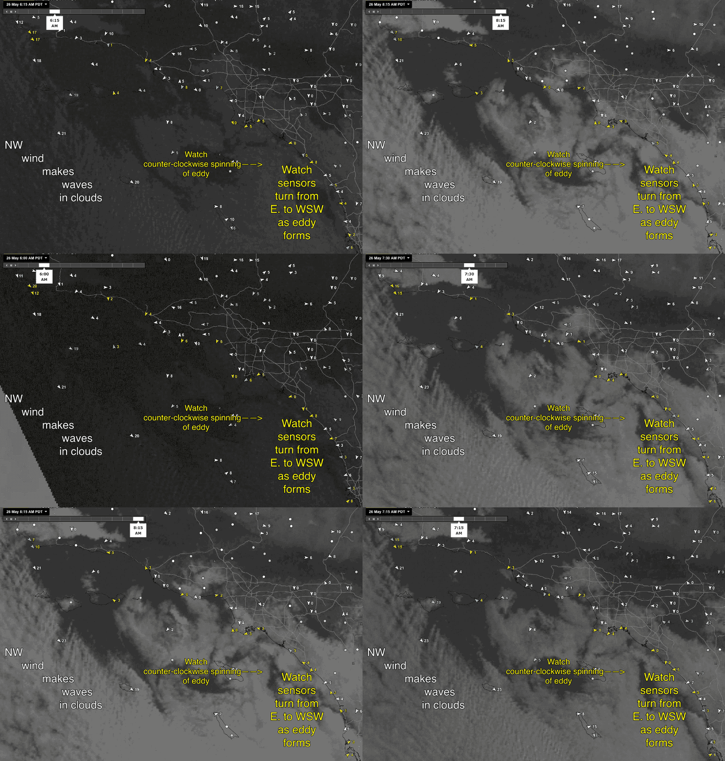
Uh oh! Fast ramp up of a Catalina Eddy.
by Mike Godsey
One of the many things that makes Southern California forecasting difficult is the unpredictability of the Catalina Eddy.
If there is an eddy then the Southern California coast marine layer takes longer to dissipate, the pressure gradient is weaker and less of the NW wind west of the Channel Islands curves in to the beaches.
Last night and this morning most models predicted an eddy to spin up by dawn between San Diego and Long Beach. But a my 7AM forecast there was not a trace of an Catalina Eddy. I made note of that but also mentioned that one could still spin up.
Well I just made a special update to the Southern California forecasts as the satellite imagery and the sensors detected a poorly defined Catalina Eddy in the expected zone.
First notice the waves in the marine layer clouds south of Jalama. Then notice the marine layer clouds banked up on the north side of the Traverse Range just north of Santa Barbara. As this air flows down the canyons it compresses and creates a local low pressure zone.
At dawn 6AM notice how the winds from San Diego to Cabrillo are mostly easterly. This tends to stop an eddy from forming. Then around 7AM as the low pressure forms near Santa Barbara the NW ocean wind curves towards shore but feels the pressure gradient and continues curving creating a Catalina Eddy. Later today as the pressure gradient increases in the Southern California deserts the NW wind will kill the eddy. However with the eddy delaying clearing it will be hard to get a strong enough pressure gradient for really strong wind on the Southern California coast.

