How can the wind blow 20 to 30 knots WEST Sunday and 20-30 knots EAST Monday? by Mike Godsey
To understand this crazy 180 degree switch in wind direction you have to look at the big picture.
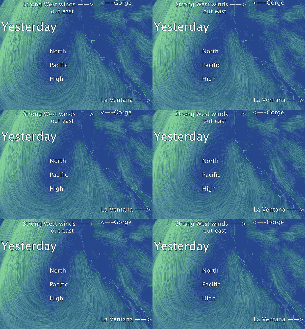
Take a look at the video of the Pacific yesterday that I annotated. Find the North Pacific High the winds that spiral out from it in a clockwise fashion. Also notice that the winds of the NPH are strong is some areas and weak in others. In the strong wind areas the isobars are compacted closer together making for a stronger pressure gradient and stronger wind.
Notice how the NPH is elongated from its center towards the Pacific Northwest. This extension of the NPH is called a ridge. In this case the ridge is just beginning to form. When this happens the isobars are compacted over the Gorge. Yesterday the max concentration of isobars was over the eastern Gorge. Look carefully at this area and you can see the wind was roaring over the area from near Dougs to past Arlington Sunday.
Follow the wind flow from this ridge and you can see why La Ventana in Baja had windy day.
Now let’s analyze this event in more detail so you can see why the wind is hitting over 30 knots EAST at Rooster Rock this Monday morning.
Looking at the 2 wind maps you can really see the dramatic 180 degree wind reversal.
Let’s start by looking at Saturday April 5 in the 3rd image.
Notice how the North Pacific High has its typical oval shape and is sending NW winds to the Northern California coast and San Carlos, Baja. While Hawaii is receiving the North Pacific High’s trade winds.
Now find the Gorge on the image and note the lack of wind. This set up of the NPH is a common spring pattern and means mostly weak winds for the Gorge until the NPH drifts northward west of the Gorge in early summer.
However check out the ridge has begun to push towards the Gorge. That ridge is poised to really jazz up the winds out east in about 12 hours.
Now drop to the image for Sunday April 6. You can see that the North Pacific High has pushed ridge over the crest of the Cascades. This means the isobars are tight from Dougs to Arlington. This creates the strong wind you see in that area.
This ridge also impacts all the other wind venues that are impacted by the North Pacific High. San Carlos, Baja now has winds that are almost straight offshore which in not favorable for wave sailing.
While La Ventana enjoys a late season blow to the low 20’s as El Norte winds blast down the Sea of Cortez. And Maui sees wind that are so northerly that the Gorge crew there probably went to the Kehei side. (Am I right, Mike Baker?)
So now you can see what happens when the North Pacific High’s ridge moves to the Gorge.
But why did those west winds die overnight and why are EAST wind blowing today at Rooster?
Things get complicated here. As the ridge moves further inland the North Pacific High was being attacked by an inbound upper trough ≈ 18,000 ft. and a surface storm. So the main body of the North Pacific High is in full retreat southward and westward. So the inland ridge part of the North Pacific High became pinched off from the NPH and moved inland into the Columbia Basin and Great Basin. This means we have high pressure to our east.
Meanwhile the inbound storms low pressure begins to stack isobars offshore. So we now have a pressure gradient between the high pressure to the east and the inbound low pressure to the west. Hence EAST winds.
The really interesting question is why are those east winds so localized in the zone near Rooster Rock. How can it be 5 knots at the Hatch 30 knots at Rooster? Some other time…..
With thanks to http://earth.nullschool.net

