Blame it on the winds aloft!
by Mike Godsey, mike AT iwindsurf.com
For old timers the strong WSW winds of recent weeks north of the Bay Bridge see like a blast from the past. And if you have been a kiter or windsurfer for less than 15 years on the coast or Peninsula it probably seems like the wind machine is broken.
The reality is more complex. Yes the WSW winds and marine layer clouds have come on strong in recent weeks yet the cause is very different than in past decades. Most of the WSW flow has been the product of very local and very persistent counter-clockwise spinning eddies just west of the Bay Area.
And… no the coast and Peninsula wind machine is not broken but rather we have had about 15 years of unusually common strong NW ocean winds and those winds have often been absent this year.
So what is the cause of the sustained eddy action? In recent years it has become common for tiny eddies to form just west of the Golden Gate. Lacking a formal name for these eddies I have taken the liberty of calling them the Golden Gate Eddy since they are typically confined to the waters from about Stinson Beach in Marin to about Pacifica.
Most of the time the southerly flow along the coast from these Golden Gate Eddies fades away mid day as the eddy dies. This allows the North Pacific High’s surface NW winds to curve into the coast and reach the Peninsula and Waddell. This also means weaker wind for the East Bay and Sherman Island.
But the recent eddies have been far larger than the Golden Gate Eddy and  have been lasting for days. Moreover they have been very variable in shape ranging from the very rotund to the extremely slender.
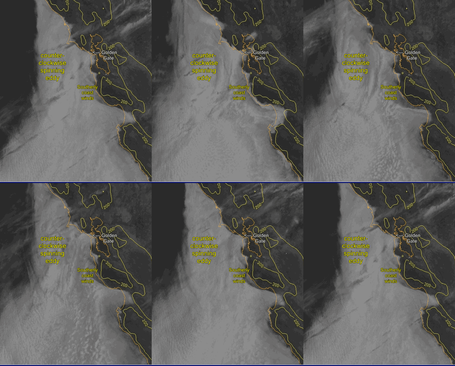
In the top satellite animation you can see such a “Jeff” type long lasting eddy which is round and mostly seen in the early days of an eddy pattern.
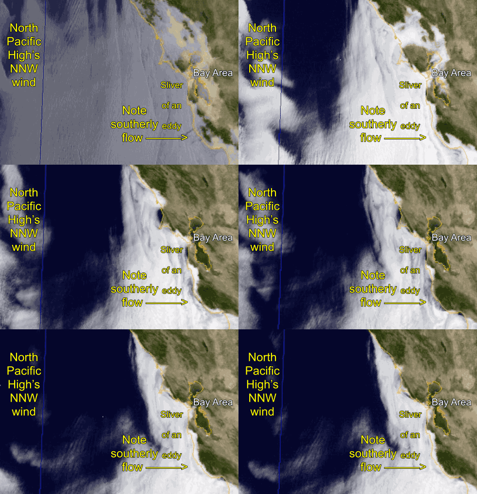
In the second animation you can see a “Mutt” type of eddy that is long and slender and runs parallel to the coast. Note that in this case it extends from Big Sur to way past Bodega.
Why the varying shapes and the very long life spans?
Well the typical Golden Gate Eddy forms when the North Pacific High’s NW winds turn more NNW. This tends to create low pressure in Marin, Sonoma and Napa. At the same time the NNW winds hit Pt. Reyes at an angle favorable for eddy formation.
And once this happens the southerly flow from the eddy is sucked towards the Golden Gate and towards the low pressure in the North Bay. Later in the day the low pressure goes up in the Central Valley and the NW wind reaches the coast and this Golden Gate Eddy is blown apart.
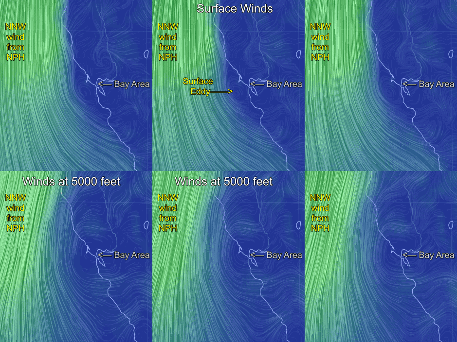
But in recent days we have upper trough at ≈ 18,000 ft. near the Bay Area and this has induced counter-clockwise circulation in the air  above us from near the surface up to the 850 mb level at ≈ 5000 ft. This flow above us goes on for days and it causes the surface eddy to enlarge and continue day and night. This means non stop southerly flow along the coast. And for the Peninsula it means W to SW flow at many launch sites.
You can see the impact of the winds at 5000 feet in the 3rd. animation. See how the winds at 5000 feet would act to reinforce and expand the surface eddy.
When the upper counter-clockwise spinning circulation is directly over the waters just west to the Bay Area we get a “Jeff” type long lasting eddy which is round in shape. This means it really only impacts the coast from about Half Moon Bay to Bodgea.
As the upper trough at ≈ 18,000 ft. moves eastward the counter-clockwise circulation above us also moves westward so the surface eddy becomes compacted near the coast and we see a “Mutt” type of eddy that is long and slender and runs parallel to the coast.
Once you see a “Mutt” type of eddy you know that the eddy pattern will end in a day or so. And it also means the the North Pacific High’s surface NW winds will return to the coast as we will see today July 17, 2016.

