Thursday May 23, 2024
Todays forecast:
Strong Gusty winds Coast, including OB and from Crissy to all Peninsula launch sites and outer waters + R&G and Sherman.
The Bodega profiler shows 35 knot NW winds 200 meters aloft while Mt. Diablo is 28g34. This afternoon these winds blast to the surface due to:
1. A large 3300-mile-wide North Pacific High.
2. Which has packed isobars along our coast.
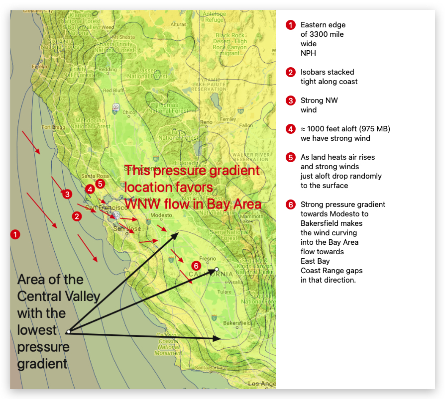
3. This means a strong NW ocean winds.
4. This has also brought very strong NW winds just over the Bay.
5. As the land heats, the surface air rises and that wind aloft swoops to the surface which you experience as gusts.
6. The NW ocean winds flow through the Nacaiso Gap, Golden Gate and San Bruno Gap where they “feel” as…
7. Strong Central Valley pressure gradient that is focussed from Stockton to Modesto to Bakersfield.
8. This causes the NW ocean winds to curve towards gaps in the East Bay hills in that direction.
9. So sites along those pathways are windy.
Curious about Bay Area winds? See our wind blogs!