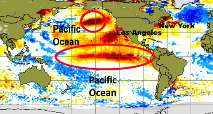
By WeatherFlow meteorologist Shea Gibson. What is El Niño and how will it affect our East Coast wind pattern? El Niño is basically the warming of the equatorial Pacific. Specifically for the effects it causes us in the United States, it’s the warming of water surface temps above normal along the eastern Equatorial Pacific. The higher sea surface…

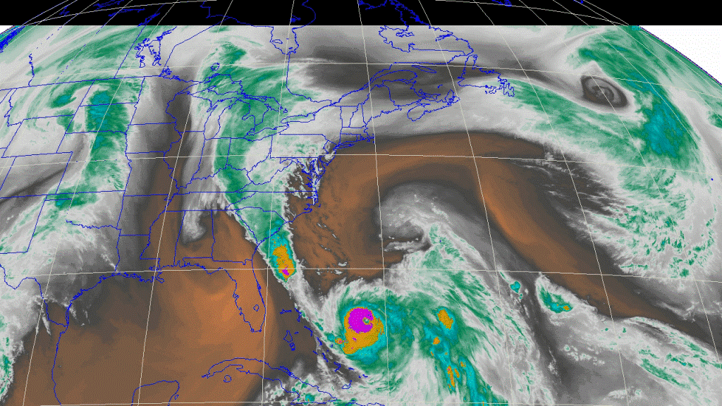
by WeatherFlow meteorologist Shea Gibson Well. Enough words cannot be said about what just happened here in the SE Region. Specifically to South Carolina. What could have been a “possible” hurricane landfall from Hurricane Joaquin became a rain event of historical levels. Why did this happen? Let’s go back and view the weather pattern setup. Then we’ll take…
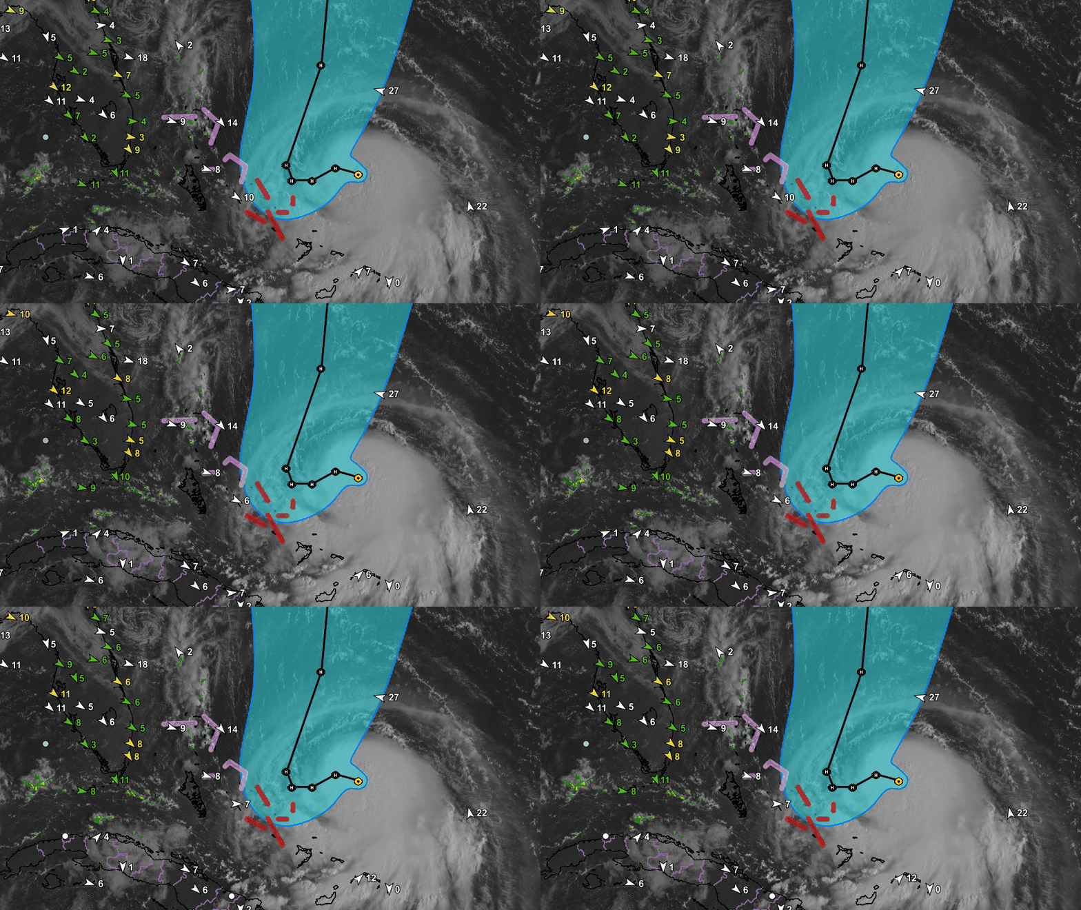
By WeatherFlow meteorologist Shea Gibson HURRICANE JOAQUIN 11AM UPDATE: The National Hurricane Center has kept Joaquin at a Category 4 Hurricane with 130mph winds (slightly down 5mph from 5AM). It has very recently started the northerly turn and is heading North at 3mph. Pressure at 939mb’s. The slight weakening phase is likely due to cold…

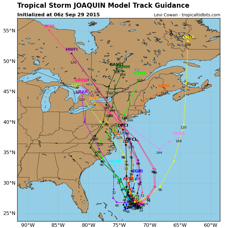
By WeatherFlow meteorologist Shea Gibson. Joaquin is now a hurricane and could very well become a major hurricane in the next day or so. As of 8am this morning on September 30, 2015, winds are up to 75mph and pressure down to 970mb’s. Movement SW at 6mph towards the Bahamas. Models currently still trend westwards…

By WeatherFlow meteorologist Shea Gibson Mixed bag of …..man what a mess. Joaquin expected to meander a couple or 3 days then make a move while slowly strengthening. NHC still betting on the West over to North turn. Could slide SW and strengthen near the Bahamas for a good tan and a fresh Mojito…then get…

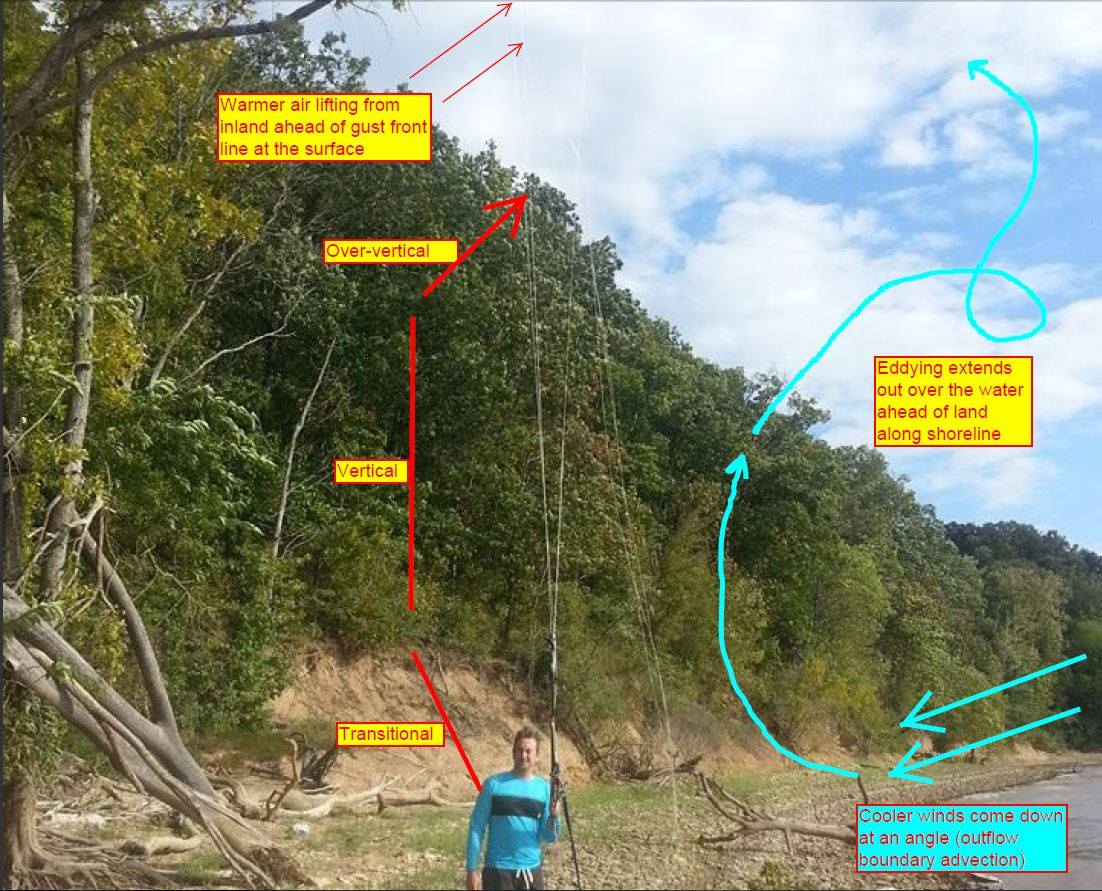
By WeatherFlow meteorologist Shea Gibson On Saturday, September 12, 2015, a friend of ours at iKitesurf named David Saunders had a kiteboarding accident on Kentucky Lake and was willing to share the story with us for educational purposes – very admirable I might add. Here is where we are talking about as we zoom into the region….

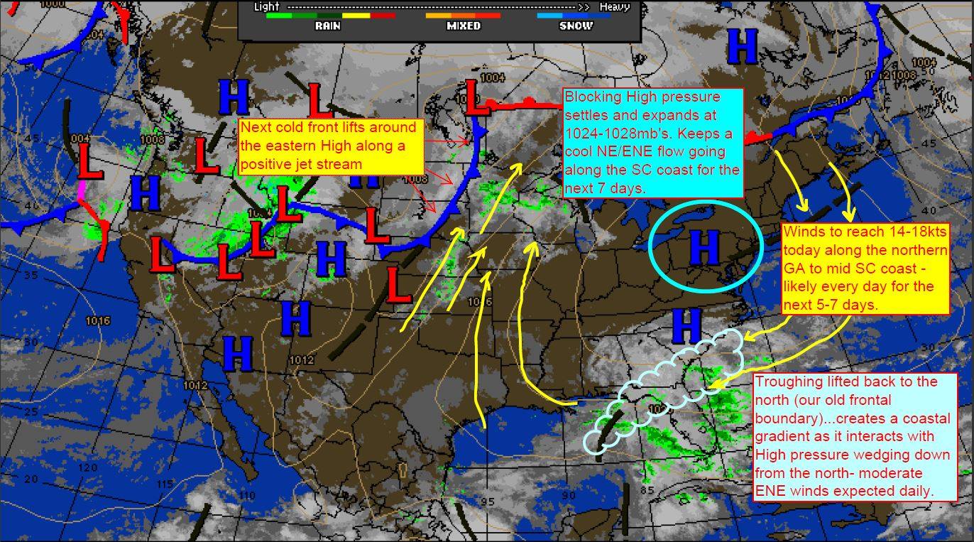
By WeatherFlow meteorologist Shea Gibson As I prepared a forecast for this evening, I thought “this seems too familiar”. It’s not like anything is really that off key for this time of the year as we head into our fall-like pattern, but it just seemed so familiar. I was thinking how the mushrooms are still…
By WeatherFlow meteorologist Shea Gibson The South Carolina coast has been seeing quite a bit of water spout activity lately – in fact pretty much on-and-off all summer. We’ve had the right conditions for these occurences on many days. Typically, water spouts are common along the SC coast in the mornings when we have offshore…
By WeatherFlow meteorologist Shea Gibson The remnants of Erika have just made it into the Atlantic off the coast of Savannah this morning. This was known as a Mesoscale Convective Vortex (a rotational land traveling Low pressure fed by concentrated storming) yesterday as it tracked across southern GA towards the ocean. These systems can be…
By WeatherFlow meteorologist Shea Gibson Hurricane Fred spun up as a tropical storm just as it entered into the Atlantic Ocean off the coast of Africa. For the first time ever, The Cape Verde Islands are seeing a hurricane develop before making landfall. Fred intensified quickly to Category 1 hurricane status at 80mph and is currently closing…
