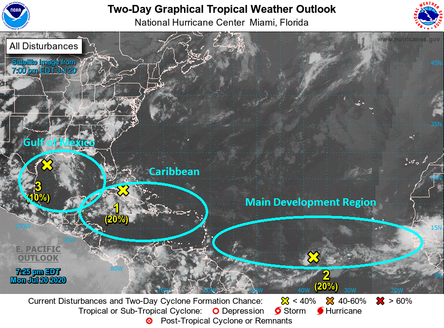
By WeatherFlow meteorologist Shea Gibson on 7/20/2020 at ~9:00PM ET. 7/20/2020 Monday 8PM Tropics Update: We are starting to climb into the more active portion of the hurricane season and will begin to see more activity in all areas of the Atlantic basin including now the MDR (main development region). Here are the 3 main…

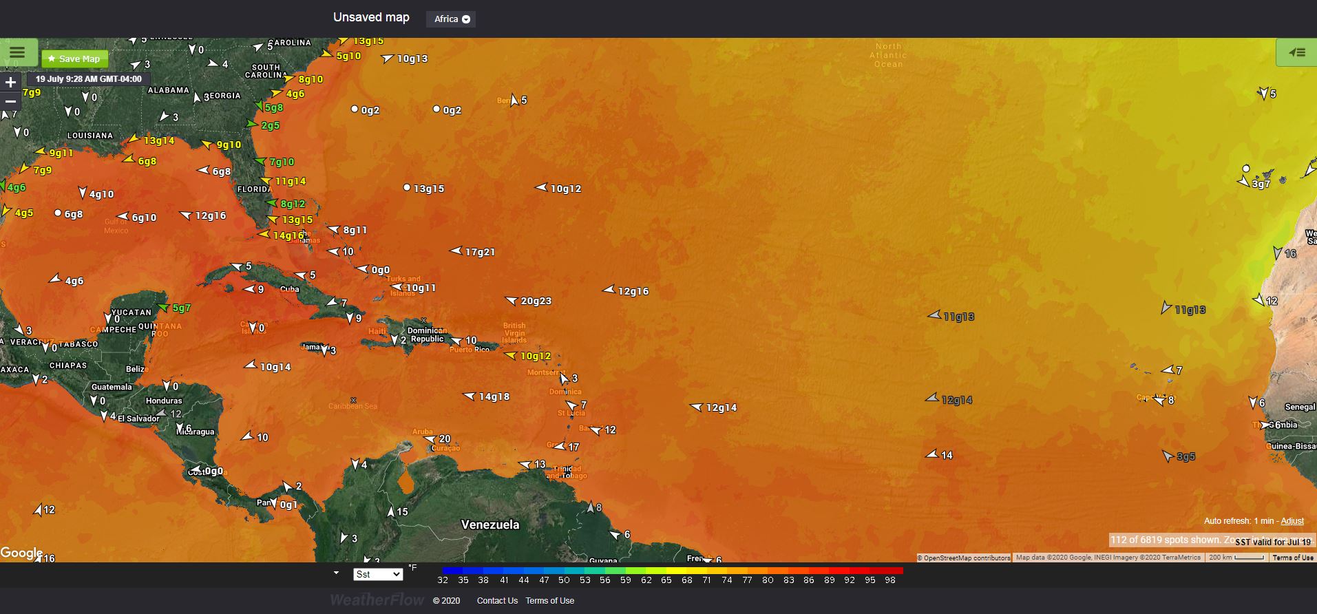
By WeatherFlow meteorologist Shea Gibson 7/19/2020 Well here we are in the middle of July with several areas of the Atlantic basin warming up to optimal sea surface temperatures that support tropical cyclone development. The magic number for tropical cyclone development is not exact, but is generally pinned right around 26°C or 78.8°F or above….
By WeatherFlow meteorologist Shea Gibson 6/30/2020 Well the Sahara Air Layer sure made the news with quite a dazzle this past month (June 2020), but just know that this is normal to see these giant plumes of dust aloft at the mid levels stretch across the Atlantic basin all the way to parts of the…

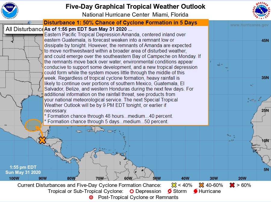
By WeatherFlow meteorologist Shea Gibson on Sunday May 31, 2020. Earlier this morning, the first named storm of the seasoned formed in the eastern north Pacific: Tropical Storm Amanda Winds 35kts gusting to 45kts As of 4PM CDT today from the NHC Eastern Pacific, the storm became a remnant low and the last advisory was…

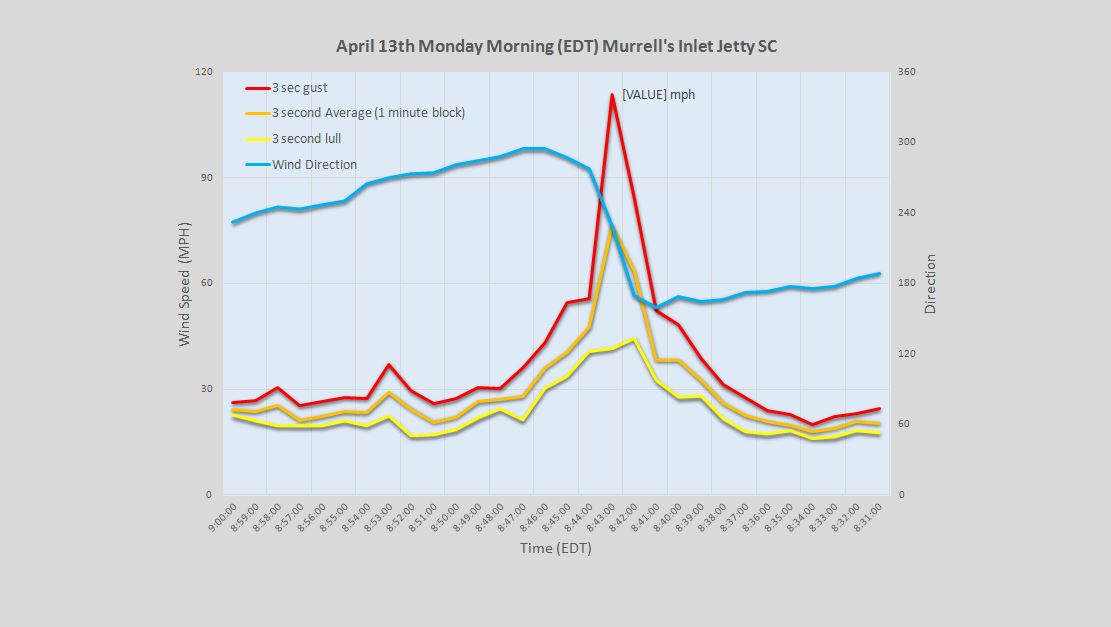
Update 4/27/20: Per the US National Weather Service Charleston, SC: “The Hampton County, SC tornado from 4/13 has been upgraded to an EF-4 tornado. It becomes the first F/EF-4 on record in the Lowcountry region of SC and the first F/EF-4 tornado in SC since 11/7/1995 (Marion County).” On Monday morning, April 13th, we saw…

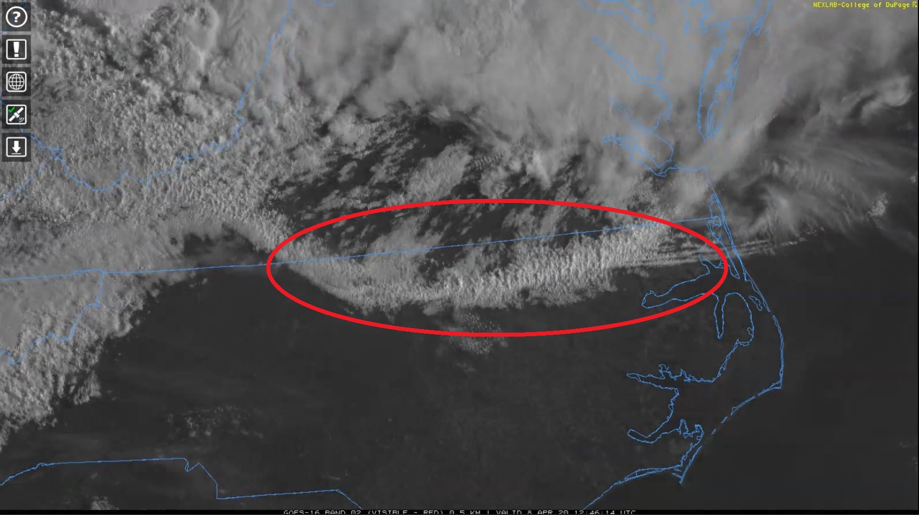
By meteorologist Shea Gibson 4/11/2020 On Wednesday, April 8 we had a unique event occur in the morning that goes to show how complex weather systems can totally change a wind forecast very quickly. Specifically, the Tidewater and OBX locales were substantially affected by what is known as an “outflow boundary” or “gust front” for…

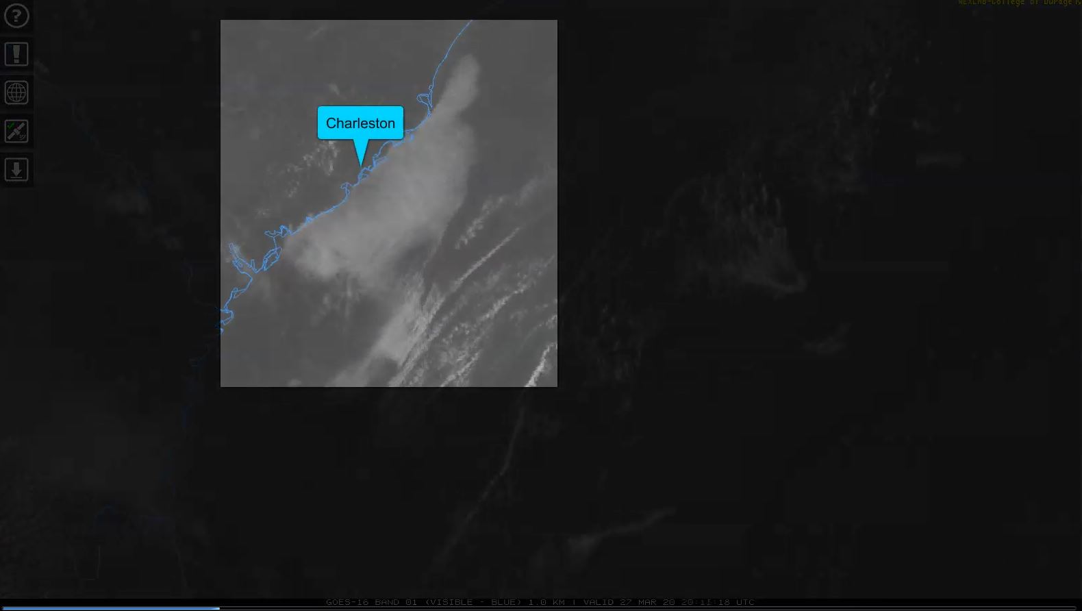
By WeatherFlow meteorologist Shea Gibson written on 3/29/20. Lots of folks on the water (and meteorologists alike) saw a fog bank encroach the coastline late Friday afternoon and into the evening. It was rather peculiar because we generally would see a marine layer (fog) build along the coast as ambient air temps surpass the water…
By WeatherFlow meteorologist Shea Gibson 3/26/2020 Ever heard of CAD? It is a term in meteorology known as “cold air damming”, where cool dense air settles under an area of High pressure under a blanket of thick stratiform clouds (mid to low level clouds). Along the East Coast, we see that this cool body of…
By WeatherFlow Meteorologist Shea Gibson Discussion viewable on Facebook Live: 8/29/19 Thursday 9:15PM ET Hurricane Dorian Discussion Posted by Shea Gibson – Meteorologist on Thursday, August 29, 2019 Stay safe and cheers from us at WeatherFlow! Shea Gibson SE/East Coast Wind Forecasting New Station Project/ Outreach Twitter: @WeatherFlowCHAS Facebook: Shea Gibson – WeatherFlow

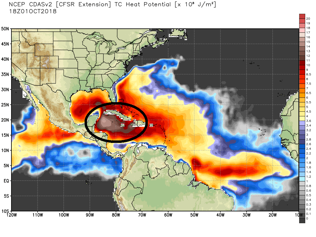
By WeatherFlow meteorologist Shea Gibson Tuesday, October 2, 2018 As we start the month of October, we are still very much in an active portion of the hurricane season, which does not formally end until November 30th of each year. The Tropical Cyclone Climatology graph below represents where we currently are on the timeline in…
