Here is the link to the daily forecast Take a look at that computer gear at my workstation in the La Ventana area. Ancient gear, huh? You can tell I have been doing Baja forecasting for a while. Since those times my computer gear is much faster and my forecasts far better. Below are some…
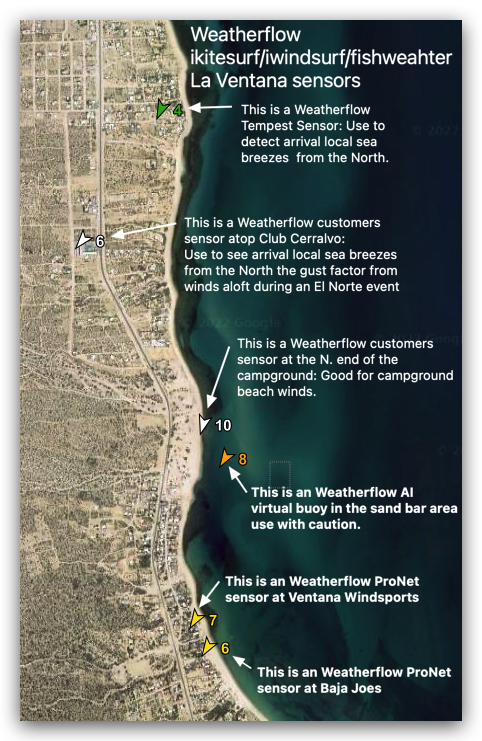
Here is the link to the daily forecast This graphic tells you how to use the various Weatherflow sensors installed in the La Ventana area. As more customers arrive and set up their WeatherFlow-Tempest sensors this page will show more wind data: El Sargento, La Ventana and Los Barriles sensors. The Weatherflow sensor at Baja…
Sometimes times you don’t need a sensor. Just a photo, like this one showing the gear of choice at one of the 3rd. Ave. launches Saturday October22 @ 5: 15 PM. This photo from the cam tells you a lot about the wind velocity Today was a very weird case of “NW clearing winds”. Weird…
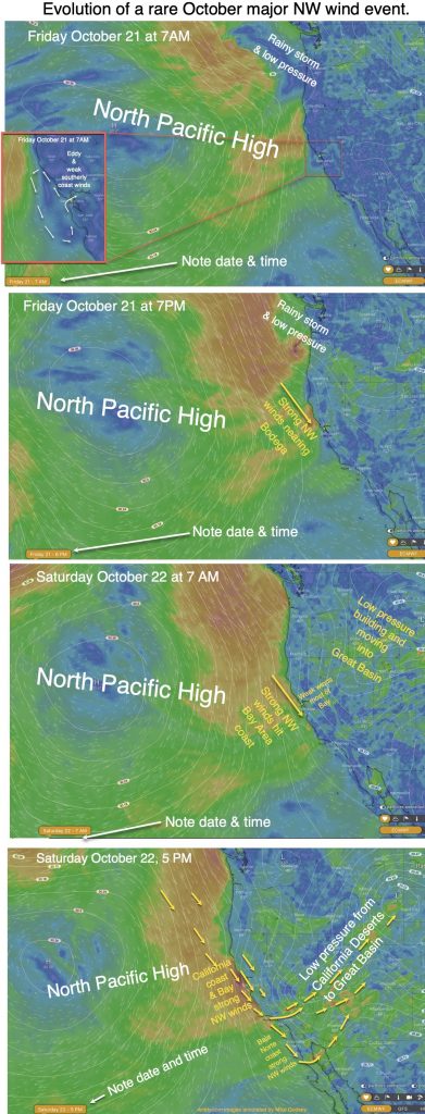
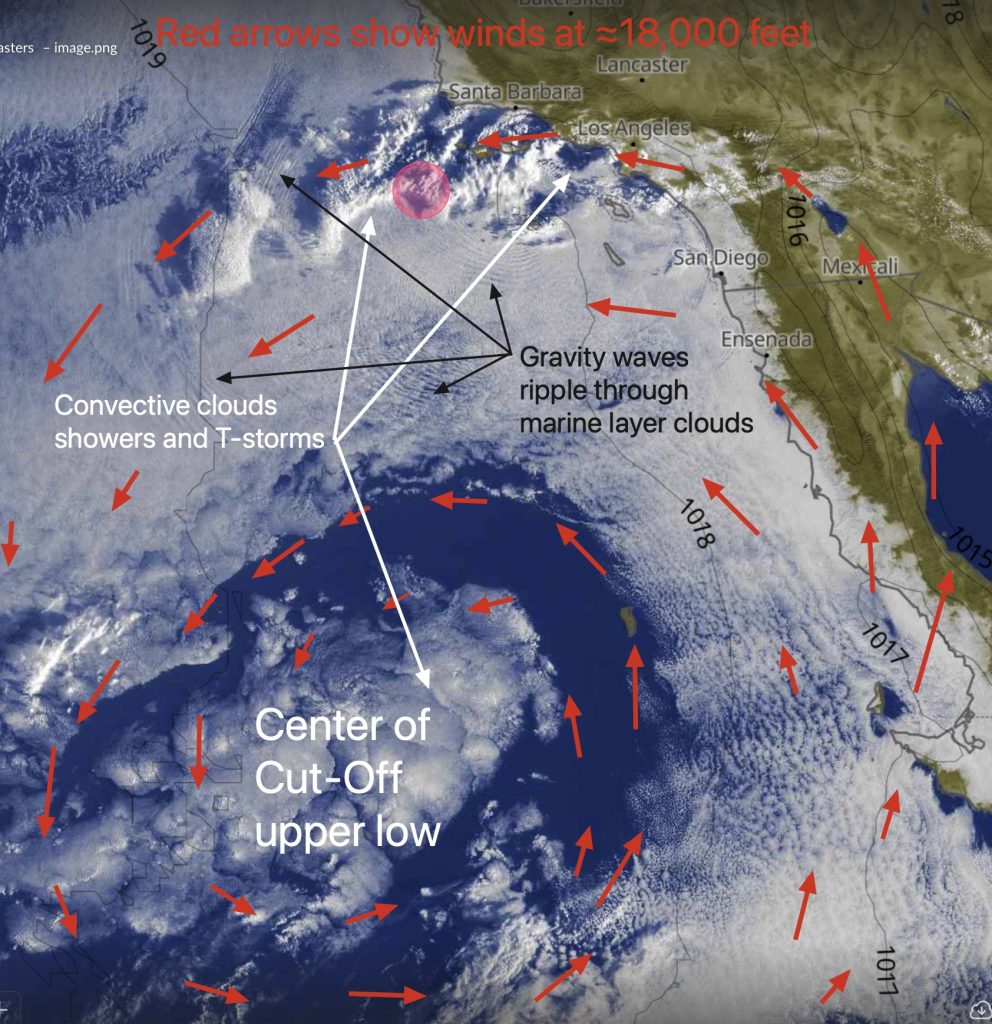
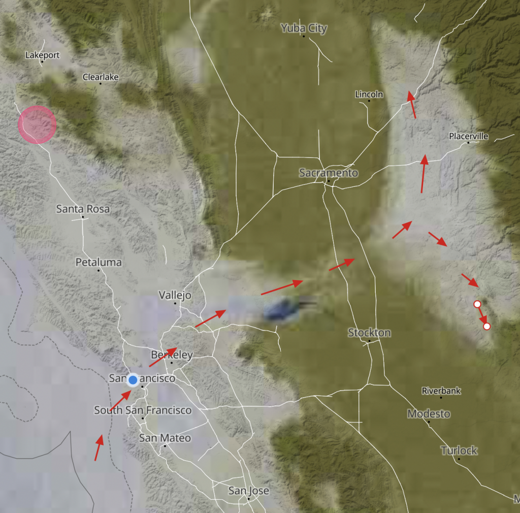
We are used to big NW clearing winds in the spring. But such events are rare in late October. Rarer yet is a counter-clockwise spinning eddy and southerly coast winds evolving into a powerful NW wind event. These images show how this event evolved. See satellite imagery of this event in this blog.
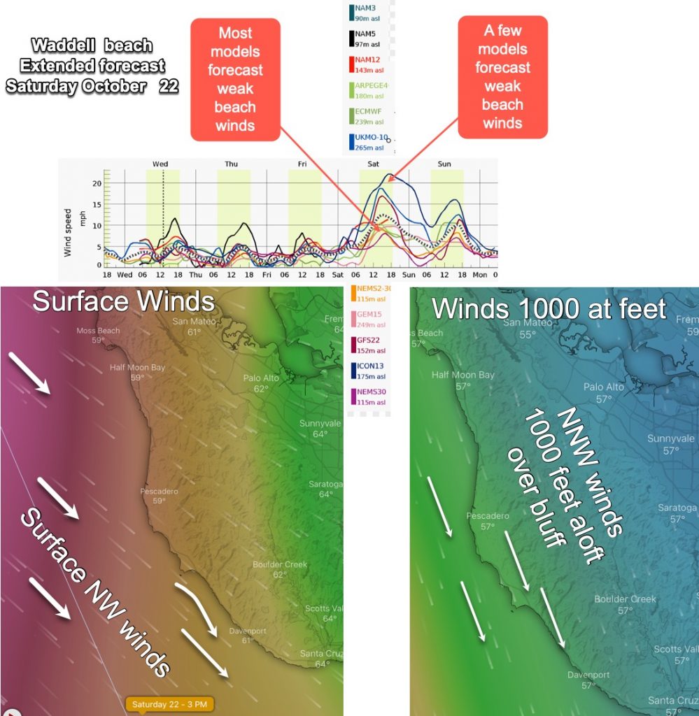
Hi Mike Hi Mike, “The extended forecast for saturday is saying “waddell low teens”. “Yet the computer generated AND the NWS both are showing 20+ (for October 22)” I seem to have to use the NWS instead of the “in person” (extended forecasts) for Waddell. Of course the NWS shows winds “out at sea” and…
Much of early October saw the Weatherflow iwindsurf.com/ikitesurf.com forecasts barely changing from day to day for Southern California and the San Francisco Bay Area. During that time marine layer clouds clogged the Bay Area and the Southern California bight much like June Gloom. The cause of this stagnant weather pattern was the Rex Block discussed…
A prolonged period of mild southerly winds due to lingering eddies and the Central Valley thermal low expanding over the Northern California has keep the marine layer very deep recently. This first half of October has been more like a classic “June Gloom” than the antiquated phrase “Indian summer” for October weather. Today is exceptional…
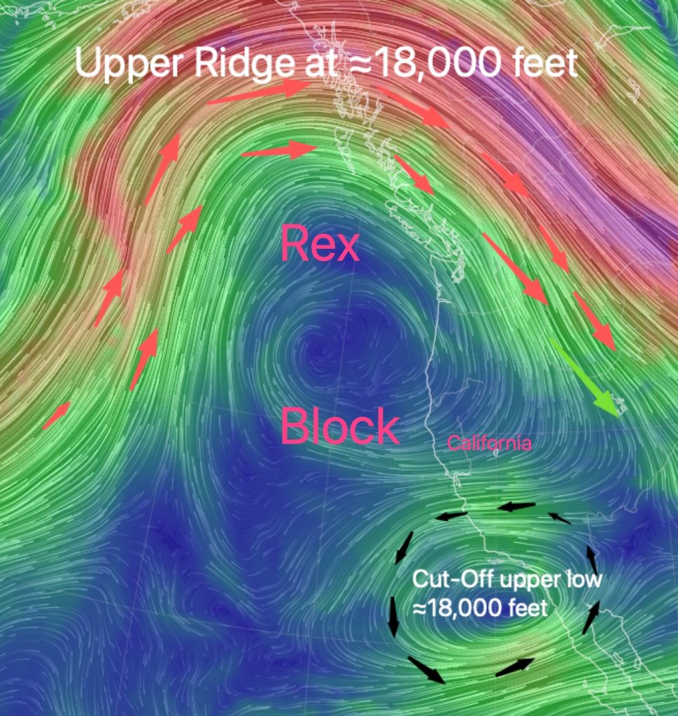
Have you noticed that our San Francisco Bay Area forecast text has barely changed recently? Almost every day there is mention of the Central Valley thermal low over the coast and a chance of an eddy and largely absent NW ocean winds. Before you attribute the repeated forecast text to forecaster laziness consider the Rex…
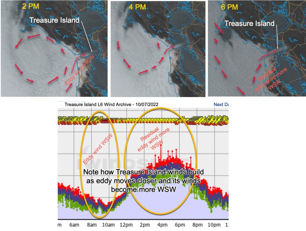
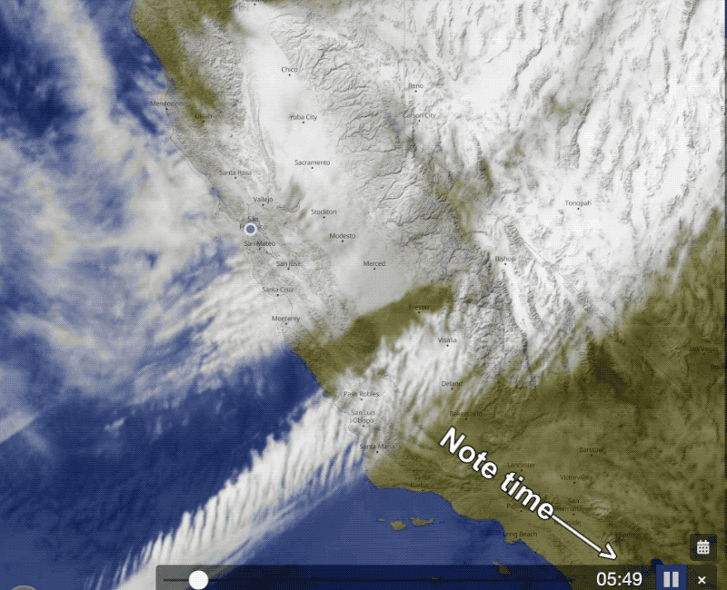
Yesterday saw a sudden appearance of an eddy around 8 AM west of Bodega. You can see that happening in yesterday’s blog. Todays blog’s first image shows the eddy from its near dawn birth to its death near nightfall. This blog concentrates on how that eddy jacked up the winds at Treasure Island and Berkeley…
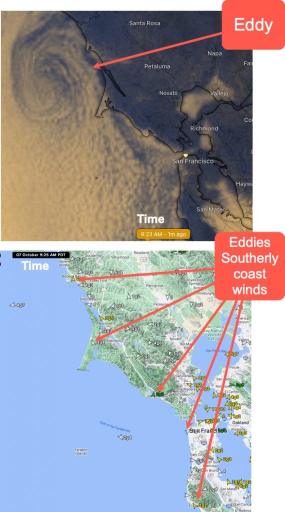
Now at 9:23 AM an un-modeled counter-clockwise spinning eddy has suddenly developed WSW of Bodega. This eddy is creating southerly wind on the coast from Half Moon Bay northward. At this time it is also directing a broad streamer of fog from the Golden Gate towards Pt. Isabel. You can see all this in this…