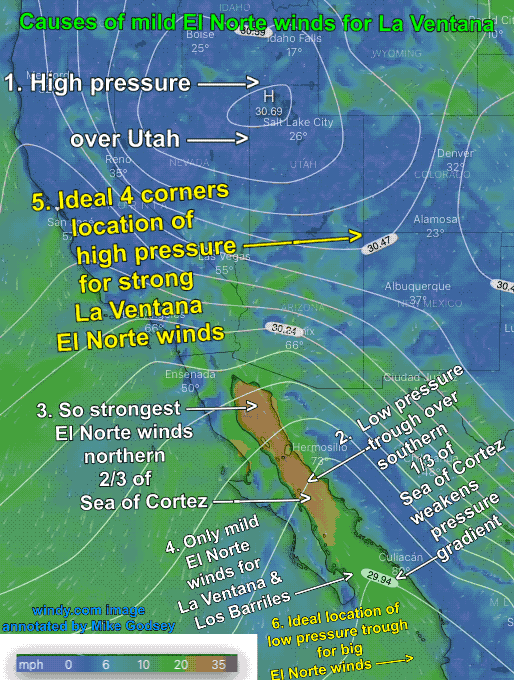
In Part 1 of this blog, we saw how lingering surface high pressure over the Great Basin kept the El Norte winds blowing for days rather than the typical 2-3 days. In Part 2 we saw how an upper ridge can anchor that surface high pressure in place while increasing its strength. Now Part 3…
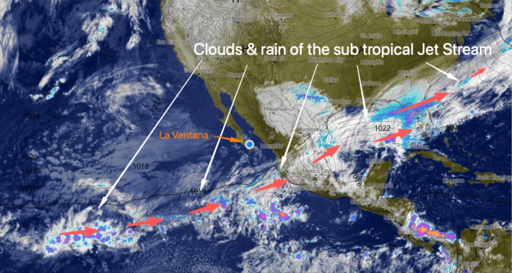
This photo from 2019 shows the dawn clouds from the sub tropical jet stream. They make for a beautiful sunrise and this big swell rolling onto the Rasta Beach north of El Sargento sure look promising. But all those clouds mean it was difficult to get coastal valley heating we needed to get that big…
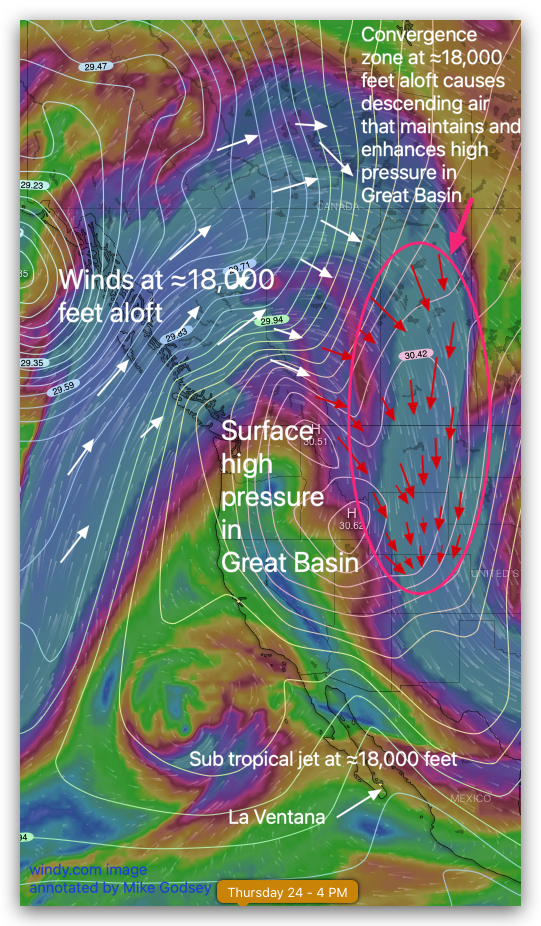
In Part 1 of this 3 part blog we saw how lingering high pressure over the Great Basin kept the El Norte winds blowing for days rather than the typical 2-3 days. But the question remains… why did that high pressure linger so long and stay so strong. Part 2 of this blog answers that…
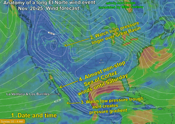
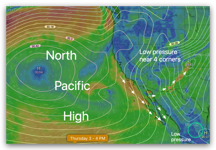
If Matt and my forecasts are right we are in for a long spell of moderate El Norte winds coming down Sea of Cortez from the Great Basin. The 3 part blog looks at the 3 major causes of this event from Nov. 20 to around Nov. 25. Typically El Norte wind events last 2-3…
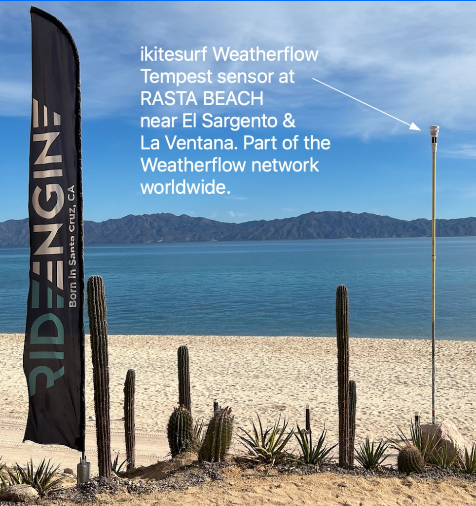
There is now a Weatherflow Tempest weather station at Rasta Beach about 1 km north of El Sargento. This sensor at hosted by the great folks at Kitesurfing Planet. Be sure to check out all their rental gear and the amazing beach side restaurant. The sensor is at the back of the beach so it…
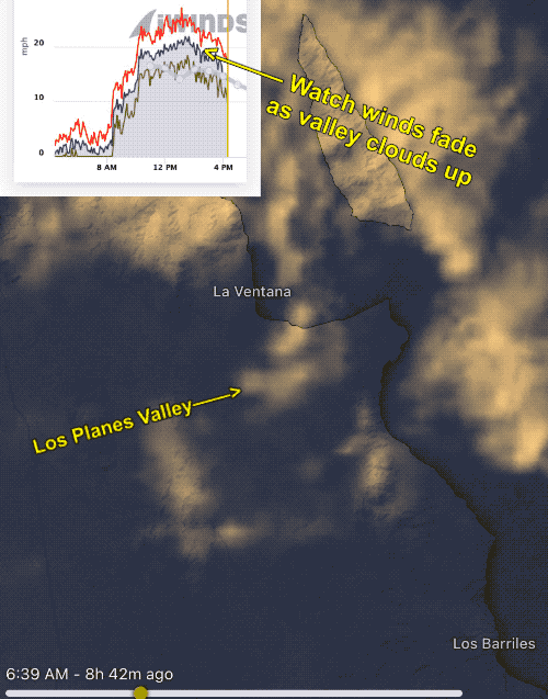
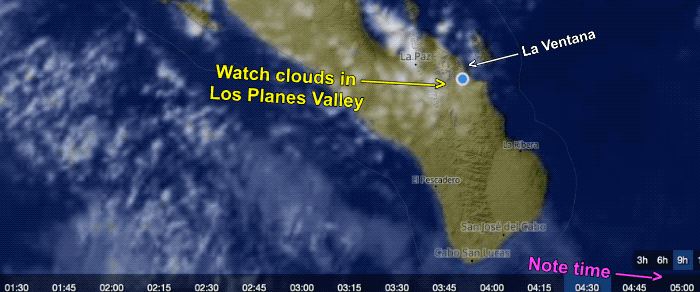
My forecast yesterday, Tuesday, Nov. 15 was for early winds but with clouds as an issue. Both of those forecasts came true but with a twist. The entire Los Planes Valley was clear mid-day to early afternoon so the winds were a bit stronger than forecast. But the cloud really danced around the valley all…
Long ago the powerful winter northerly winds that started in the middle of the night and then blew for several days were called the “El Norte” winds. This photo taken at the sand bar break called “The General’s) just north of the La Ventana campground shows a classic El Norte day. In recent years those…

Clouds are likely to limit local sea breezes today and make it difficult for weak El Norte NNE winds to reach the shore:
Today we are seeing a massive 4000-mile-wide North Pacific High repeating last winter’s pattern. On the right margin is the Southern California wind graphs from Ventura to San Diego’s Silver Strand. What caused these strong NW winds clearing winds in November? The first map image shows the North Pacific High which is located in a…
As we go into the 3rd La Nina winter our hope is that this is a repeat of last year’s epic winds from the North Pacific High. Typically La Nina means poorer winds compared to a Neutral Year. But last year the North Pacific High hung closer to Baja’s west coast than normal from whence…