
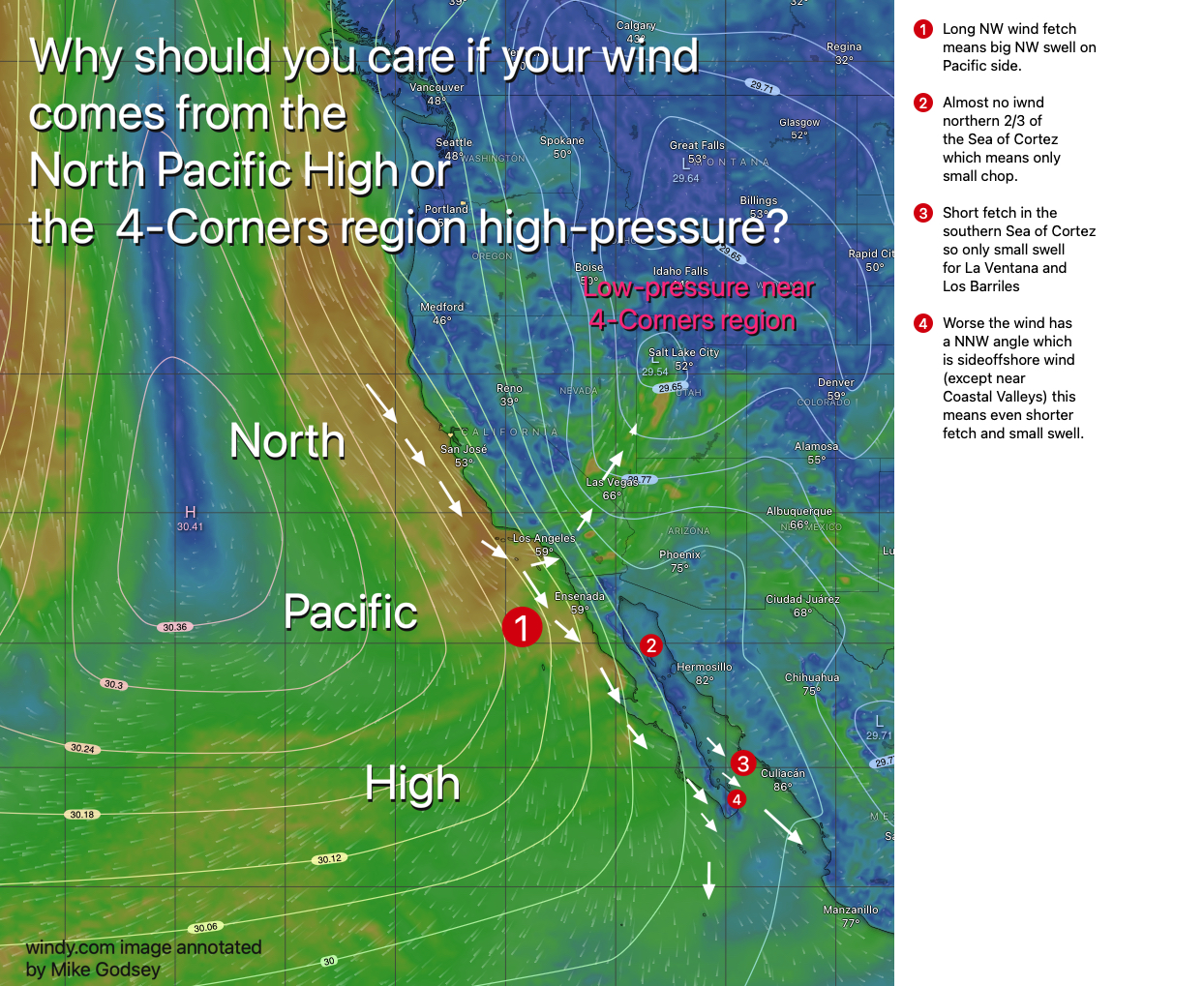
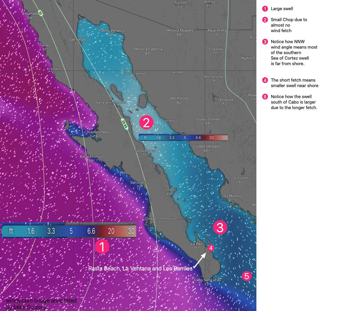
This year most of our wind on Baja’s East Cape has been a combo of mild local thermal winds and moderate large scale winds. In past decades most of that large scale winds originated in the 4-Corners region of the USA and roared down the Sea of Cortez with a N to NNE angle. That angle allowed it to blow straight in to the Rasta Beach, La Ventana and Los Barriles launch sites.
It also meant the wind blew over hundreds of miles of the sea creating large swells with a long period.
In recent years most of our stronger days were a combo of local thermal winds and NNW wind from the North Pacific High west of Baja. This created a problem. NNW winds are at a slight side offshore angle to most of the Sea of Cortez shoreline so part of the wind has to come over the mountainous backbone of
the Peninsula. This makes the winds more unreliable compared to wind coming over water. It also means the the wind will not reach the shore reliably unless there is a local pressure gradient to make to curve into N to NNE winds.
But what does this all mean for the swell?
And the old-timers talking about the huge swell of bygone decades… are they right or are they just blowing old steam?
I will explore this issue in later blogs but these graphics show the issue with the North Pacific High’s surface NW and NNW wind and how they impact swell size and period.