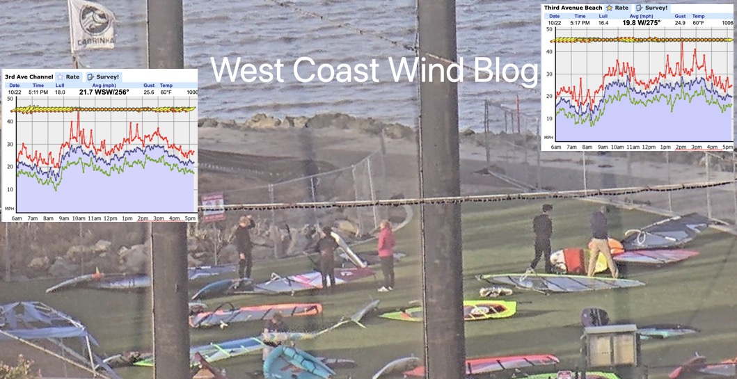
Several years ago I was at 3rd. Ave. on San Francisco’s Peninsula rigging when I heard a conversation that went something like this: “We just are not getting the usual NW winds this summer. The North Pacific High has disappeared”
That season the San Francisco Bay Area had a summer cursed by frequent eddies off the Golden Gate which created very frequent southerly winds on the coast and Bay and often no NW ocean winds near shore.
Or rather…
Several years ago the San Francisco Bay Area had a summer season blessed by frequent eddies off the Golden Gate which created very frequent southerly winds on the coast and Bay and often no NW ocean winds near shore.
Pick the preamble sentence you prefer based on your home launch site.
Either way, the North Pacific High rarely disappears although it may shrink and be far from California and Hawaii in the winter as you can see in this study of the 43-year average monthly size and location of the NPH. Notice how it moves closer to Baja in the winter.
But sometimes each summer the North Pacific High’s surface NW winds do disappear from the Bay Area coast for days or at least greatly weaken from their spring and early summer robustness. And this happens even more frequently in Southern California.
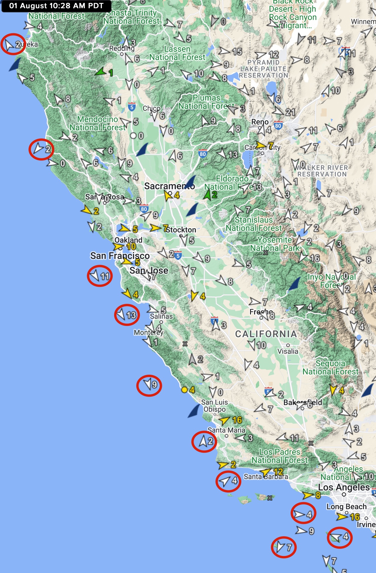
Today, August 1, 2022, is a good example of a “disappearing North Pacific High” with weak NW winds at all of the California ocean buoys.
So where exactly ARE the North Pacific High’s surface NW winds today and other times when the NW winds are absent or weak?

The weak NW winds you see in the mid map above extend all the way from the Oregon border to San Diego. But looking at the Pacific today, August 2, 2022, you can see that there is actually a huge 4000-mile-wide North Pacific High that stretches from way west of Hawaii to the Gulf of Alaska to Canada. But, notice the small low-pressure system just west of Northern California. The low is being caused by a Cut-Off upper low at ≈18,000 feet. And this system is diverting the NW wind to the west stopping them from reaching California inshore waters. Notice that it is also partially blocking coast winds for Oregon. So there are still strong NW ocean winds but it would be a long slog from shore to get to them.
On a smaller scale, this diverting of the NW ocean wind also happens when there is a Catalina Eddy in the Southern California bight
Likewise larger eddies west of San Francisco can keep the NW winds away from shore.
In the case of Southern California and San Francisco Bay Area eddies, the key factors in producing them are NNW to NE winds inland blowing over the coast range plus inland low pressure bulging over the coast. And often both of these factors fade mid-day allowing the NW winds to curve into the coast in the afternoon. You can see this happening in this animated satellite image. It is very difficult to forecast exactly when an eddy will die and the NW winds return. But we are pretty good a forecasting when an eddy will develop and which days it will linger all day.