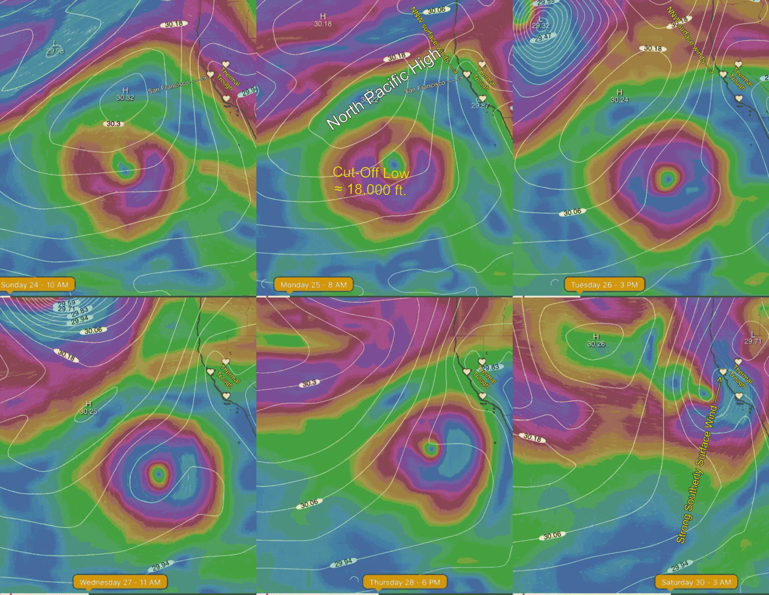
About a week ago I mentioned a wayward Cut-Off Low located between Hawaii and Baja up at ≈ 18,000 ft. At the time it looked like it would march towards Northern California and impact the Bay Area. Turn out I was right on. This animation shows the Cut-Off Low as well as the North Pacific High.
Note that today we have NNW ocean winds along the coast just west of the ocean buoys and eddy conditions near shore.
Watch how the Cut-Off Low first brings strong southerly marine surge like winds for the entire coast late Friday. Then Sunday we see southerly storm winds and a chance of rain.


