Forecast Jargon Decoder: June 29, 2024
Unsettled upper-teens to low 20’s winds focus in the mid Golden Gate to Pt. Isabel ton near Pt. Isabel to mid San Pablo Bay. Meanwhile, upper-teens winds are unsteady in the 3rd. Ave. Channel and especially near the launch sites late.
This pattern develops as:
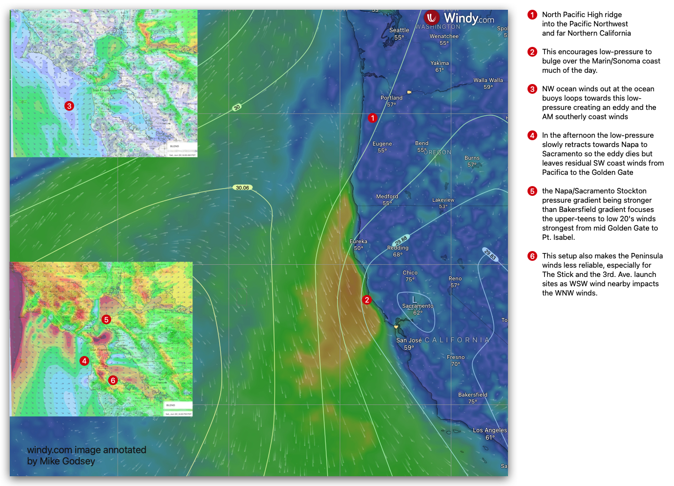
1. The North Pacific High pushes a strong high-pressure ridge into the Pacific Northwest, causing NNE wind over our Coast Range.
2. This encourages low-pressure to bulge over the Marin/Sonoma coast much of the day.
3. So the NW ocean winds out at the ocean buoys loops towards this low-pressure creating an eddy and the AM southerly coast winds you see in our sensors this morning.
4. In the afternoon, the low-pressure slowly retracts towards Napa to Sacramento, so the eddy dies but leaves residual SW coast winds from Pacifica to the Golden Gate.
5. This and the Napa/Sacramento Stockton pressure gradient being stronger than Bakersfield gradient focuses the upper-teens to low 20’s winds strongest from mid Golden Gate to Pt. Isabel.
6. This setup also makes the Peninsula winds less reliable, especially for The Stick and the 3rd. Ave. launch sites as WSW wind nearby impacts the WNW winds.
Curious about Bay Area winds? See our wind blogs!