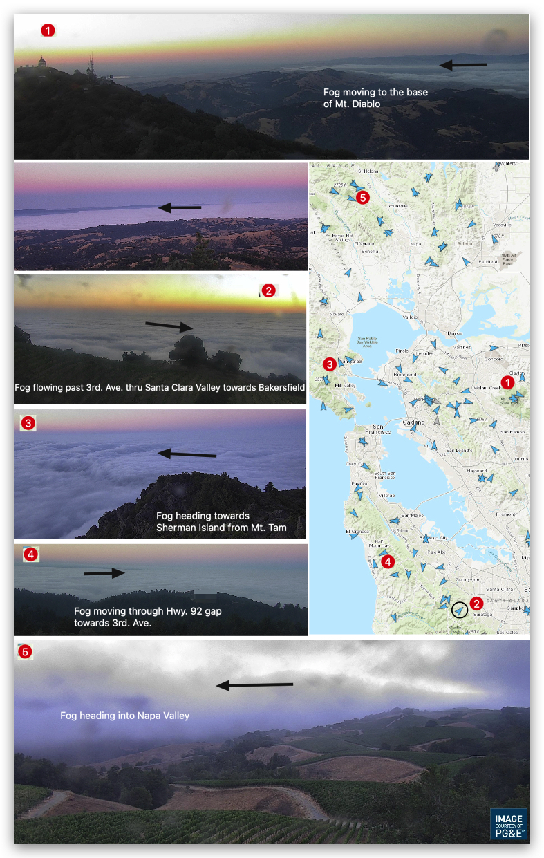
The cams atop Mt. Diablo and Mt. Tam show a sea of fog blanketing the Bay Area with both the Carquinez Strait, Napa Valley and the Santa Clara Valley fog filled.
This fog distribution, along with the barometers, tells us that there is a strong pressure gradient to Napa, Sacramento, Stockton and towards Bakersfield.
So if you are air parcel flowing through a gap in the Coast Range you will feel forces sucking you over almost every launch sites in the Bay Area.
How do you spell Déjà vu? 1. North Pacific High’s surface NW winds: Same, 2. Pressure gradient evenly split between Sacramento, Stockton and towards Bakersfield: Same. Strong winds mid Golden Gate to Treasure Island to near Pt. Isabel and Sherman Island, Same. Fog limiting Crissy winds, Same. The only real difference in the forecast is the lack of monsoonal over the Central Valley in the AM and no sign of an eddy. Both of which help the Sherman Island, Waddell and Peninsula winds.