Forecast Jargon Decoder. Saturday, June 1, 2024
Ye Haw! Can you count to 7? It takes that many numbers to bring low to mid to upper 20’s+ winds to the entire coast and most of San Francisco as:
1. Overnight, the North Pacific High retracts the high-pressure ridge that caused the WSW coast eddy winds.
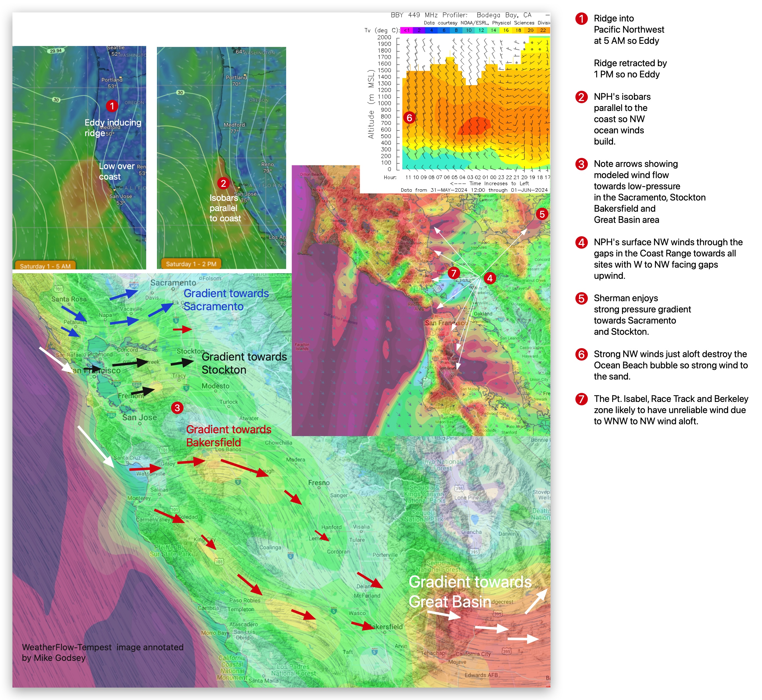
2. This allows the NPH’s isobars to stack up along the coast.
3. Meanwhile, the max pressure gradient is pretty evenly split between Bakersfield, Stockton, and Sacramento PLUS the southern Great Basin.
4. This tends to accelerate the NPH’s surface NW winds through the gaps in the Coast Range towards all sites, with W to NW facing gaps upwind.
5. So Sherman Island rocks in the afternoon and Tubamancha, Dillon and Natural Bridges are great!
6. Strong NW winds just aloft destroy the Ocean Beach bubble so strong wind to the sand. These winds also add a gust factor at some sites.
7. This also means unreliable winds for Point Blunt, Pt. Isabel, Race Track and Berkeley.
Curious about Bay Area winds? See our wind blogs!