The La Ventana & Los Barriles launch site wind forecast for the current day can be found on iwindsurf.com or kitesurf.com.

There is more promise today as high pressure presses into the northern Four Corners region and the North Pacific High strengthens and pushes closer to Baja Norte. But clouds will be the wind decider today.
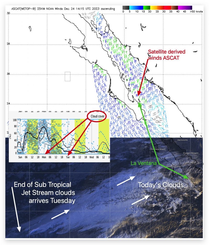
Starting Tuesday we see a long stretch of favorable blue skies but today the tail end of the Sub Tropical Jet Stream keeps clouds streaming from WSW. The models and the satellite-derived ASCAT wind both suggest mid to upper-teens El Norte winds streaming down the southern 2/3 of the Sea of Cortez.
We need blue sky to heat the Coastal Valleys and create to local pressure gradient to suck those El Norte towards us and accelerate them to the beaches. And for that we need a large blue patch to come over the area and at this time the satellite imagery only shows thicker clouds inbound from the west. .
Extended Forecast:
Monday: Unreliable upper-teens winds mostly just outside. About 1400 miles to the WSW I can see the ned of the Subtropical clouds but it will take some luck for the blue sky behind those clouds to reach us Monday afternoon. The Pacific side of Baja Norte picks up to upper-teens NW.
