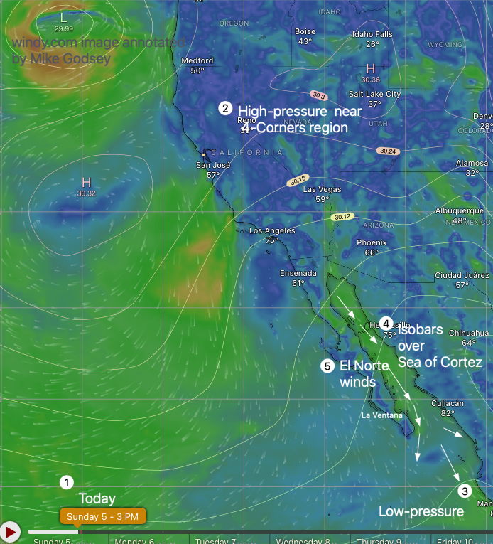
Today’s Wind Recipe:
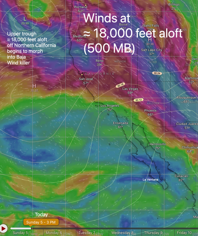
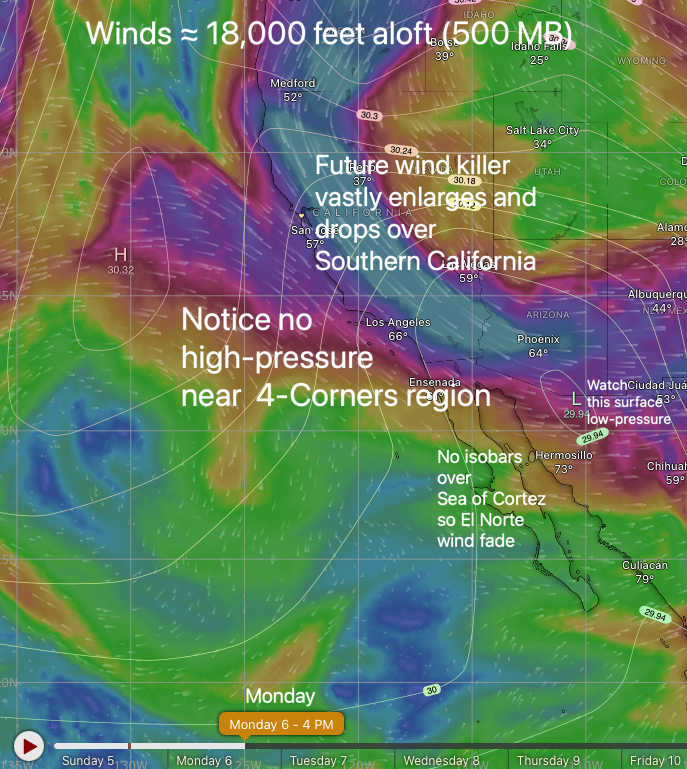
1. A chilly upper trough at ≈ 18,000 feet aloft drops over the 4-Corners region destroying the El Norte wind producing 4-Corners region high-pressure.
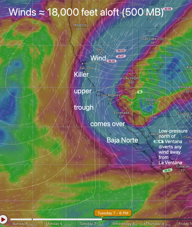
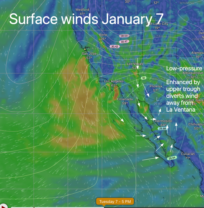
2. Killer creates a surface low-pressure at the north end of the Sea of Cortez spoiling the wind for that north half of the sea.
3. Low-pressure south of Cabo continues to create a pressure gradient over the Sea of Cortez and you can already see that wind line towards the horizon.
4. But blue skies over our Coastal Valley also curves and jacks up our beach winds as a local low-pressure develops.
5. Meanwhile, the wind killer you see in the blog above move closer may fade a bit earlier than usual.
La Ventana Area: Upper-teens to low 20’s but winds may fade a bit early.
El Sargento to Rasta: Upper-teens to low 20’s but winds may fade a bit early.
Los Barriles: Upper-teens to 20.
Extended Forecast:
Tuesday: Light and variable winds turn weak
easterly, with low pressure over Baja Norte.
Wednesday: Rasta Beach, La Ventana and Los Barriles likely see weak westerly winds and clouds as a cold front passes overhead.
Slight chance of sprinkles in the mountains especially near El Sargento. Very strong El Norte winds build as far south as La Paz.
There is a SLIGHT CHANCE that wind reaches
La Ventana. At the same time upper-teens NW winds develop on most of the Pacific side of Baja.
Thursday: Near Cut Off Low wobbles around making forecasting very iffy.
All models have strong El Norte winds over northern half of the Sea of Cortez.
One model has those winds reaching us. My take is: variable winds with a slight chance of upper-teens.

