Mike Godsey
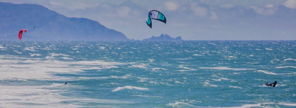
These photos from the Ocean Beach King of the Cove event on April 26, 2024, tell the wind story.
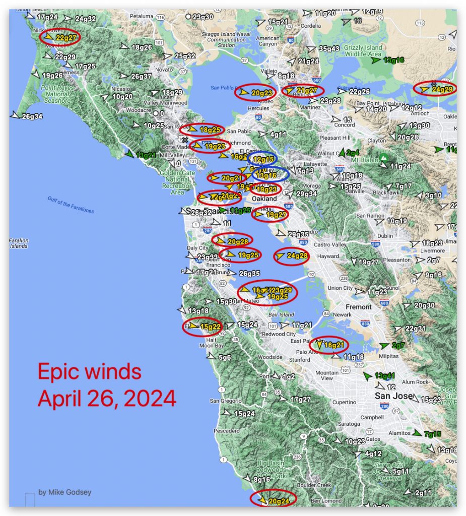
But if you need convincing that this was an epic day, look at the powerful winds at almost every WeatherFlow-Tempest shoreline sensor in the San Francisco Bay Area.
The Red circles show sites with strong winds.
The blue circles show the few sites with weak winds.
Both red and blue circles largely conformed to the values in my forecasts that day.
Lets look at Friday’s forecast and dissect what caused those epic winds and the weak winds at Pt. Isabel and Berkeley.
Powerful GUSTY EARLY winds hit Bay from Ocean Beach to Benicia and Sherman Island and Crissy to Palo Alto.
The “Perfect Wind” scenario yesterday replays today BUT with a much stronger gradient towards Bakersfield!
Whitecaps at Anita Rock at dawn foretell the AM story up and down bands of strong wind.
Then PM brings constant gusty low to mid 20’s WNW wind.
The pattern is similar to yesterday with fewer clouds and more reliable winds in the low to mid 20’s+ range on the coast at almost every site in the Bay Area.
This wind develops as:
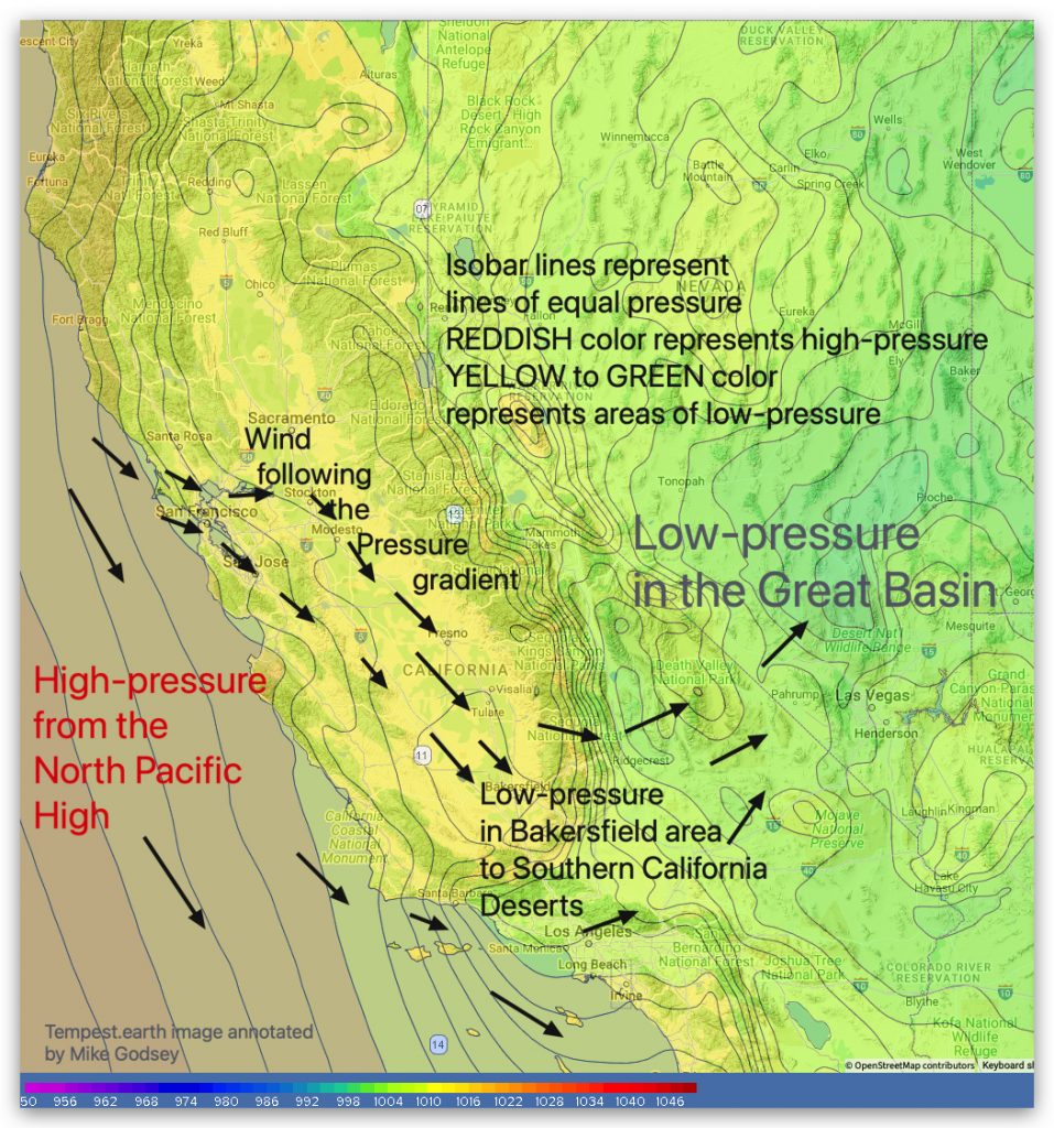
1. A very large North Pacific High delivers even stronger NW winds to the coast. 2. But the pressure gradient is different than Thursday since it is strongest towards Stockton and Bakersfield.
3. This causes the NW ocean winds to curve into WNW winds as they accelerate through Coast Range gaps and head toward Stockton and Bakersfield.
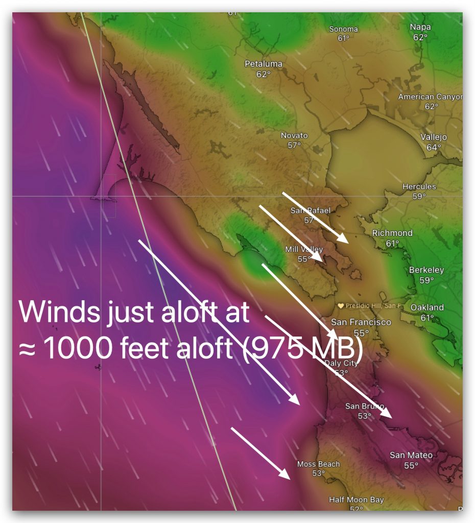
4. Winds at ≈ 1000 feet aloft (975 MB) crash into the Coast Range, become turbulent and randomly transfer momentum to the surface winds. Your wing, kite or sail experiences this as sudden shifts, lulls and blasdts
4. The Pt. Isabel and Berkeley launch sites will see weaker, less reliable winds as a wind battle occurs due to 2 different winds colliding in the sailing area.
Use caution when launching kites, especially at Stinson, Alameda, and 3rd. Ave. and Ocean Beach!
New to the Bay Area? Here are lots of wind blogs!


