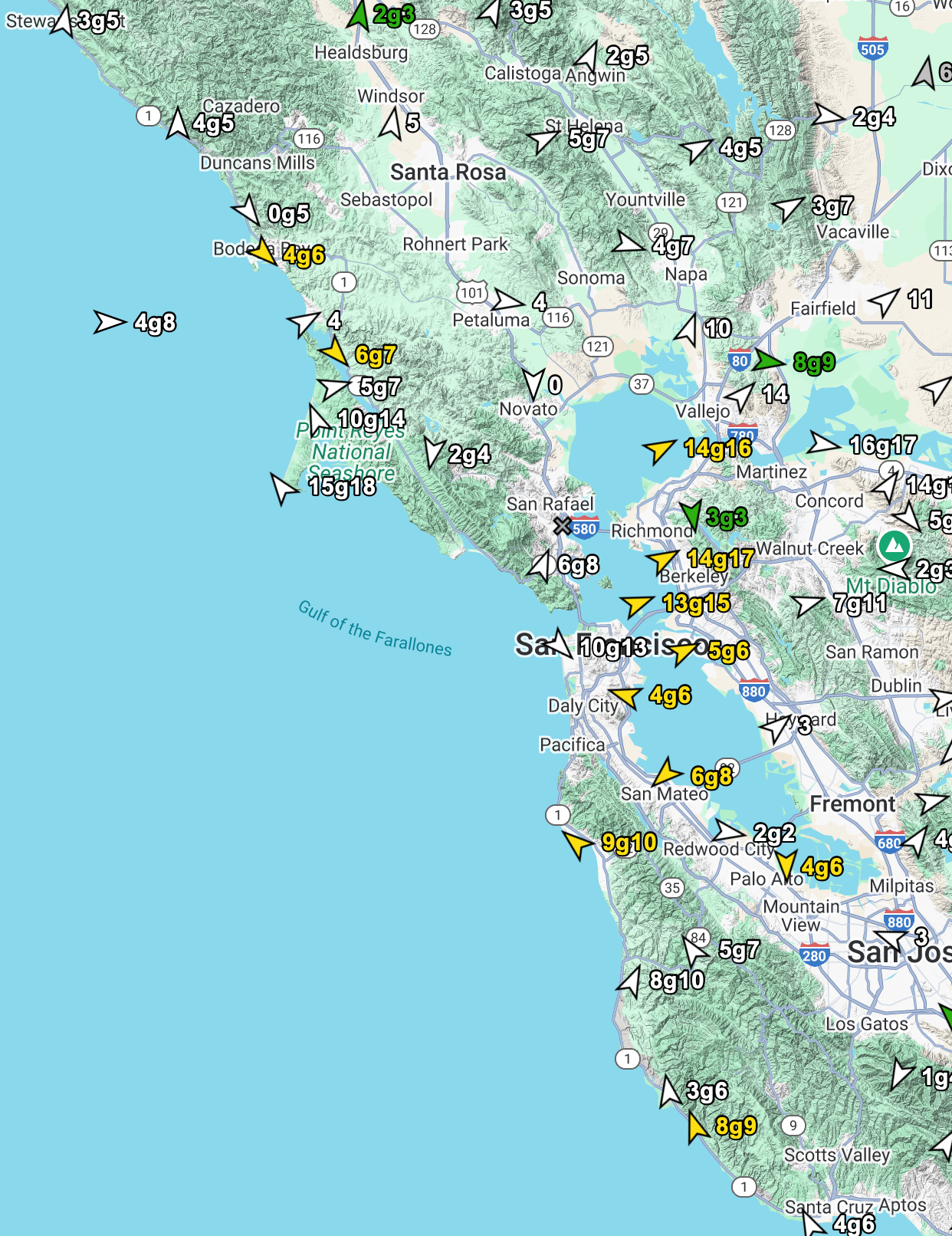
Preamble: Since the Bodega ocean buoy is NW 23g29, while the 449Hz profiler has average winds of 35 just aloft and my beloved Pt. Reyes is 23g3 I best will leave well enough alone:
Sunday forecast:
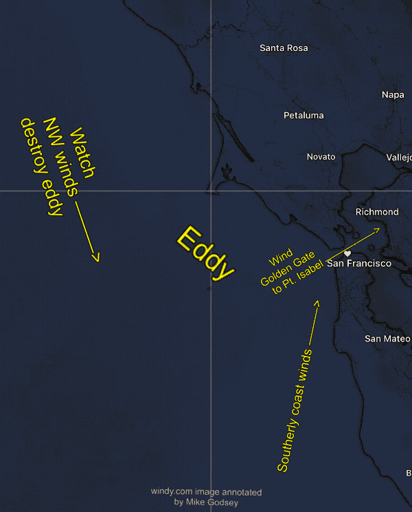
Powerful NW ocean winds obliterated the eddy and southerly coast winds as a massive, 3100 mile-wide North Pacific High and a Great Basin low-pressure grab the weather machine’s steering wheel.
Overnight a huge Gulf of Alaska storm pushes the NPH towards the West Coast and northerly winds hit the beaches from Canada to Cabo, Baja Sur. The low-pressure extends from the Sacramento to Stockton area to the NORTHERN Great Basin. This means the NW ocean winds turn WEST as they enter the Bay.
This focuses the low to mid 20’s+ winds in the Rod and Gun to Benicia to Sherman Island area as well as the Anita Rock to Treasure Island to Berkeley zone. On the Peninsula, this means low to mid 20’s+ winds from the Stick/Flying Tigers/Haskins to Alameda zone. Coyote and 3rd have very strong WEST winds in the Channel but UP AND DOWN WEST winds at the launch sites. Pt. Isabel to Race Track is mostly weak and UP AND DOWN.
Note: 30-40 knot NW winds ≈ 1000 feet aloft (975 MB) make the surface winds extremely GUSTY and way above table values at times. Use caution launching kites. East Bay and Coyote and 3rd winds subject to sudden lulls and blasts.