Forecast Jargon Decoder: Saturday Sept 21, 2024
The satellite imagery animation shows a rip-roaring eddy off Pt. Reyes with the lighthouse sensor SE 19g22!
But the Sacramento pressure gradient is strong enough to turn those SW ocean winds into WNW winds 15g19 at Sherman Island.
All this suggests I should just shut up and stick to my last night’s forecast:
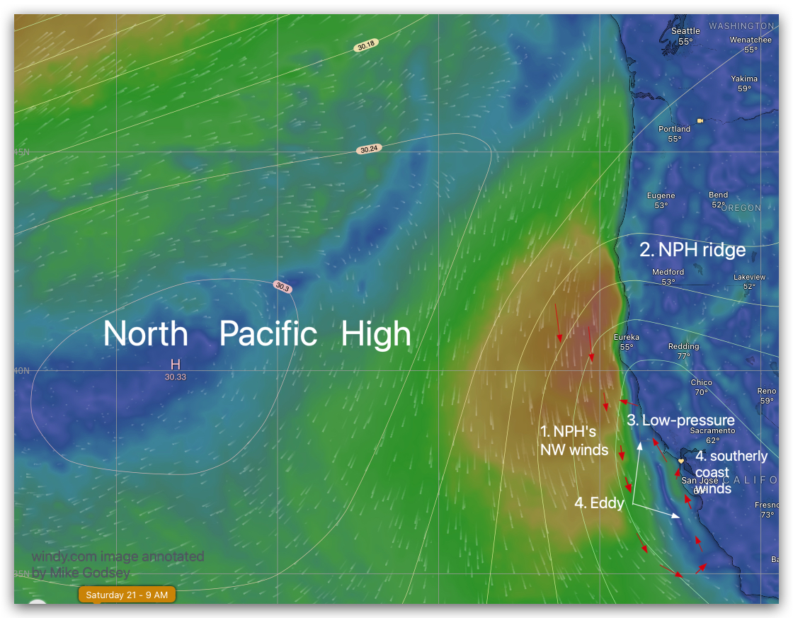
- The North Pacific High’s surface NW winds continue to roars about 80 miles west of the Golden Gate but…
2. The NPH holds a ridge into far Northern California and Pacific Northwest.
3. So, low-pressure from the valley bulges over the coast from Pismo Beach to Pt. Arena.
4. The resulting S. to N. pressure gradient causes an elongated counter-clockwise eddy to spin up, creating southerly coast winds in that same area.
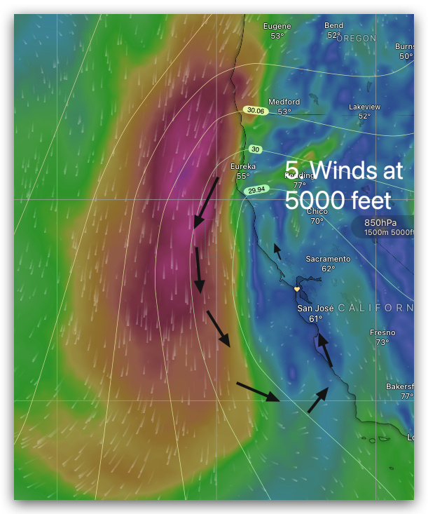
5. This surface eddy has counter-clockwise support up to 5000 feet aloft so it endures ALL DAY.
6. The same low-pressure makes the strongest pressure gradient towards Sacramento.
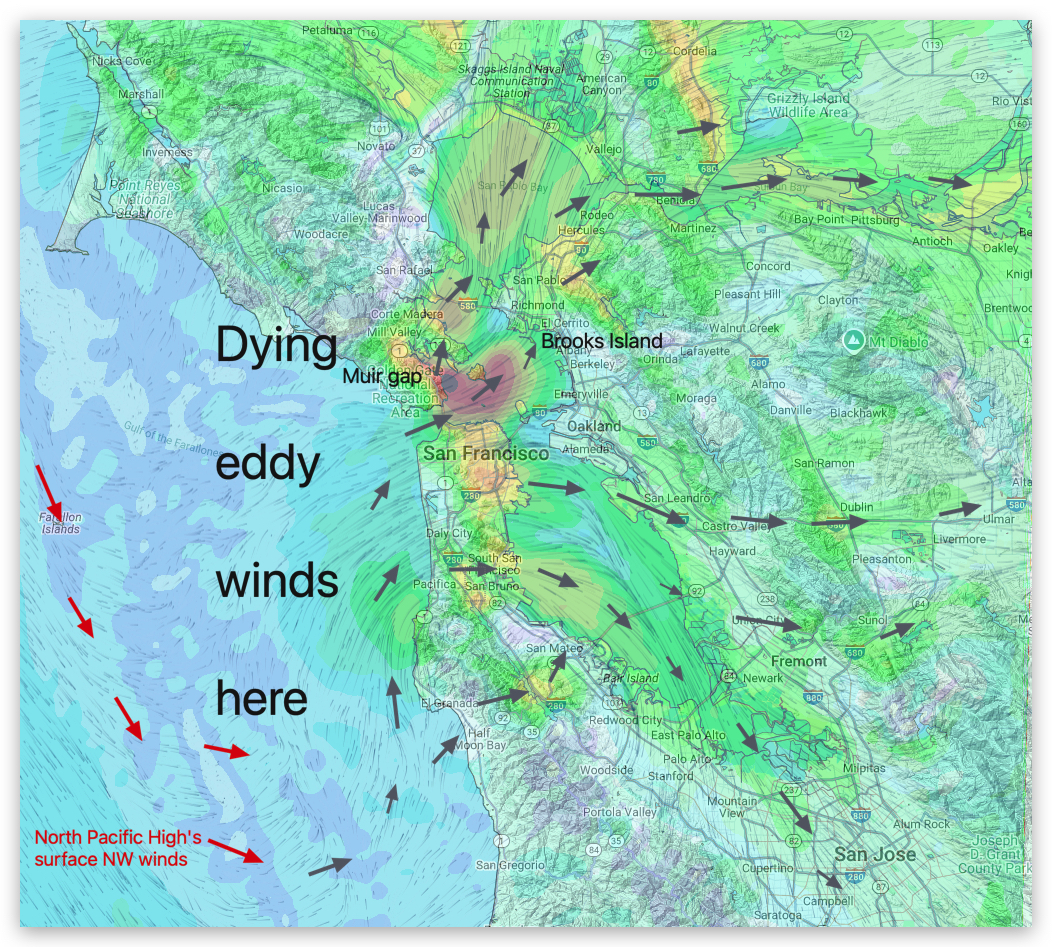
THEREFORE: SW coast winds flow through Marin’s Muir Gap to Larkspur/Clark’s Brickyards, North Tower to near Brooks Island and to Sherman Island late afternoon. Mid to upper-teens SW winds in San Bruno Gap turn WNW and hit the 3rd. Ave. Channel, but are often unreliable at the launch site.