Forecast Jargon Decoder: June 30, 2024
It’s a fun day to arrive at Ocean Beach near dawn and watch the SSW eddy winds blow apart as big NW white caps reach the sand by 1 p.m.
Ohh! Be sure to bring your kite! Expect upper-teens to mid 20’s winds on the ENTIRE coast, Crissy beach, TI. launch, Rod and Gun, Benicia, Sherman PM and the Entire Peninsula!
Why? Well, can you count to three?
A huge, 3700-mile-wide North Pacific High pulls back the eddy-inducing ridge from far Northern California, so the NPH’s isobars lie parallel to the coast, creating strong NW ocean winds.
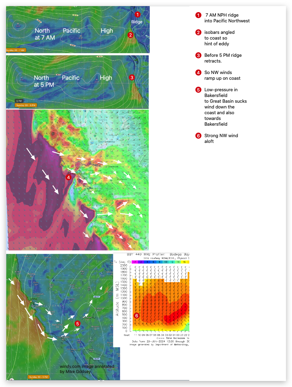
A powerful pressure gradient develops in the Las Vegas to Bakersfield to Stockton area, which sucks those NW ocean winds down the coast and San Bruno Gap and shreds the Peninsula waters with WNW winds.
Blowing sand from Pacifica buries the Hwy. 92 gap so NO WSW winds at the launch sites.
Meanwhile, 30-40 knot winds develop ≈ 1000 feet aloft (975 MB) and collide with Coast Range, becoming turbulent and randomly transferring momentum to the WNW surface winds AND pushing the inbound WSW coming through the Slot away from Pt. Isabel and maybe Berkeley.
Need I mention GUSTY!
Still befuddled? Start looking at the Jargon Decoder, and don’t play with matches Today!
Curious about Bay Area winds? See our wind blogs!