Mike Godsey
Forecast Jargon Decoder: Friday, May 17, 2024
Long ago eddies off San Francisco were rare events. Sure, each summer we had major Marine Surges that brought deep fog and strong wind all the way to Sherman Island.
But those Marine Surge events were triggered by a heat wave and started near Southern California spent a day or 2 working their way up to San Francisco. Here is a video showing what a Marine Surge looks like.
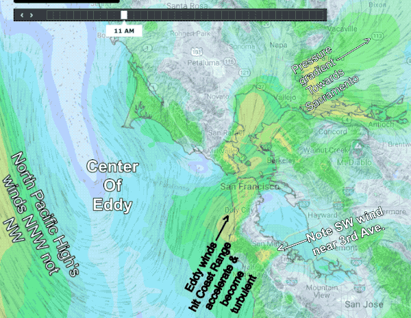
In the last decade small counter-clockwise eddies and southerly coast winds have become increasingly common to the glee of wind folks in the Treasure Island to Pt. Isabel corridor and the wrath of 3rd. Ave. and coast folks.
Most of these small eddies are AM events triggered by NNW to NNE flow over the Coast Range in the Marin and Sonoma area. These small eddies are SURFACE events and are confined to the coast in the Bodega or Stinson area to Daly City to near Waddell one. They are tricky to forecast but they usually die in the early afternoon allowing the North Pacific High’s surface NW winds to reach Waddell and 3rd. Ave.
But we are also seeing a newer and far longer lasting type of eddy.
These are also triggered by NNW to NNE flow over the Coast Range and they create a much larger low-pressure over the entire coast. This makes the eddy much bigger.
But why do they keep spinning for so many days?
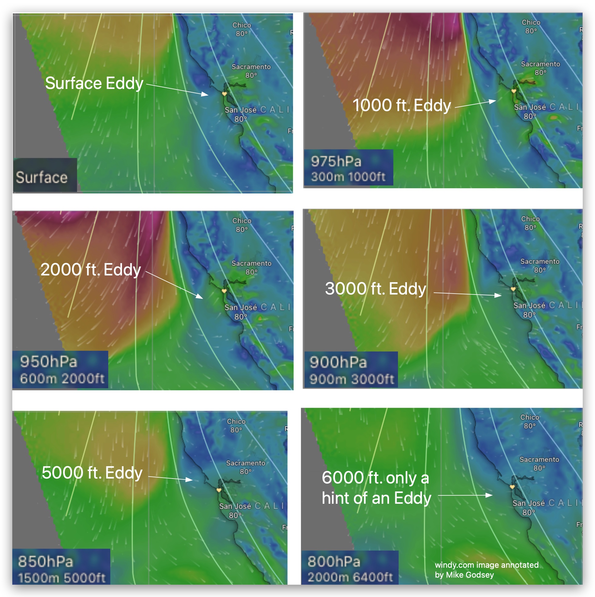
This models data for yesterday tells the story. The eddy is still a surface event but look at the winds aloft above the surface eddy. These winds keep the counter-clockwise spin of the surface eddy going for days. And why does the surface eddy have all this upper level support? That is due to the large scale weather setup and is the topic of a future blog.