Part 1 of this blog covered the basics of how low-pressure south to southeast of Cabo San Lucas at the tip of Baja often impacts the winter winds in the Sea of Cortez.
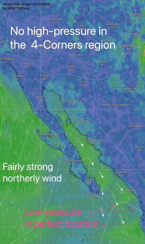
In that blog this graphic showing how that low-pressure can produce winds even when the big wind machines, the NPH and the 4-Corners high-pressure are absent.
This second blog is more technical and looks at the causes of that low-pressure trough.
The low-pressure area just south of Cabo during winter is influenced by several atmospheric and oceanographic factors:
1. Topographical Effects
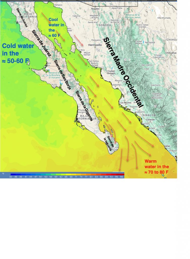
The surrounding mountainous terrain (Sierra Madre Occidental to the east and the backbone mountains of the Baja Peninsula to the west) act to funnel the Sea of Cortez’s northerly winds. Near Cabo this wind leaves the confines of the mountain ranges. This allows the wind to fan out or diverge. This promotes the development of the low-pressure trough that increases the Sea of Cortez and accelerates the wind. You can see this low-pressure via the white isobar lines in this image.
2. Land/Sea temperature Contrast
The southern Sea of Cortez, especially Baja’s East Cape, experiences a significant temperature gradient between the warmer waters of the Sea of Cortez and the cooler land masses of the Baja California Peninsula and mainland Mexico during long winter evenings. This gradient can create localized atmospheric instability, favoring the formation of the low-pressure trough.
3. Jet Stream and upper trough location
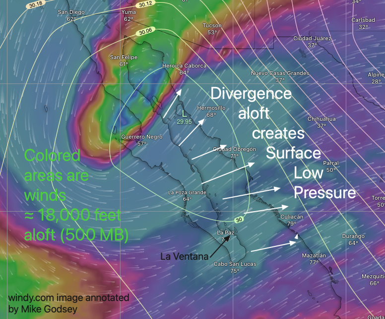
In the winter, the subtropical jet stream sometimes dips southward near or over Baja Norte. This brings upper-level troughs ≈ 18,000 feet aloft (500 MB) over Baja northern Mexico.
These troughs can enhance divergence aloft where the winds spread out encouraging surface low-pressure systems to form or intensify. This divergence can cause the low-pressure south of Cabo to migrate over the southern part of Baja or even the entire Sea of Cortez for a few days, weakening the surface pressure gradient and spoiling the wind.
3. El Niño-La Niña Southern Oscillation (ENSO) Influence

During certain ENSO phases (especially El Niño), the subtropical jet stream becomes more active and shifts further south.
This can bring long periods of wind-weakening clouds (and even light rain) over southern Baja and causes low pressure to hold over the Baja’s East Cape, causing long wind droughts.
During La Niña years the average location of the Sub Tropical Jet Stream moves northward so cloudy days are less common and the low-pressure is more likely to stay south of Cabo where it enhances the El Norte winds.
4. Moisture Convergence
The relatively warm Sea of Cortez acts as a source of moisture as water evaporates. When prevailing northerly winds bring moist air over the even warmer sea surface south of Cabo San Lucas the air rises, cools, and condenses, further lowering pressure in that area.
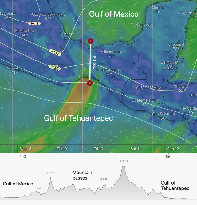
5. Tehuantepec wind divergence
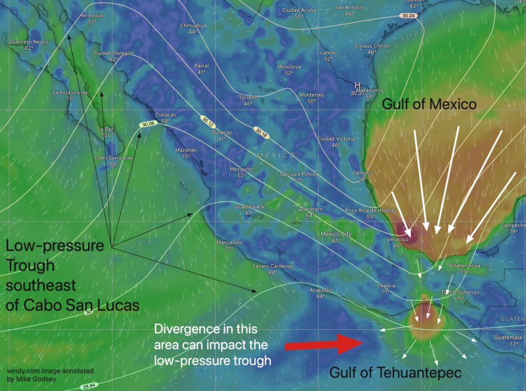
Any time there is high-pressure the area from Texas to Flordia NE winds develop in the Gulf of Mexico. The land mass between Texas and the Yucatan Peninsula makes a natural wind funnel creating extremely powerful winds through the mountain passes leading to the Gulf of
Tehuantepec in the Pacific. These winds are feared by fishermen and yachties. As the moist warm air from the Gulf of Mexico has to climb the mountain passes it cools producing heavy rainfall. This cool dry wind is then funneled down the passes and blasts down to the water. There the wind diverges and interacts with the warmer tropical air which can augment the low-pressure SE of Cabo and impact its location.
6. Forecast implications:
As you can see the factors impacting the size and location of this low-pressure are diverse. Plus, none of the higher-resolution models cover the area of the low-pressure, so it is hard for us to pinpoint the location of that low-pressure. This leads to crappy forecasts.

