Mike Godsey
Forecast Jargon Decoder: Wednesday, May 15, 2024
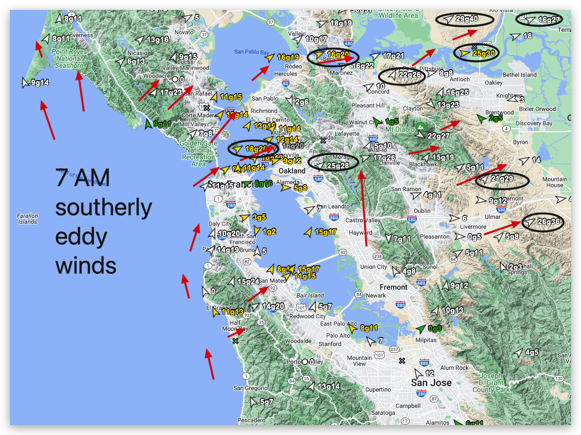
Despite the deep fog at 7 AM, the winds are already ripping in the SW-facing gaps in the Coast Range and at Point Blunt, Benicia, and Sherman Island.
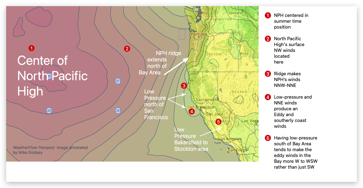
If you glance at a low-resolution model of the Pacific Ocean winds, you might expect strong NW winds for the California coast since a massive North Pacific High stretches 3400 miles from Alaska to the tip of Baja. Indeed, 100 miles to our west, the North Pacific High has strong northerly winds. However, near-shore
southerly winds prevail ALL DAY due to a lingering counter-clockwise spinning eddy.
This scenario exists because:
1. A huge NPH is holding a ridge into the Pacific Northwest.
2. This causes NNE winds aloft north of the Bay Area and at the same time…
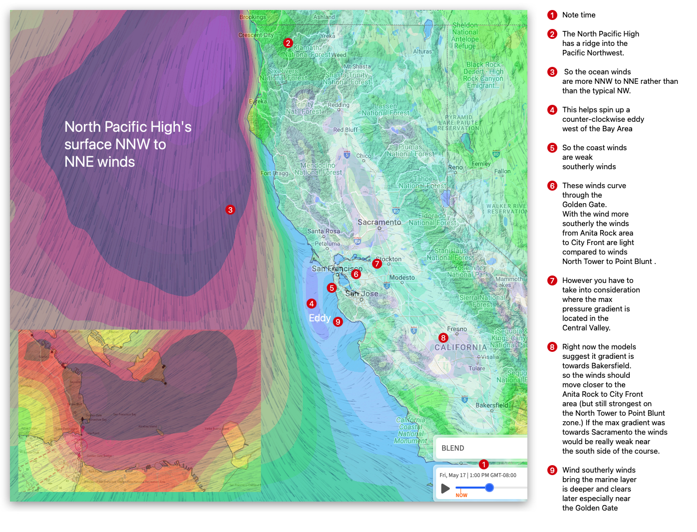
3. Low-pressure balloons over the north coast.
4. Together, these create an S. to N. pressure gradient, so an eddy spins up, creating southerly coast winds.
5. This southerly flow deepens the marine layer and shoves in far into the Bay in the AM.
6. This foggy air is sucked towards a strong pressure gradient focused in the Sacramento to Stockton
area.
7. This means strong winds in the North Tower to Larkspur, Pt. Isabel and Sherman Island. Plus Flying Tigers/Haskins. 3rd. Ave. struggles with WSW launch site winds despite WNW winds in the far side of the channel.
Note: Why do some eddies die mid-day while others, like this one, last for many days? See tomorrow’s blog for the answer!
Curious about Bay Area winds? See our wind blogs!