Todays Wind Recipe:
1. A 3000-mile wide NPH already has NW to W wind tickling coast sensors.
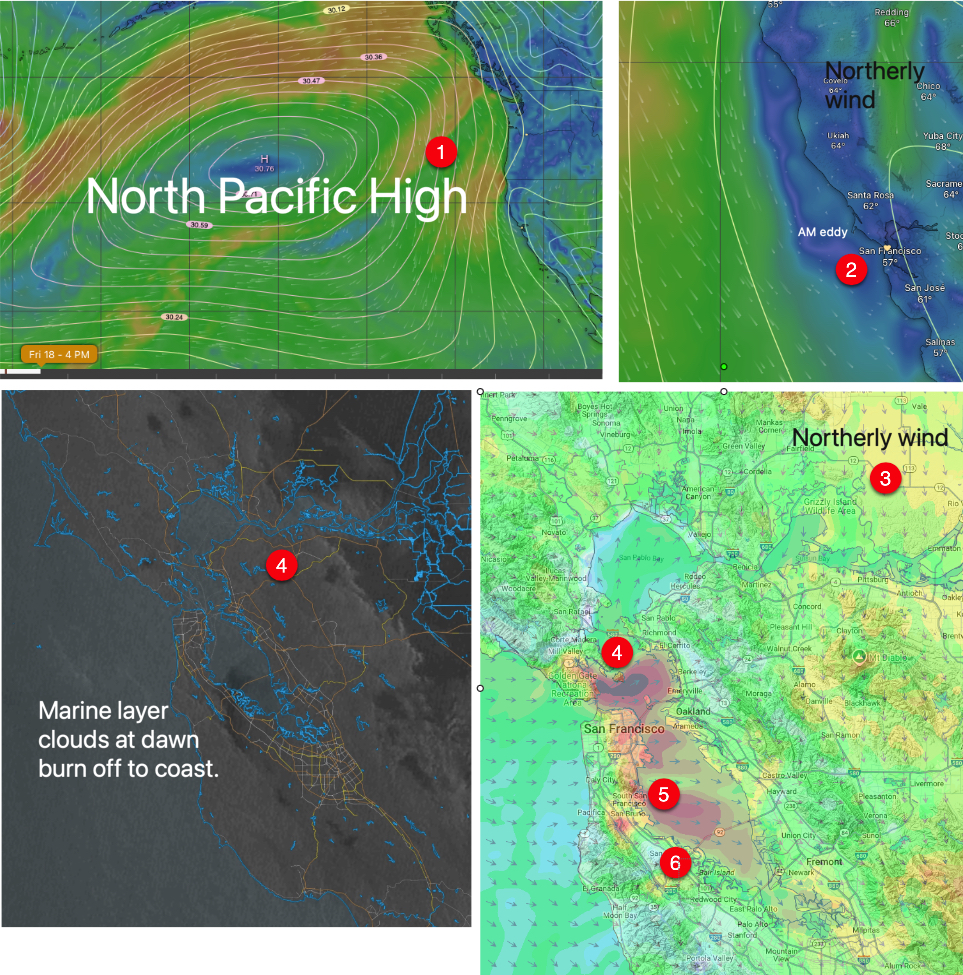
2. This kills the eddies southerly coast winds.
3. N. Central Valley wind weaken the Sacramento gradient while enhancing the Stockton and Bakersfield gradient.
4 As the clouds burn off this causes W. ocean winds to curve & accelerate in the North Tower to Anita Rock zone past TI hitting the upper-teens to low 20’s then weakening near Berkeley and Brooks Island.
5. Meanwhile, similar winds blast through the San Bruno Gap towards the 3rd. Ave. Channel, fading to Palo Alto.
6. The Stockton gradient pulls some of this wind away from the 3rd. Ave. launch sites.
Saturday Human Forecast: Upper-teens winds mid Golden Gate to near Race Track and much weaker coast & 3rd. Ave. Channel.