West Coast Wind Blog: Forecast Jargon Decoder, Oct 10, 2024
Sherman blows lightly early AM then late PM. Stronger winds near Anita Rock to Brooks Island. Coyote and 3rd channel blows but launch sites a bit iffy.
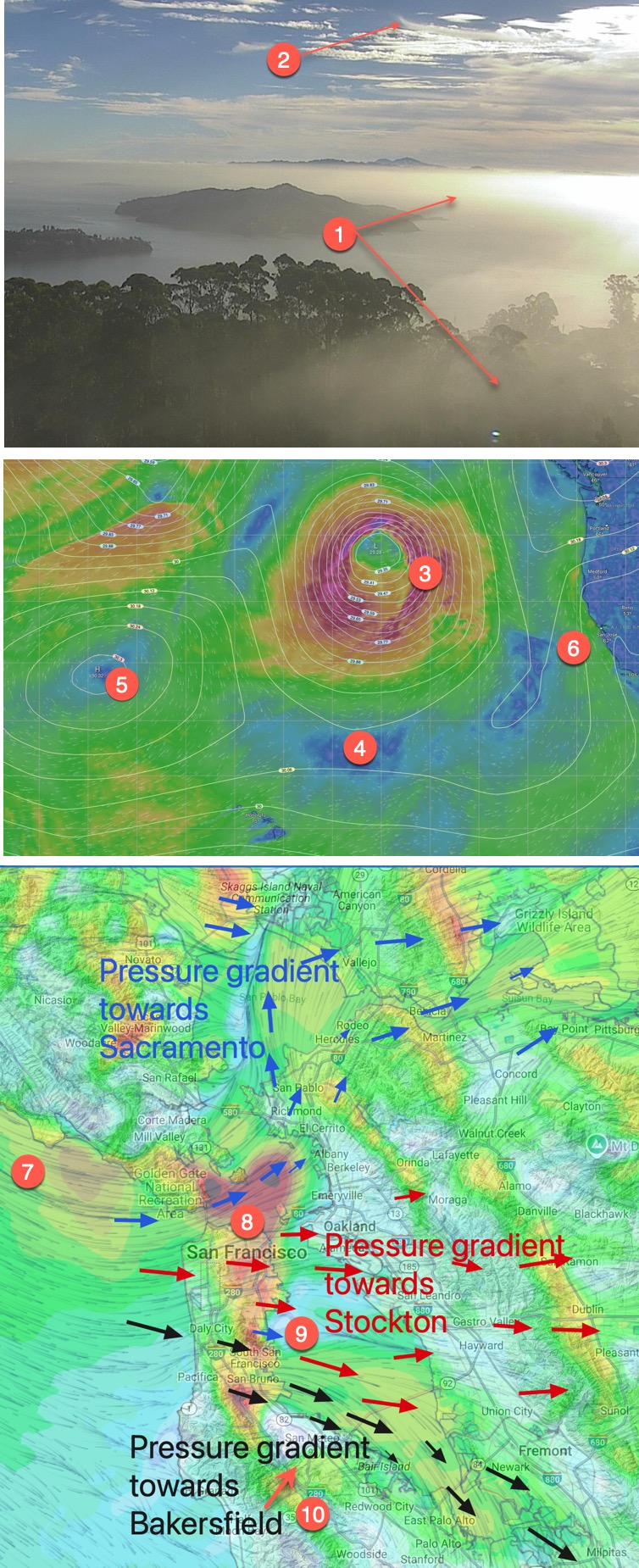
1 & 2. Patchy marine layer clouds mostly near the coast with slowly increasing high clouds and mare’s tails.
3. The North Pacific High’s surface NW winds have weakened as a potent wintry storm centered 1200 miles WNW of San Francisco drifts our way.
4. This storm has cleaved the NPH
5. Leaving the bulk of the NPH near Hawaii and
7. With only a sliver of high-pressure bringing NW ocean winds to our coast. This afternoon, those ocean winds are sucked through the Golden Gate and other gaps in the Coast Range. As wind enter the Bay they curve towards the Sacramento and Stockton pressure gradients and a weak gradient towards Bakersfield.
8. This focuses wind: In the upper-teens to mild low 20’s from mid Golden Gate to near Anita Rock through the Slot to Brooks Island and near Pt. Isabel.
9. On the Peninsula, upper-teens to 20 WNW wind comes through the San Bruno Gap curves towards Stockton, bringing wind to the 3rd. Ave. Channel
10. And also encourages a bit of WSW wind in the Hwy. 92 gap area. Meanwhile, the Bakersfield gradient brings mid to upper-teens wind near the 3rd. Ave. launch sites, sometimes creating a wind battle with the WSW wind.