Forecast Jargon Decoder
Big Eddy delivers low/mid 20’s Anita Rock to Slot to Brooks Is. to Larkspur/Clark’s & bit lesser Tigers, Benicia to Sherman.
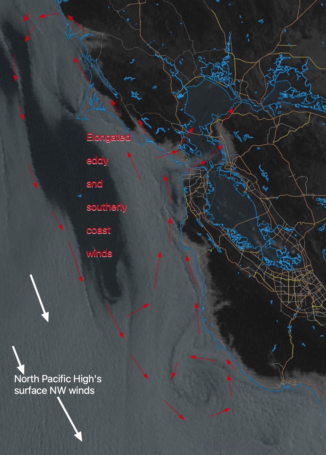
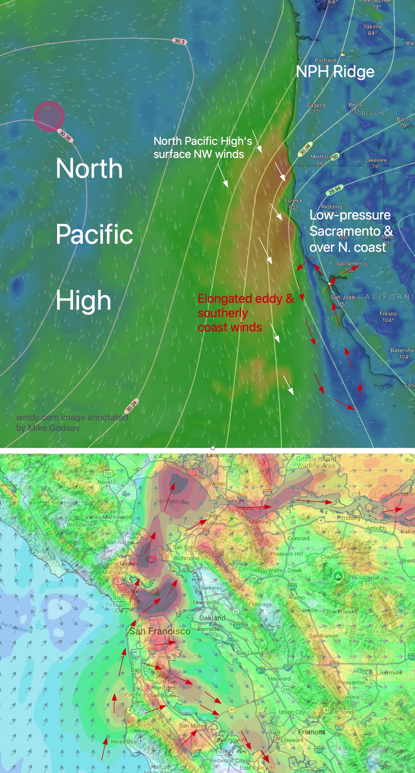
1- Overnight, the NPH shoved a huge ridge into far Northern California and the Pacific Northwest causing low-pressure to develop from Stockton to Pt. Arena.
2- The satellite imagery shows this has produced an elongated counter-clockwise eddy and weak southerly coast winds from Big Sur to the Russian River, despite NW winds 27g31 at Cape Mendocino.
3- The strongest Central Valley pressure gradient is towards Napa Valley and Sacramento sucking low to mid 20’s winds from Anita Rock to North Tower and Point Blunt to near Brooks Island and upper-teens to low 20’s Shimada Park, Larkspur/Clark’s Brickyards, Benicia to Sherman Island.
4- Weak, unreliable winds for the Peninsula except Oyster ane Flying Tigers/Haskins.
5- Weak southerly winds for entire coast except for Pacifica that reaches the mid to weak upper-teens.