Sunday’s Wind Jargon Decoder:
1- A distant cold front bringing rain to the Gorge is compacting the NW ocean winds along our coast.
2- The dawn view from space shows NW ripples in the fog just offshore confirming that NW winds ≈ 1000 feet aloft will add a strong gust factor to the launch sites winds for Waddell, Bodega, Anita Rock, Coyote and 3rd.
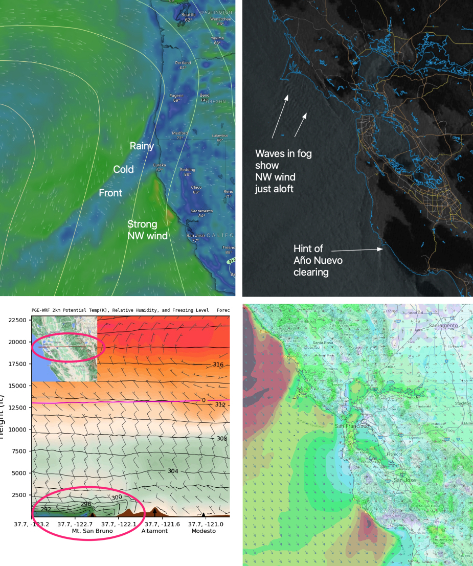
3- As the fog retreats to the coast winds aloft + the low-pressure pressure gradient towards Bakersfield and Stockton bring upper-teens to low 20’s winds with gusts stronger to the coast, Crissy Beach and Coyote and 3rd. launch sites.
4- The Stockton pressure gradient brings mid to upper-teens winds to Sherman and Pt. Isabel and weaker Race Track and Berkeley.
5- There is already a trace of Año Nuevo clearing
.