I am sticking to current forecast as the larger eddy expected Sunday begins brewing 12 hours early!
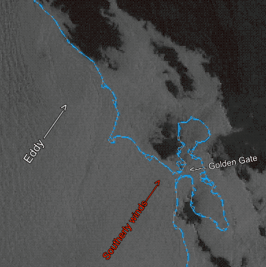
Wind Recipe: 1. A small eddy off Golden Gate is creating southerly coast winds and has pushed the marine layer far inland.
2. This eddy probably lingers so residual S. coast winds from Waddell to Bodega.
3. Meanwhile, a strong pressure gradient towards Napa to Redding accelerates wind thru the mid Golden Gate, Slot, Pt. Isabel and Larkspur/Brickyards. 4. Some of that southerly coast wind enters the San Bruno Gap and makes a radical turn into WNW due to Stockton gradient thru the Altamont Pass, causing upper-teens to 20 wind at Tigers and 3rd. Ave. Channel.
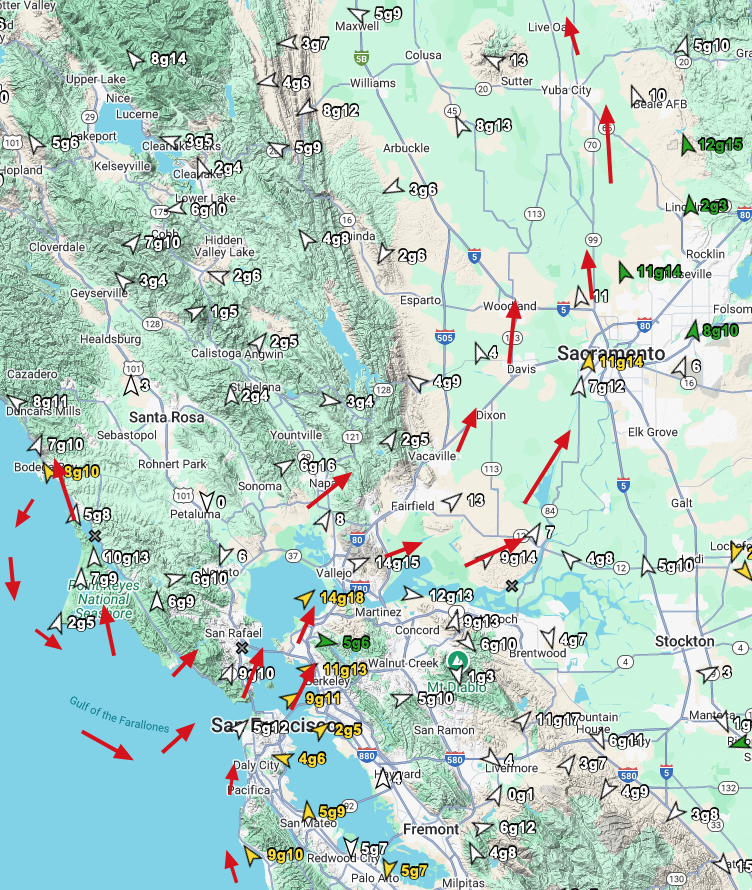
5. This makes 3rd. launch sites very iffy due to SW flow towards Altamont. Sunday Human Forecast: Late dying eddy favors mid Golden Gate to Pt. Isabel and Sherman Island with upper-teens winds mid Golden Gate to near Race Track to Stick.