Yep, it is a conspiracy. The fat cat surface weather machines
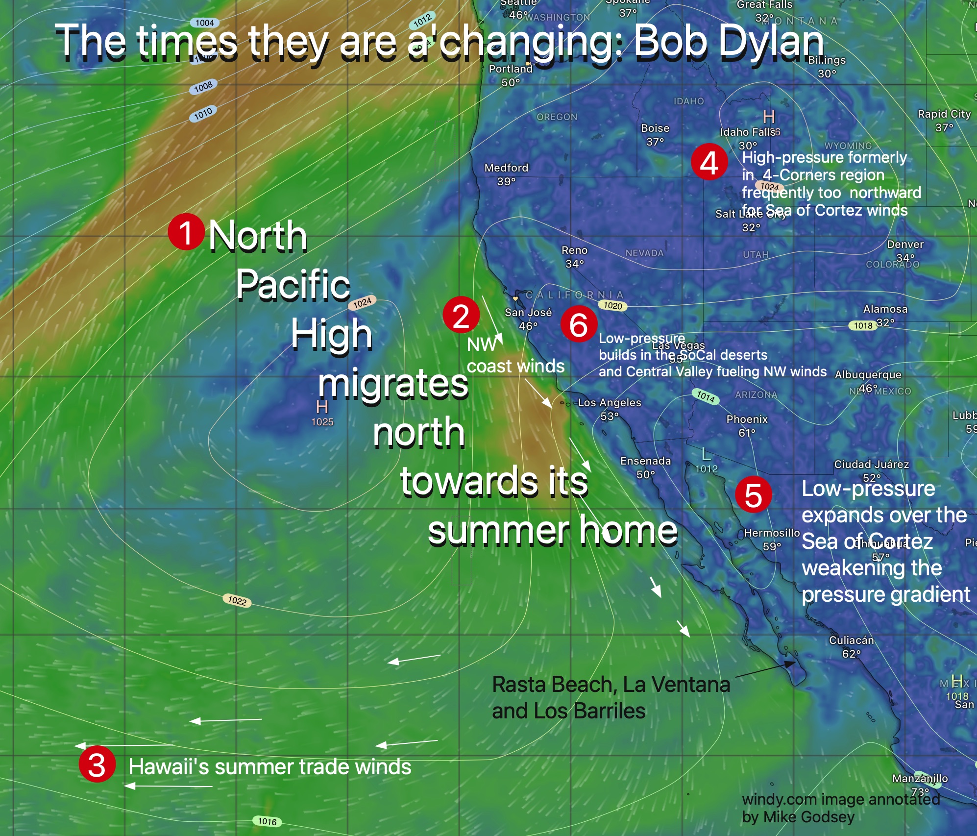
- The North Pacific High and its NW winds
- The 4-Corners region Northerly winds
- The low-pressure south of Cabo
They all follow the dictates of their climate overlord, the jetstream and its northward migration of the upper troughs and upper ridges winds that steer the surface wind machines.
The why behind this annual migration is beyond the scope of this blog but let’s take a look at some imagery of those wind machines and how they move to increasingly deprive the Sea of Cortez of its northerly winds in late spring.
- As we move into April that huge mass of high-pressure known as the North Pacific High begins a slow march northward. During the winter its average location is off Baja and it’s pressure gradient, represented by the white isobar lines often stack up across the Sea of Cortez making NW winds on the Pacific side of Baja and NNW winds for the Sea of Cortez.
- Notice how in late spring the mean location of the NPH is off Southern California. This brings NW winds to Southern California and Baja Norte and mild winds to Baja Sur and no wind to the Sea of Cortez.
- This NPH location also brings stronger easterly Trade Winds to Hawaii. So, in April, plan on flying your Gulfstream from Cabo to Maui. The great tailwinds will keep the fuel costs down.
- Meanwhile, the best Baja wind machine, the 4-Corners region high-pressure is increasingly too far north to create northerly winds in the Sea of Cortez.