Yesterday the North Pacific High’s surface NW ocean winds were exceptionally weak yet my forecast was for strong upper-teens to low 20’s winds for almost every water location in the San Francisco Bay Area.
There are 2 keys to Bay Area summer winds.
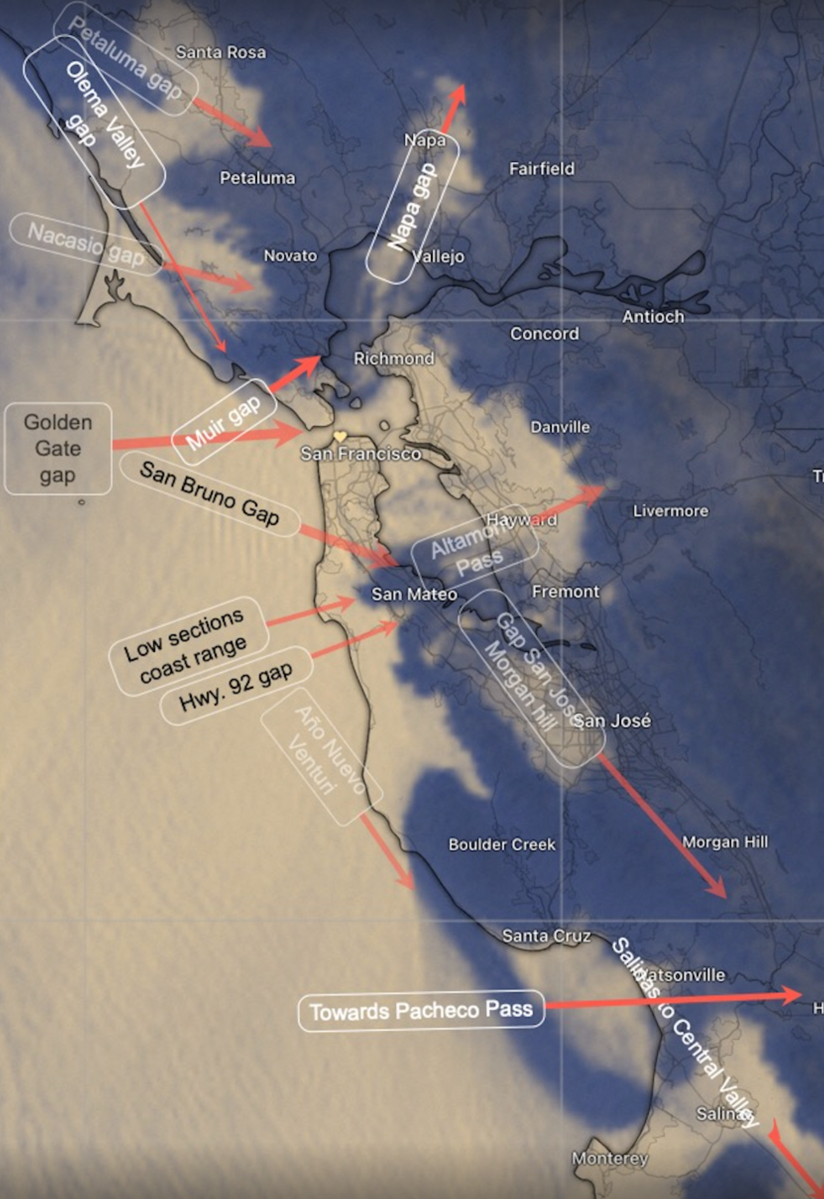
The first is the many gaps in the Coast Range and East Bay hills that funnel and direct ocean winds.
The wind accelerates through these Coast Range then curves towards the part of the Central Valley with the strongest pressure gradient. However, these winds first have to navigate through the East Bay hills.
Which gap they flow towards determines the location and strength of the strongest winds.
For, example if the pressure gradient is strongest towards Sacramento then ocean winds flow past the North Tower of the Golden Gate towards Larkspur and Pt. Isabel to Sherman Island.
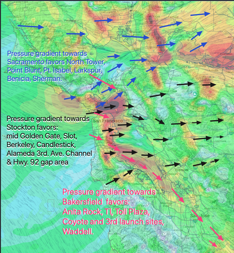
If the maximum pressure gradient is towards Modesto – Bakersfield the winds flow through the Gate near Anita Rock. And on the Peninsula they flow past the Coyote and 3rd launch sites.
If the pressure gradient is focused towards Stockton the winds are strongest from the mid Golden Gate to the Treasure Island Slot to Berkeley. And wind trickles through the Hwy. 92 gap area over the 3rd. Ave. launch sites often making an “evil” wind.
This all sounds very simple but in the real world most days have a mixture of Sacramento, Stockton and Bakersfield pressure gradient and those gradients move around during the day, due to clouds or temperature changes, often after a forecast is issued.
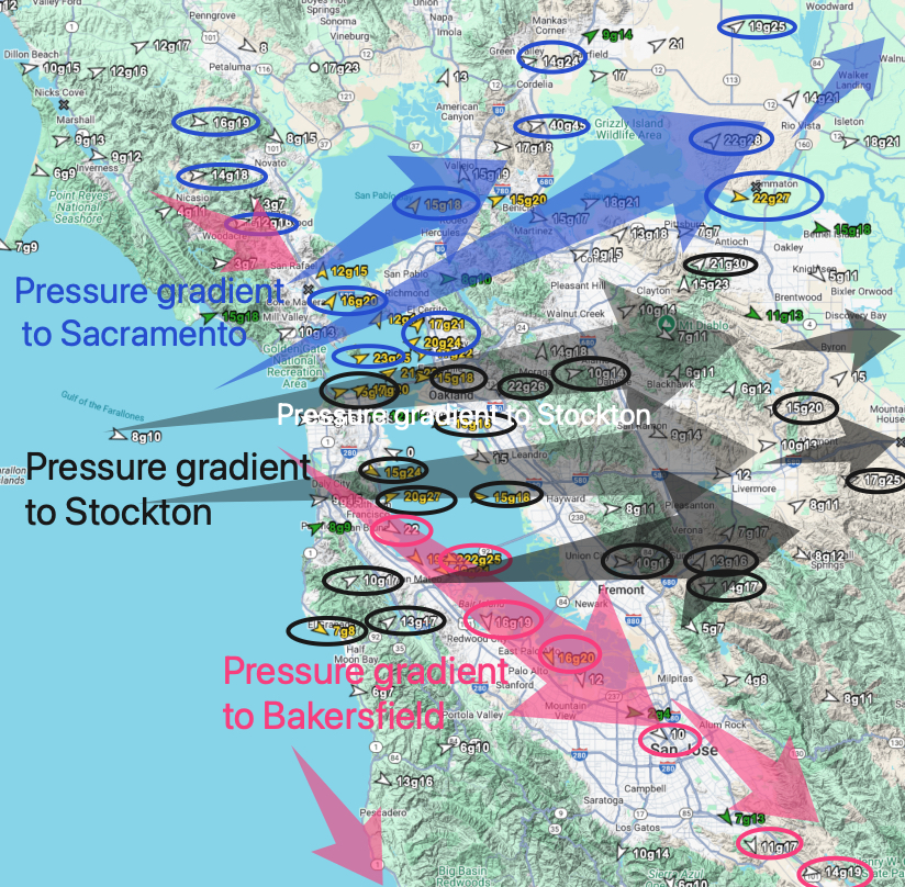
But what if there was a strong pressure gradient to the entire Central Valley from Sacramento to Bakersfield?
Then a wind parcel has some tough choices as it enters the Bay since it can flow towards multiple gaps in the East Bay hills. Yesterday, June 7, was such a day.
This imagery shows why it blew everywhere yesterday.
And today’s forecast is quite similar: