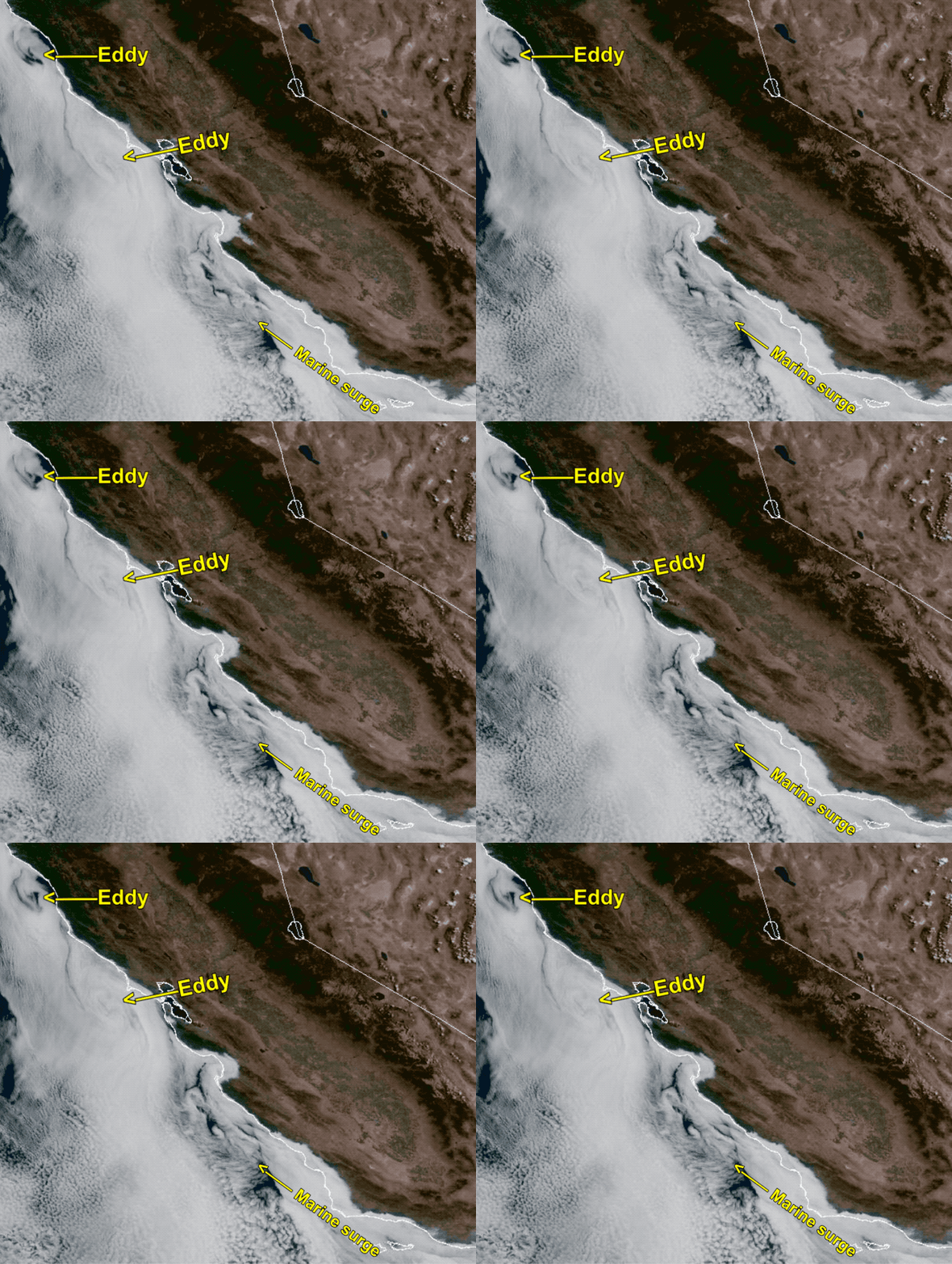
Now at 11:30 AM: In several decades of forecasting San Francisco winds
I have never seen huge 75 mile wide eddy west of the Golden Gate PLUS a marine surge that extends from Southern California waters to the Golden Gate PLUS, paradoxically, a fast retreating marine layer despite all the Southerly flow. So it is hard to do much other than a guesscast for the winds today.
From 7:30AM: The eddy you see in the blog above continues to make
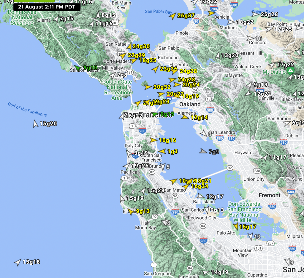
southerly winds along the coast. But late yesterday afternoon a marine surge shot up from near Southern California bringing stronger southerly winds so at dawn the combo of an eddy + marine surge has Pt. Isabel and Berkeley at 21g24. I have never seen an eddy and a
marine surge happen at the same time. As this southerly wind enters the Bay it “feels” the max pressure gradient towards Napa and Sacramento which enhances the SW flow through the Golden Gate and the Hwy. 92 Gap near 3rd. Ave keeping the wind away from shore..


