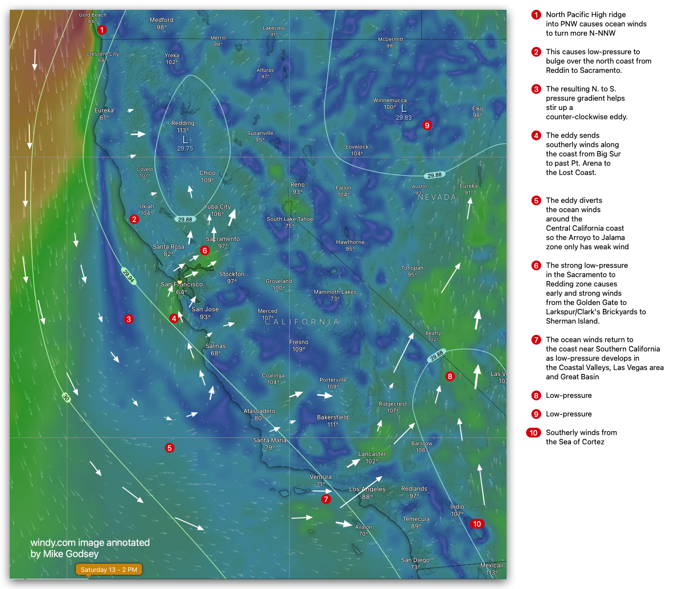
The greater San Francisco Bay Area usually has very different wind patterns than the Central California coast and Southern California Coast. But, on Saturday, July 13, a huge eddy impacts the entire region.
Sat, Jul 13 2024, Bay Area extended forecast.
Note: DAWN PATROL: Very early AM strong winds develop Larkspur/Clark’s Brickyards to Benicia to Benicia to Sherman Island! Low pressure develops along the coast from Eureka to Jalama to Sacramento/Redding creating a huge S. to N. pressure gradient creating a combo of southerly eddy winds and Marine Surge like winds blow on the entire coast and into the Bay Area following a Sacramento to Yuba City pressure gradient. and Southerly winds push up from Monterrey. Strongest winds will be in the Central Bay.
Wind forecast: Bodega S low-teens. Waddell S low teens. Coyote and 3rd W to W to WSW mid-teens. Crissy & TI 20s with stronger towards North Tower Point Blunt. Berkeley and Pt Isabel near 20. Alameda WSW low-teens. Larkspur/Clark’s Brickyards SW upper teens to low 20’s. Sherman Island see low to mid 20s much of the day.
Sat, Jul 13 2024: Southern California Extended forecast.
The low-pressure and eddy, southerly coast winds continue from Northern California to near Arroyo so the Central California coast only has weak southerly winds while Lopez enjoys strong winds. Onshore flow picks up for Southern California and this helps to promote earlier sea breezes. The thermal Low shifts further inland which allows Isabella to strengthen.
Central California: Arroyo southerly low teens, Pismo sub-teens, Lopez upper-teens to 20, Isabella upper-teens to 20, Jalama low teens.
Southern California: Santa Barbara mid-teens. Ventura mid-teens. Leo mid-teens. Cabrillo upper-teens+. Huntington Beach low-teens.
San Diego: WNW sub to weak low-teens.