Forecast Jargon Decoder: August 3, 2024
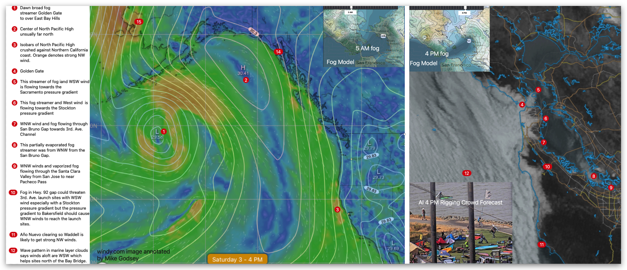
A broad streamer of dense low fog blankets the coast and Central Bay, but it shrinks to a narrow steamer that only impacts the Crissy winds.
A rainy Gulf of Alaska storm crushes the North Pacific High’s surface NW winds against the west coast. So the NW ocean winds curve through the Golden Gate and San Bruno Gap and minor gaps like Marin’s Muir Gap and Half Moon Bay’s Hwy. 92 gap.
Once through the gaps, the wind “looks” for routes to the Central Valley through the barrier of the East Bay hills. From the Golden Gate upper-teens to mid 20’s wind heads towards that huge gap in the East Bay hills north of Richmond to Vallejo so Brooks Island and Sherman Island blow hard with milder winds
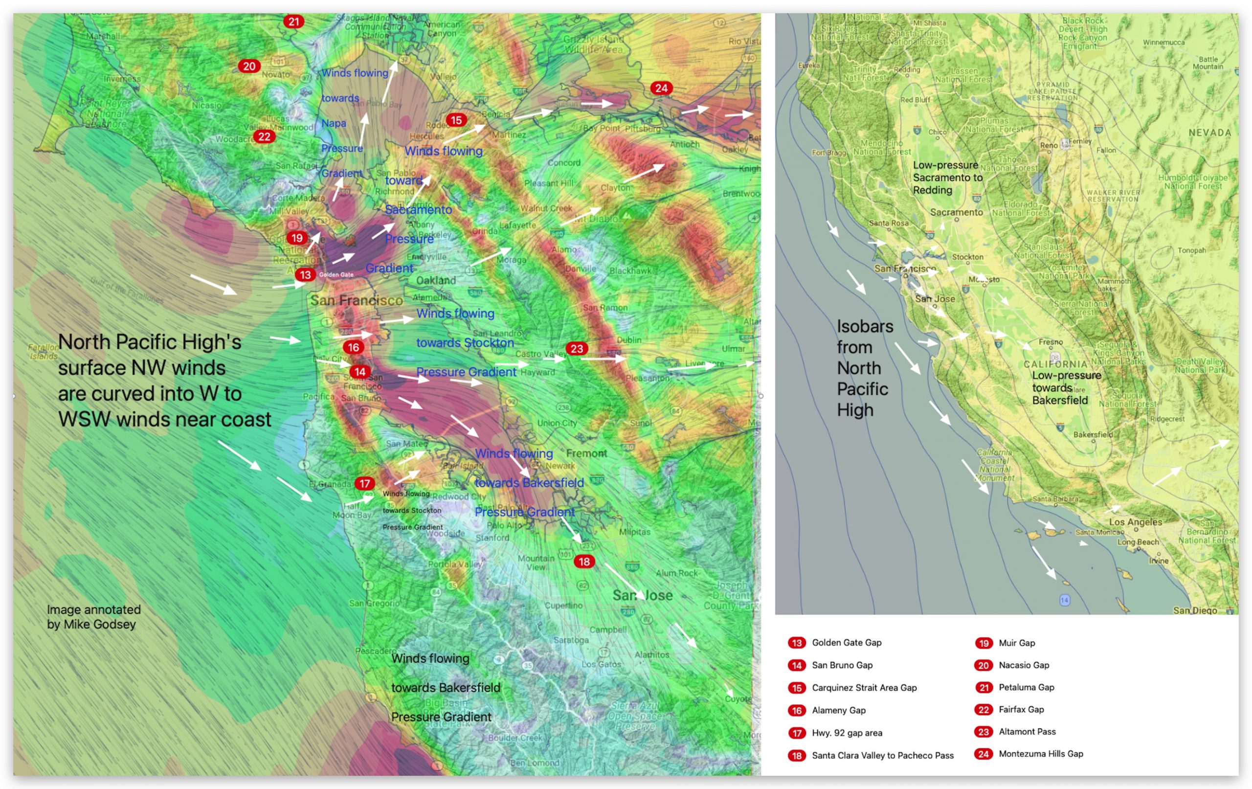
for Berkeley.
A bit of wind flows through the Muir Gap towards Larkspur/Clark’s Brickyards. Wind coming in the San Bruno Gap has 2 possible routes. The Stockton gradient creates strong winds in the 3rd. Ave. Channel, while a stronger Bakersfield gradient sucks winds over the channel and 3rd. Ave. launch sites thru the Santa Clara Valley from San Jose to near Pacheco Pass to the Central Valley.
Meanwhile, the Stockton gradient sucks some wind through the Hwy. 92 gap but those WSW winds are defeated by the stronger WNW winds.
Curious about Bay Area winds? See our wind blogs!