Forecast Jargon Decoder: Thursday Oct 3, 2024
Jargon: Compressional heating continues as masses of subsiding air continue to pour over the west coast today but at a slackening pace.
In plain English, that means descending air from an upper ridge is descending to the surface, crushing the marine layer and pollutants to the surface while heating the air.
What does this mean for our wind?:
1. Heat-produced low-pressure expanding over the coast blocks the NW ocean winds.
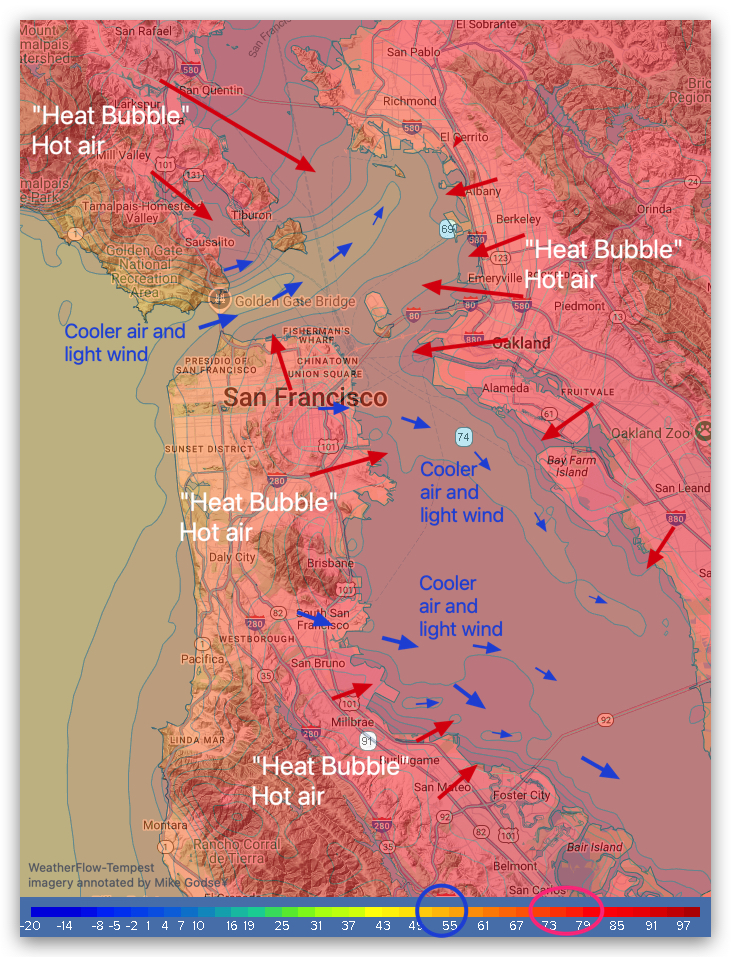
2. Hot air from the land oozes over all the launch sites except maybe Treasure Island, further killing the local pressure gradient.
3. With the fog crushed out of existence, any breezes that stir up will be up and down.
4. Late in the afternoon all the hot air rising from the land creates a very local pressure gradient, so mild winds stir the water from mid Golden Gate over Harding Rock to near the Slot between Angel Island and Treasure Island to near Brooks Island.
5. But the hot air “Heat Bubbles” block most of that wind from reaching our launch sites. If you look at the heat map above, you can see that I am forecasting foil range winds reaching the Treasure Island launch site and perhaps Coyote and 3rd launch sites in the late afternoon to early evening.