Wind Recipe:
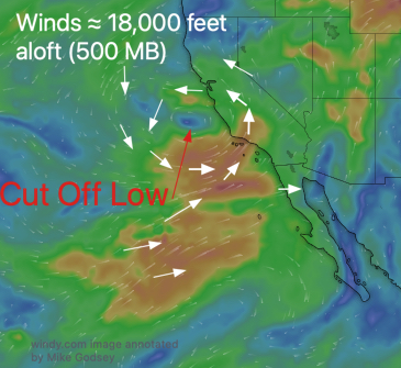
1- The Cut-Off Low ≈ 18,000 feet continues to block most of the NW ocean winds while enhancing:
a. Coastal eddies.
b. WSW ocean winds.
c. Strong ≈ 1000 feet aloft WSW turbocharges surface wind at Sherman/TI/N. Tower.
d. broken atypical marine layer.
d. Cool weather.
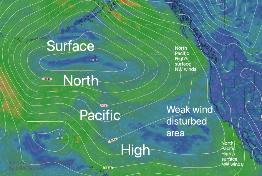
2- The WSW ocean winds accelerate through gaps in the Coast Range and flow towards gradient strongest in the Sacramento and Stockton areas.
3- Fog permitting, this focuses upper-teens to low 20’s in the North Tower to TI to Olympic Circle to OUTSIDE Pt. Isabel, Race Track and Berkeley.
4- The very strong winds ≈ 1000 feet aloft (975 MB) ripple near the surface in the Sherman Island area so gusts stronger than forecast.
5- The WSW ocean winds and Stockton gradient make for weak W. winds at Coyote and 3rd launch sites despite some periods of upper-teens to 20 WNW winds in the channel.
6- If Año Nuevo clearing, then Waddell and especially Natural Bridges may hit the mid-teens.