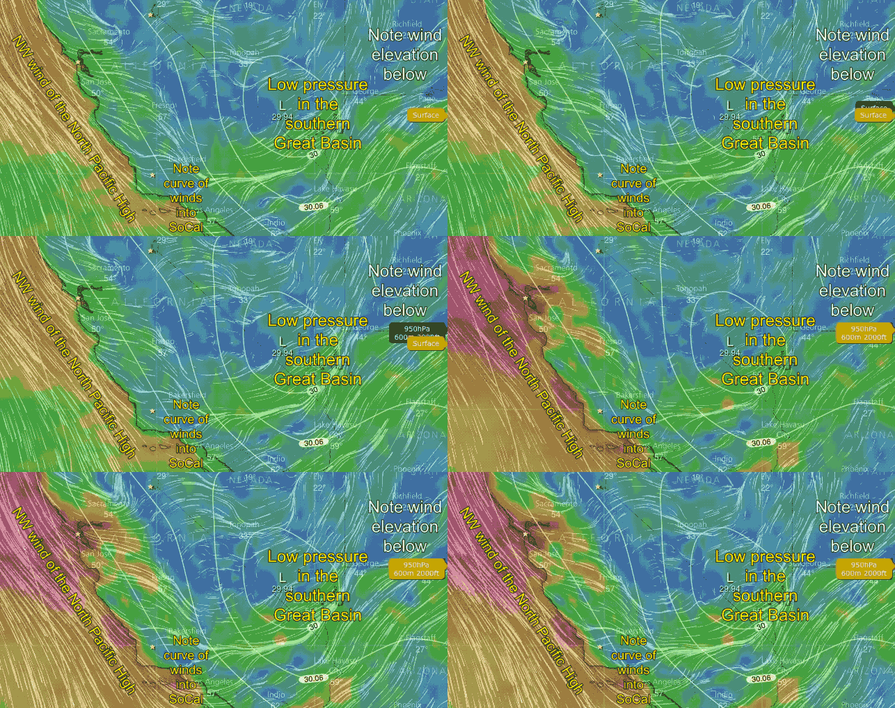
..A Combo of low pressure in the Great Basin and turbulent NW winds just aloft.
Check out the headlines in Kerry’s forecast and the details in the text. This is a pattern we see frequently in the spring where the normal moderate NW clearing winds become very strong but also extremely up and down.
Here is some imagery that shows these crazy strong up and down winds at select sites yesterday Feb. 23, 2018.
So far 2018 has seen an unusually early arrival of the North Pacific High’s surface NW winds.
The first map shows the mild morning winds at most locations in the Bay Area. Note the unusual NNW direction of the winds at the ocean buoys and at many sites inside the Bay. Also, check out the strong northerly wind at Sherman Island. These winds are a clue that the Central Valley is seeing strong northerly wind and that the eastern edge of the coast range is acting as a venturi at Sherman.
The next map shows, in red, the peak gusts on the ridges over the greater Bay Area and Central Valley. Notice how strong these morning gusts are compared to the surface wind.
Then the upper right image shows the powerful winds inbound over Bodega as detected by the 449 Mhz profiler.
Lastly, check out the often extremely UP AND DOWN winds on the wind graphs around the Bay during rest of that day.
 This animation shows the modeled winds at the surface. Note how the surface winds are strongly NW over the ocean. Also, note how the curve in towards the low pressure in the Great Basin. But also notice how much stronger the winds are aloft in the 2nd part of the animation.
When this wind aloft hits the coast range it becomes turbulent and randomly transfers momentum to the surface. This really stirs up the surface winds and makes for very up and down winds and even significant wind shifts. That is why I had the warnings about using caution launching kites near rocks.

