Forecast Jargon Decoder: June 20,2024, do you enjoy these Decoders?
Tricky day for launch site winds. Strongest winds mid Golden Gate to Brooks Island to near Shimada Park + 3rd. Ave. Channel & Waddell.
Napa
Complex day with a combo of strong WSW/SSW wind north of the Bay Bridge and WNW vs WSW wind on the Peninsula, with deep fog being the decider. This occurs as:
1. An upper trough reduces the pressure aloft so the marine layer deepens.
2. The strongest pressure gradients are towards Napa, Sacramento and Stockton.
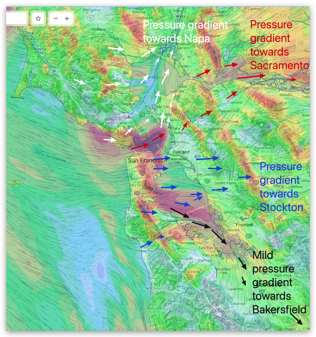
3. This causes the wind coming through the Golden Gate and passing Treasure Island to make a sharper curve towards Napa so it may partially bypass Berkeley and even the PI. launch sites as it flows towards the wind country.
4. Meanwhile, on the Peninsula, wind coming through the San Bruno Gap is curved more towards Stockton so low 20’s in the channel.
5. BUT, the launch site winds will be iffy as the San Bruno Gap’s WNW winds battle with WSW winds from the Hwy. 92 gap area that are also sucked towards Stockton.
6. If the 3rd. Ave. folks could get their act together and build a high wall blocking the Hwy. 92 gap area it would trump that WSW flow making their winds and my forecast much better.
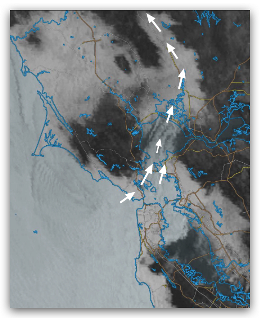
7. Fog may return early shutting down sites near the coast.