Delight for many at  sites North of the Bay Bridge but despair to most sites to the south.
by Mike Godsey, mikeATiwindsurf.com
The banner image above looks all to familiar this year to those who kite or sail the waters of 3rd. Ave. All to often strong NW wind days found unfavorable light W to WSW winds inside.
And this was on days when the forecast was for strong NW wind for the entire coast and most of the Bay. So locals on those waters are probably hoping for a transition to a different wind pattern.
We today and especially tomorrow we transition into a different pattern. Sadly it is on that is even worse for the coast and 3rd. Ave.
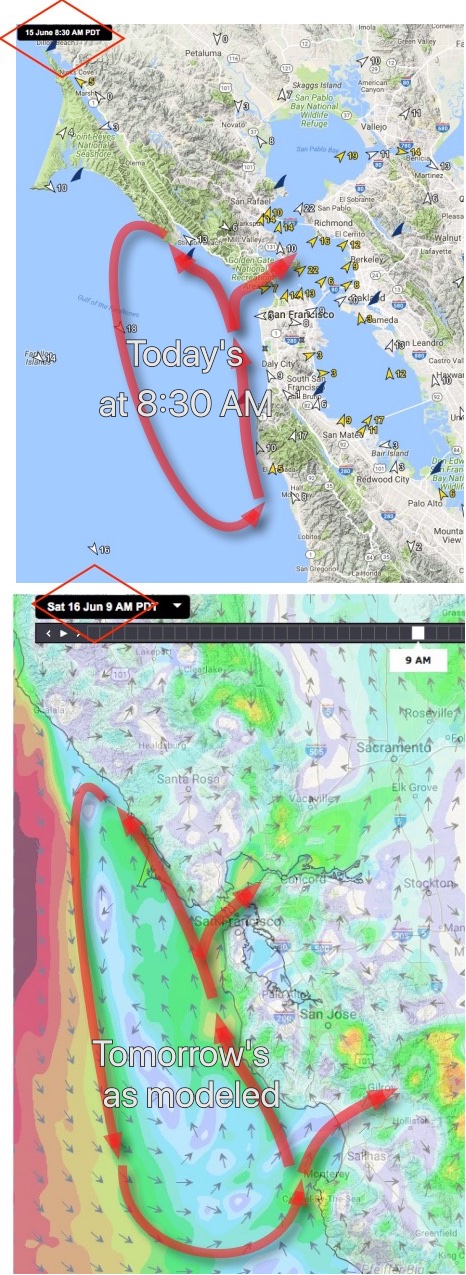
As you can see in the top image there is a small counter-clockwise spinning eddy west of the Bay Area. I am forecasting this eddy to keep spinning most of the afternoon. When this happens the eddies southerly winds jazz up the SW flow through the gaps in the coast range.
his makes the north tower to Treasure Island to Pt. Isabel winds stronger. But it also pushes W over the coast range near 3rd. and SW flow through the Hwy. 92 gap from Half Moon Bay to near 3rd. Hence the weak winds forecast inside for 3rd. today. It can’t get worse than this for 3rd… yes it can.
Looking at the next image you can see the modeled winds tomorrow morning.
Notice how much larger the eddy becomes. If the models are right we will have southerly eddy winds from past Bodega all the way to Monterey. This means doom and gloom to 3rd. and the coast.
But the huge eddy should favor the north tower to Sherman Island corridor.
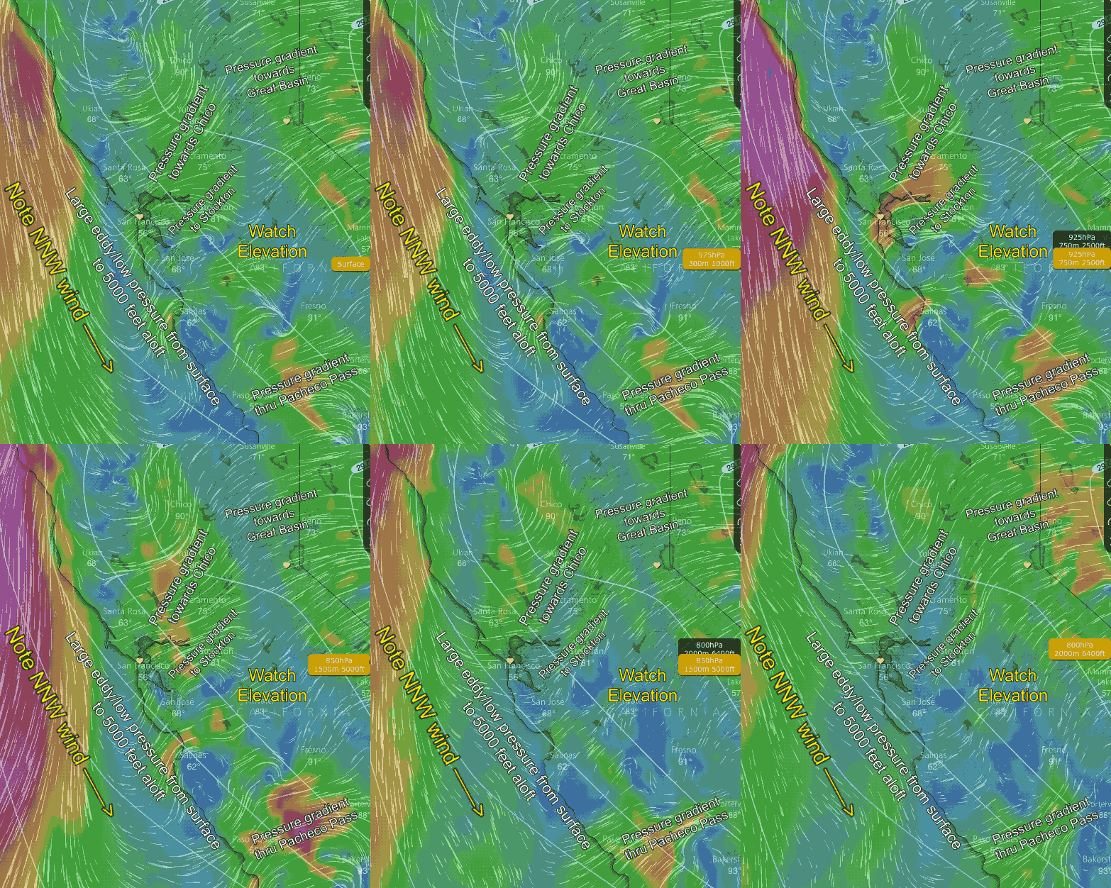
So what is with the giant eddy. To answer that we have to look aloft.
The last image is an animation of the winds from the surface to 5000 feet. Notice how the eddy at the surface is augmented by a counter-clockwise spinning low pressure aloft.
Also notice how there are surface pressure gradients towards Chico, Stockton and on to the Great Basin. There is also a strong pressure gradient through Pacheco Pass to San Luis.
More a bit later…


