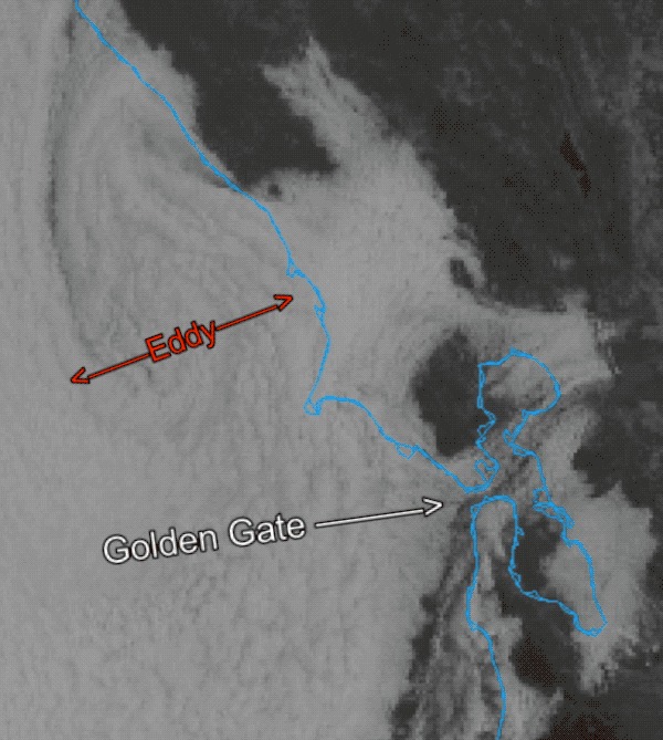
For nearly two weeks, a persistent counter-clockwise eddy off the coast of San Francisco has been the dominant meteorological feature, overriding the typical summer wind patterns of NW ocean winds and funneling strong southwesterly winds through the Golden Gate and into much of the San Francisco Bay.
This unusual and prolonged event is the result of a complex interplay between the North Pacific High, California’s Central Valley & Great Basin low-pressure system, and the steering currents of the winds aloft.
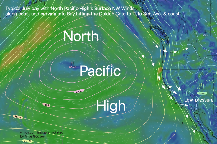
Typical Summer Pattern: Under normal summer conditions, the massive North Pacific High sits off the coast, directing northwesterly winds down the California coastline.
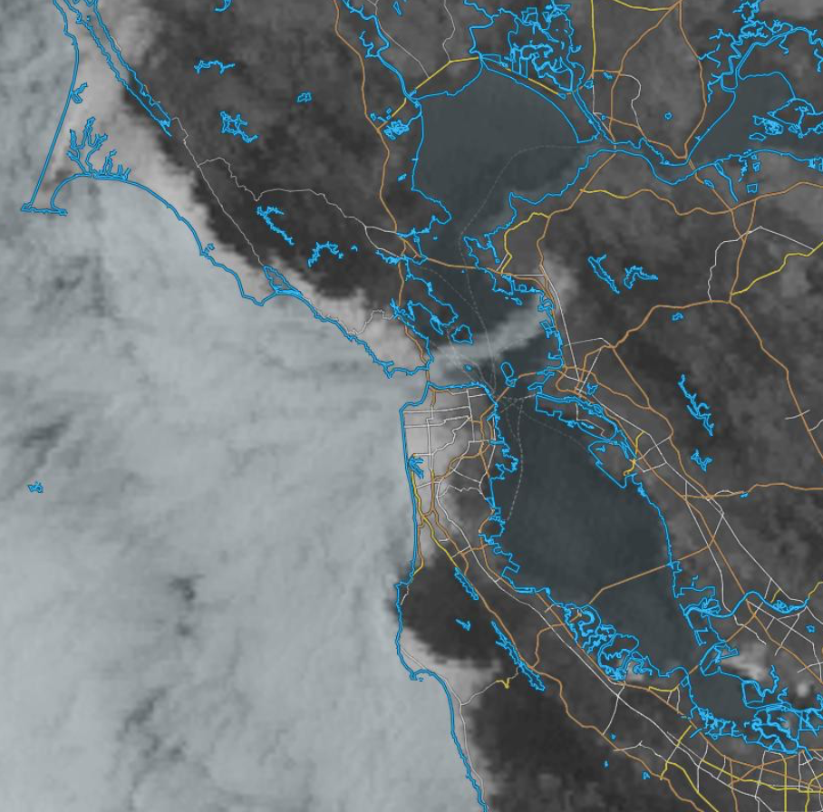
Simultaneously, intense heating in the Central Valley creates a thermal low-pressure area. This pressure difference pulls cool, moist air from the Pacific Ocean inland, resulting in the Bay Area’s characteristic WSW to WNW thermal winds. These winds focus near the Crissy beach to TI to the East Bay and Sherman Island in the afternoon. They also bring Año Nuevo clearing and NW winds to the coast south of San Francisco.
Recent lengthy Atypical pattern:
However, the recent weather pattern has been anything but typical. The key to the current situation lies in the positioning and behavior of the North Pacific High, influenced by the winds aloft.
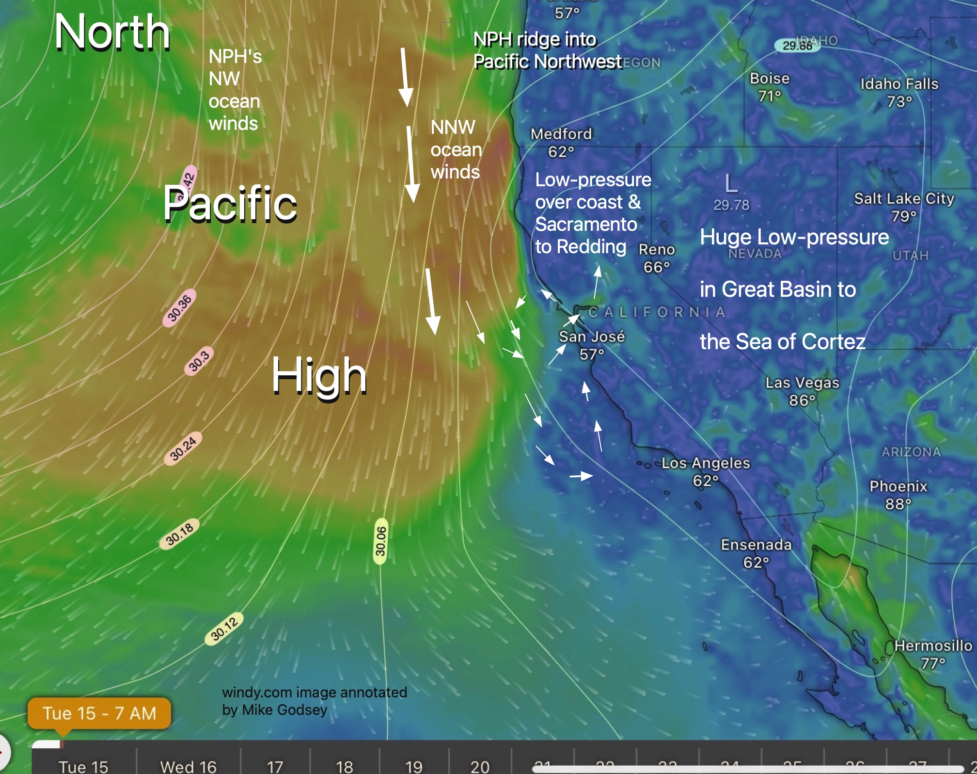
A ridge of high pressure in the upper atmosphere has likely pushed the North Pacific High further north and inland over far Northern California and into the Pacific Northwest. This shift alters the surface pressure gradient and the direction of the surface winds along the coast.
Instead of the usual northwesterly flow, this modified alignment has induced a more northerly to NNW direction north of the Golden Gate. As this air flows over the coastal mountain ranges, it creates a localized area of low pressure, or a “lee-side trough,” on the western slopes and immediate coastline.
This is where the Central Valley’s thermal low plays its crucial role. The strong onshore pull from the valley’s low-pressure system interacts with this newly formed coastal low to expand to the north.
This interaction helps to initiate and sustain a counter-clockwise circulation, or eddy, in the coastal waters.
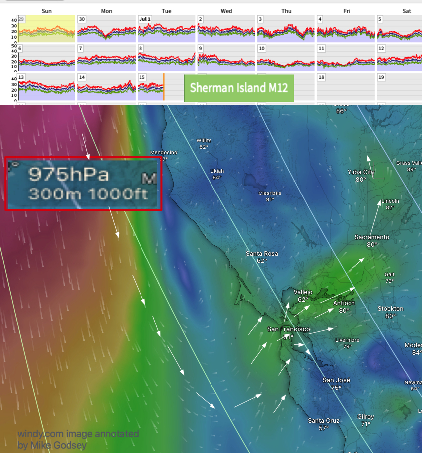
At the same time counter-clockwise low-pressure areas develop up to 10,000 feet above the coast sustaining the eddy. The pattern has also created strong WSW winds ≈ 1000 feet aloft (975 MB) that has often pushed lingering marine layer clouds into the Bay.
The formation of this eddy effectively reverses the typical coastal wind direction. The western flank of the eddy pulls air from the south towards the coast, while the eastern side, closer to shore, sees a southerly flow.
It is this southerly flow at the coast that is then drawn inland through the Golden Gate by the ever-present Central Valley low centered in the Sacramento to Yuba City to Redding area. Once inside the Bay, this pressure gradient causes the winds become southwesterly as they are channeled by the local topography.
Why has this eddy pattern been so long?
The persistence of this eddy for nearly two weeks suggests a very stable locked-in anomalous upper-air pattern that has kept the North Pacific High in a position favorable for this atypical wind regime. This in turn has created the anomalous persistence of a ridge over far Northern California to the Pacific Northwest and into Canada. This anomaly is shown in this graphic.
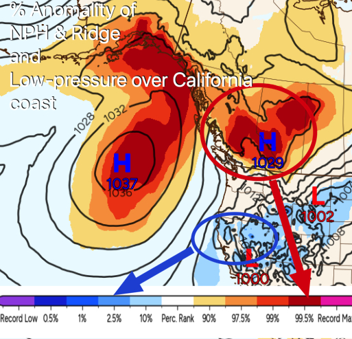
Likewise, the low-pressure over the Northern California coast has been highly anomalous as you can see in the same graphic.
These animalities have created weeks of strong WSW winds from the North Tower to Larkspur/Clark’s Brickyards and Pt. Isabel. They have also created all day winds for Sherman Island.
At the same time the coast has only had weak southerly winds and frequent all day fog.
The strength of the resulting southwesterly winds within the Bay is a direct consequence of the significant pressure gradient between the eddy-influenced coastal region and the hot, low-pressure interior of the state.