Kerry Challoner Anderson
Last Saturday I spent the evening in Southern California but I was glued to the broadcast from KOCO TV in Oklahoma City. As a wind forecaster, this is akin to watching the Super Bowl. Also, I am invested as I now have grandchildren who live in the area. It was a marathon broadcast that started before lunch and went past midnight. I am still not sure when the meteorologist ate or went to the bathroom. It was a heroic effort as the team worked to alert and save Oklahomans from a severe outbreak that included at least 30 tornadoes.
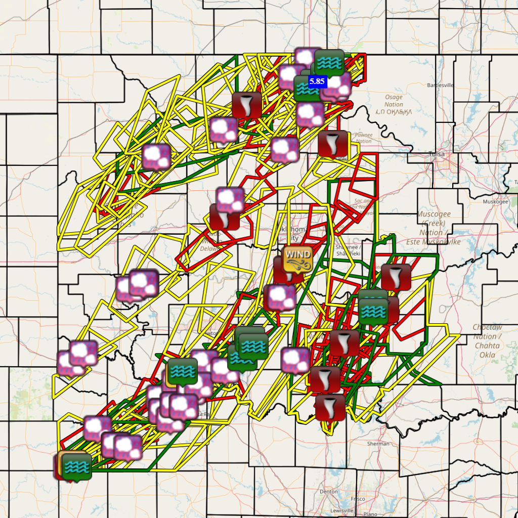
Tornado and Flash Flooding Event in the NWS Norman Forecast Area
Unexpectedly, this week I took a trip to Oklahoma. On the drive up from Dallas, I needed a break and decided to pull off at the next exit to get something to munch on. As I pulled off the freeway I quickly had an up close and personal encounter with the aftermath of one of the tornadoes I had been watching on the radar just a few days earlier.

In Marietta, metal signs and poles had been wrenched from the ground. A semi-trailer was overturned as well as a car. National Weather Service surveys estimate that this destruction came from an EF 4 tornado.
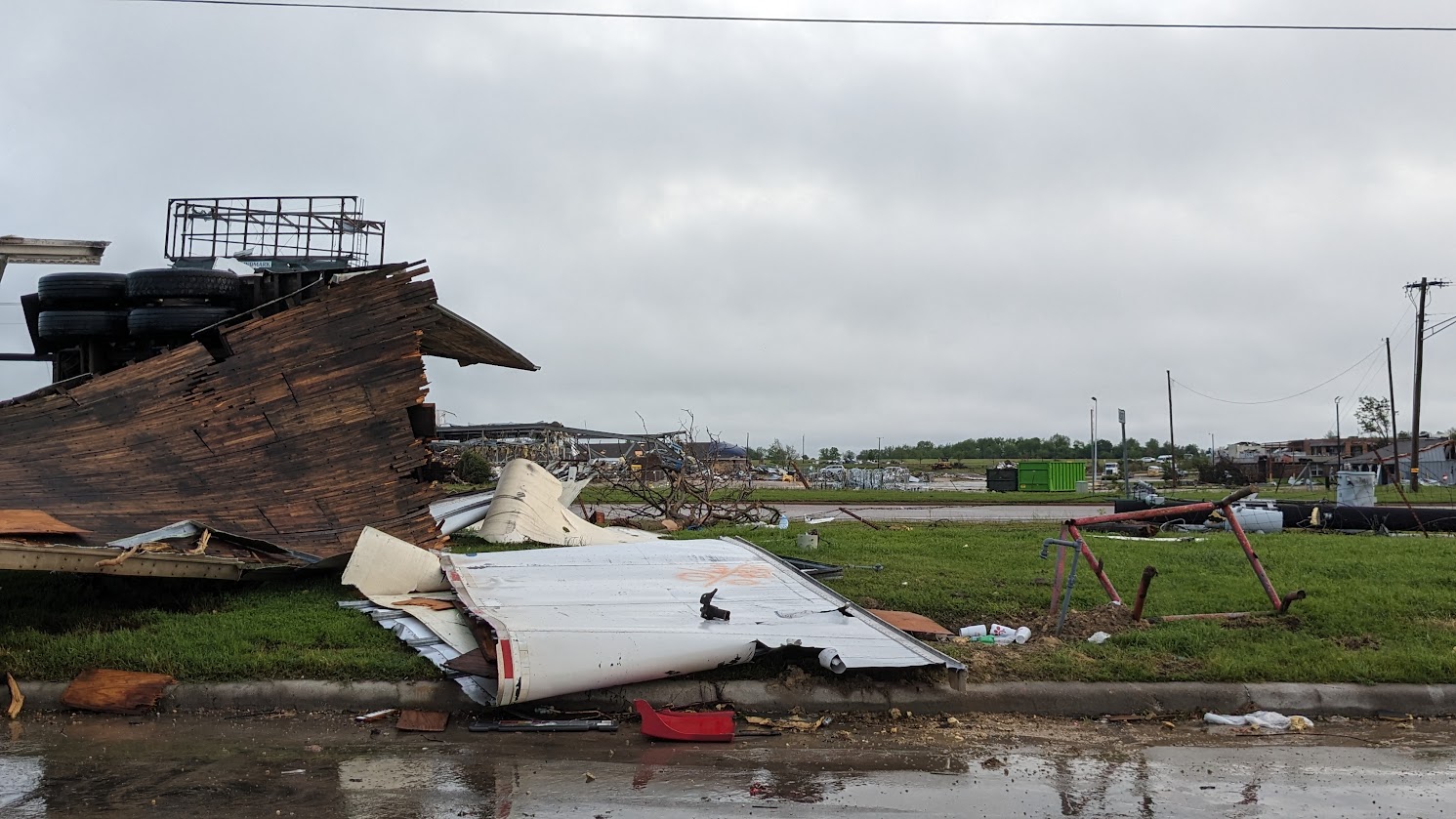
EF stands for Enhanced Fujita which is a scale that estimates the speed of a tornado based on the type of destruction that is observed. The scale starts from 0, with the highest value being 5. An EF 4 tornado is considered to be a “violent” tornado with wind speeds of 166 – 200 mph.

These violent rotating winds shredded this metal frame building, while across the street the buildings were untouched.
I have wanted to see a tornado all of my career. I studied severe storms as one of my electives in college. My first forecast job was in Iowa, where I learned to calculate instability indexes and I would hope they were high enough that we might get some thunderstorm action. But I only got to hear reports from others. After I married, my husband and I took a trip that took us across South Dakota. While driving I saw the classic “Wall Cloud” and so I pulled over hoping to see a tornado appear. My husband was horrified to find out that I planned to sit and wait in hopes of seeing a tornado. They did materialize but he made sure we were well out of the area and questioned the sanity of the person he had married. Later my graduate program offered a severe storm chase which I tried but couldn’t quite squeeze into my busy schedule. So after 40 years, I have only “seen” tornadoes through radar and photographer’s lenses.
Instead, now I have had the chance to personally see the destruction that these violent winds can do. I will admit my desire to see one personally has quickly waned. To say it was sobering is an understatement.