What’s with the weasel words? Bay Area & Southern California
by Mike Godsey, mike@iwindsurf.com
There is a “good chance” of a Bay Area marine surge in the next 24 hours and a chance of atypical wind isn Southern California Friday .
Bay Area:
Usually I can pinpoint the arrival time more accurately than that and usually I don’t insert weasel words like “good chance” to  describe an marine surge event.
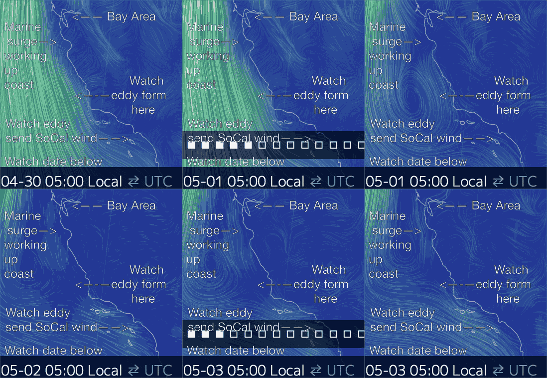
The problem is that this marine surge has an atypical cause. Take a look at the first image. This marine surge, it actually happens, it will be caused by a huge counter-clockwise spinning surface eddy you see in the animation and an eddy above the surface at about 5000 feet just NW of Point Conception towards Southern California. And most of the eddies juice is at least 1000 feet aloft.
Since eddies are always unpredictable and since most of the SW flow of this eddy is not at the surface I am not certain how it will impact the wind at the surface tomorrow or when it will arrive.
As I noted in the forecast Special Update at 9:19 AM today the SW marine surge winds are already  tickling the Waddell sensor and have since reached Half Moon Bay. So far this is an unusual marine surge since the SW winds are dry so we are not seeing the typical fog.
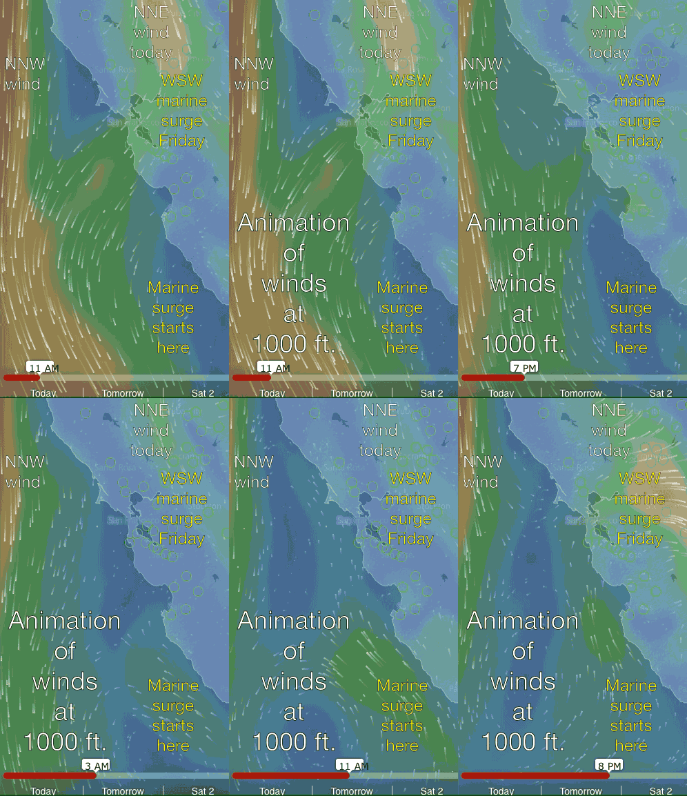
The animation below shows how the winds at 1000 ft. play out over the next 24 hours. My bet is that this energy will cause a marine surge at the surface tomorrow but I could be wrong.
Looking at the 2nd video note the time scale at the bottom. Also note the strong NNE winds hitting Sherman Island and over the Bay Area today. Also note how these winds are pushing the North Pacific High’s winds away from shore. Then watch as the marine surge at 1000 ft.gains strength.
Southern California
The same eddy you see NW of Southern California will be pushing the North Pacific High’s surface NW winds far from the Southern California coast. So Southern California loses this part of its wind machine. So you would expect weaker winds Friday. However if you watch the top animation the counter-clockwise spinning winds of the eddy looks like it will paradoxically send wind to the Southern California coast. Let’s see how this plays out tomorrow.
