What does this mean and why will the winds be weak today?
by Mike Godsey, mike@iwindsurf.com

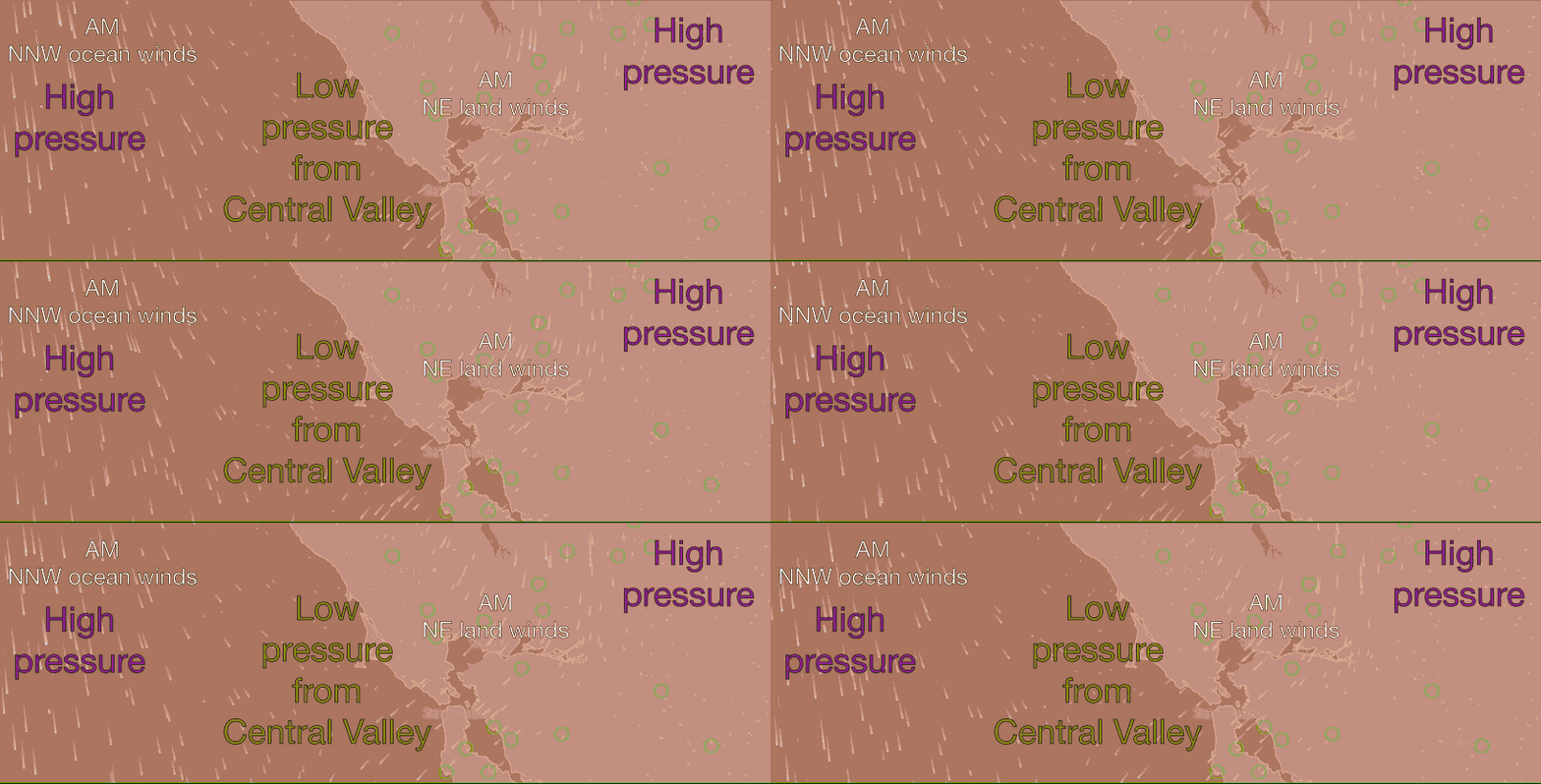
Something is really weird with the wind this morning. Looking at the Bay Area wind graph at 9AM you are seeing mostly NE winds. And looking at the model animation above you can see the ocean winds are NNW rather than NW out at the ocean buoys and NE over the bay. Also notice the purple area in the Central Valley that represents high pressure (not the typical low pressure) and instead there is low pressure just west of the Golden Gate.
Let’s analyze this set up to see what caused it and why most Bay Area sites will only see weak wind today.
Looking at the wind graph, #1 below you can see this unusual wind pattern. Next notice how image #3 shows the SFO-SAC pressure gradient was actually negative at dawn today while the Redding pressure gradient was strongly reversed meaning there was high pressure there hence NNE to NE winds towards the Bay Area.
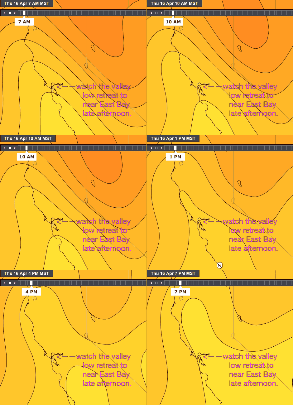
The critical image is #4. Notice how the isobars of the Central Valley thermal low have expanded west of the Bay Area. This is creating the low pressure you see at the top of the page and the NE winds. There NE winds tend to push the NW ocean wind away from the coast as you can also see in the top image and they tend to keep the low pressure west of the Golden Gate.
Next notice in image #5 how this afternoon the isobars of the Central Valley thermal low retreat eastward towards the East Bay hills Notice in image #2 that as this retreat happens the SFO-SAC pressure gradient inches upward. However most of the pressure gradient is focused from Treasure Island westward. That is why I am forecasting weak winds for the East Bay and Sherman Island.
In the final animation you can see the dance the valley low performs as we go from early morning to late afternoon.
Of course the big question what caused the Central Valley thermal low to lunger over the coast. And the short answer to that when the North Pacific High pushed a ridge into the Pacific Northwest the resulting NE flow causes the valley low pressure to drift westward and the Bay Area only sees mild winds.
