Post frontal NW clearing winds develop Saturday.
by Mike Godsey
Sunday: (updated Thursday April 21 at bottom of blog)
If you have lived east of the Rockies you were constantly hearing broadcast meteorologist talk about cold fronts and thunderstorms heading towards your locale.
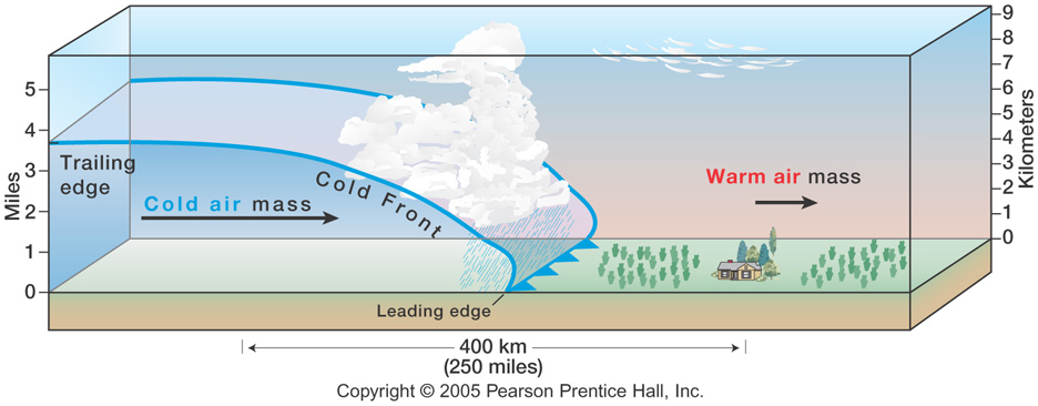 And on the TV weather maps you were always seeing those blue lines with the ominous looking points that signify a cold front.
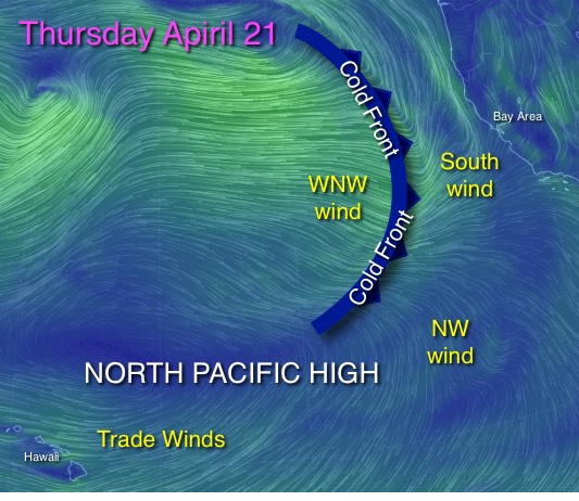
But on the west coast the huge thermal mass of the pacific makes cold fronts
less common and often poorly defined.
But out in the pacific today there is a well defined cold front which will bring a chance of rain Friday and, more importantly, NW post-frontal wind Saturday.
So exactly what is a cold front? The graphic above shows the basic concepts.
As a low pressure area approaches there is often a demarcation between the chilly air of the storm and the warmer air in its pathway. This is called a cold front and is represented on weather maps as the blue line with pints you see in the imagery.
Since the colder air in the front is heavier it pushes the warmer air aloft.
And if there is significant moisture vapor in the warmer air this moisture will condense as it rises and cools. This creates clouds that often clearly make the front. With all this moisture condensing there is potential for rain. The cold front also brings southerly wind as it approaches and has northerly winds in its wake
Let’s take a look at the pacific cold front that will impact our weather and wind the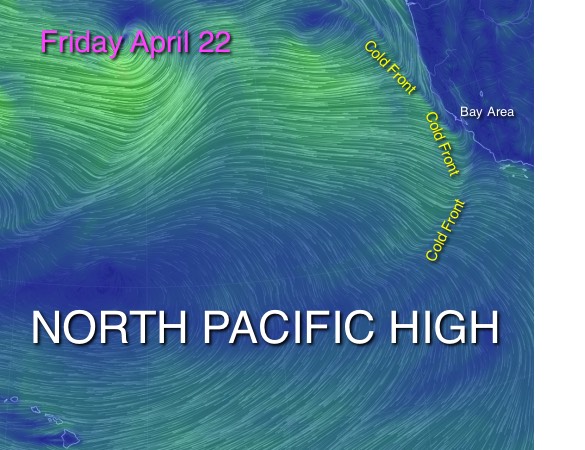 next few days.
Thursday:
In the next image find the Bay Area and note the blue line outlining the Cold front.
Note the south winds in front to the cold front which hitting the Bay Area as weak storm winds Thursday.
Also note the small flattened North Pacific High way SW of the Bay Area.
Also note how the NPH is creating mild WNW winds for Southern California and easterly trade winds for Hawaii.
Friday:
The next image show the cold front and the wind patterns Friday afternoon. Check out how much the North Pacific High as enlarged. It now spans the waters from Hawaii to Southern California.
 Now notice the cold front which is just 100 miles west of the S. F. Bay Area.
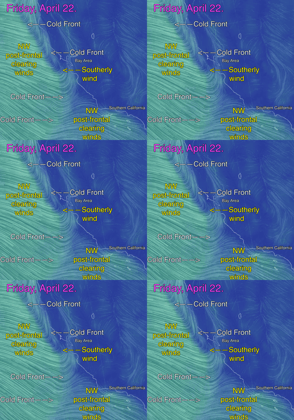
Also notice how there are weak southerly storm winds hitting the Northern California coast.
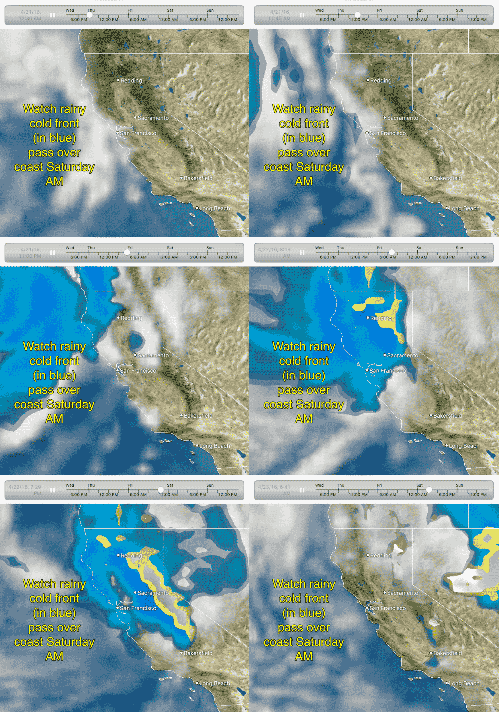
There is about a 60% chance of rain Friday from this cold front.
Next notice the WNW winds just west of the cold front. These are the clearing winds.
You are probably wondering why these clearing winds are WNW since you normally expect clearing winds to the NW.
The reason for the WNW winds is that the NPH is still a bit too far south for optimal clearing winds Friday.
Let’s zoom in on all this action in the wind animation to the right.
In this animation notice that off Northern California you can see a very well defined cold front with southerly winds in front of it and WNW/NW post frontal winds behind the front.
Also notice how ill-defined the cold front is off Southern California.
Now check out the left rain animation. This shows the area where rain might fall in BLUE. Looking at the days passing at the top of the graphic and you can see how the rainy cold front passes in the early AM predawn Saturday.
Saturday:
Now let’s get to the bottom line. Look at the last imagery
for Saturday April 23. Notice 4 developments: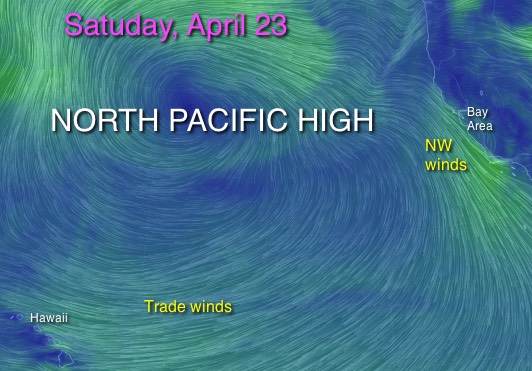
- The North Pacific High has moved much further north so Friday’s WNW winds are more NW on Saturday.
- The NPH also has greatly expanded in size and now dominate the northern pacific.
- Also note how the NW winds are at the coast Saturday while Friday they were west of the ocean buoys.
- Lastly notice that while there is strong coast wind there is not much wind streaming over the California interior. This is because the pressure gradients to the Central Valley and the Great Basin looks like they will be modest.
If this is the case the Saturday NW blow will be mostly in the upper teens to barely modest low 20’s focused mostly near the coast. Let’s hope those pressure gradients go up over the next few days.
Sunday: (updated Thursday April 21)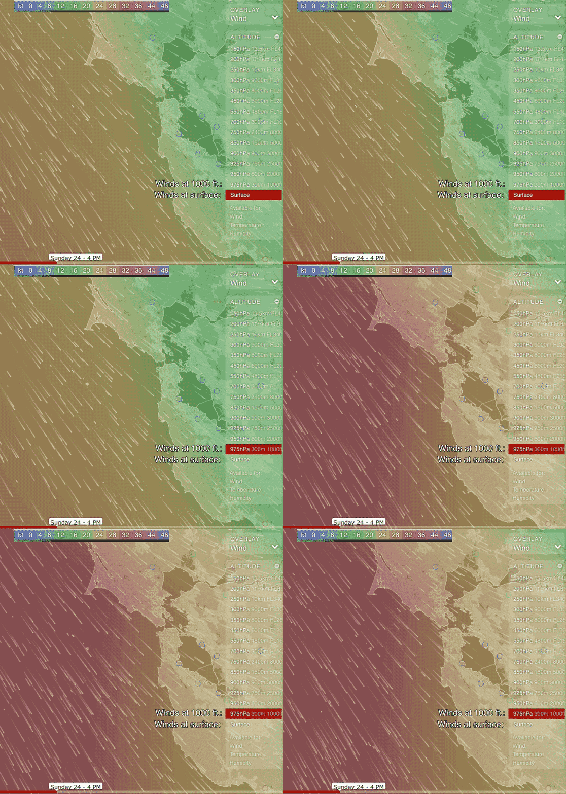
It now looks like the big NW blow for Sunday. Strong NW winds develop just aloft while the pressure gradients to Bakersfield, which favors NW flow goes up. At the same time the pressure gradient to the Great Basin ramps up which also accelerates the NW wind. So it could be a big blow.
You can see part of the scenario in this animation. Notice the strong 4PM surface NW wind during the first half of the video. Then the video jumps to 1000 ft. above the surface. Notice how much stronger the winds are aloft as they come in from the Pacific.
Annotated graphics derived from windyty.com and Null School

